
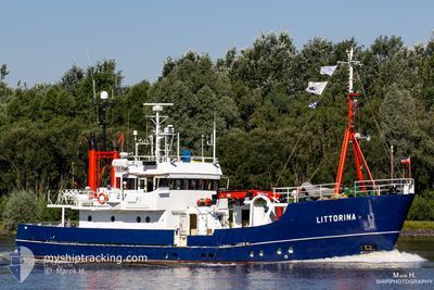
LITTORINA
Fishery Research Vessel
Current Trip
| Time Travelled | 1 day |
|---|---|
| Remaining Time | --- |
| Distance Travelled | 0.20 nm |
| Remaining Distance | --- |
| AVG Speed | --- |
| MAX Speed | --- |
| AVG Wind | 1.9 knots |
| MAX Wind | 1.9 knots |
| MIN Temp | 6.6°C / 43.88°F |
| MAX Temp | 6.6°C / 43.88°F |
| Dybgang | 2.9 m |
| Position Modtaget | 1 d siden |
Current Position
| Longitude | 7.90382° |
|---|---|
| Latitude | 54.16575° |
| Status | Under way using engine |
| Fart | 5.9 Knots |
| Kurs | 204.5° |
| Område | North Sea |
| Station | T-AIS |
| Position Modtaget | 1 d siden |
Info
Information
The current position of LITTORINA is in North Sea with coordinates 54.16575° / 7.90382° as reported on 2024-04-25 05:13 by AIS to our vessel tracker app. The vessel's current speed is 5.9 Knots
The vessel LITTORINA (IMO: 7360942, MMSI: 211214250) is a Fishery Research Vessel that was built in 1975 ( 49 år gamle ). It's sailing under the flag of [DE] Germany.
In this page you can find informations about the vessels current position, last detected port calls, and current voyage information. If the vessels is not in coverage by AIS you will find the latest position.
The current position of LITTORINA is detected by our AIS receivers and we are not responsible for the reliability of the data. The last position was recorded while the vessel was in Coverage by the Ais receivers of our vessel tracking app.
The current draught of LITTORINA as reported by AIS is 2.9 meters
Weather
| Temperature | 6.6°C / 43.88°F |
|---|---|
| Wind Speed | 2 knots |
| Direction | 13° NNE |
| Pressure | 1002.6 hPa |
| Humidity | 69.7 % |
| Cloud Coverage | 100 % |
Featured Company
Last Port Calls
| Port | Arrival | Departure | Time In Port |
|---|---|---|---|
| 2024-04-24 18:19 | 2024-04-25 05:11 | 10 h | |
| 2024-04-18 02:36 | 2024-04-24 06:08 | 6 d | |
| 2024-04-16 12:39 | 2024-04-17 05:02 | 16 h | |
| 2024-04-15 14:22 | 2024-04-16 05:00 | 14 h | |
| 2024-04-13 14:31 | 2024-04-15 04:56 | 1 d | |
| 2024-04-12 16:29 | 2024-04-13 04:59 | 12 h | |
| 2024-04-09 20:45 | 2024-04-12 04:00 | 2 d | |
| 2024-04-04 11:08 | 2024-04-09 06:05 | 4 d | |
| 2024-03-28 13:38 | 2024-04-04 06:01 | 6 d | |
| 2024-03-27 14:04 | 2024-03-28 06:50 | 16 h |
Last Trips
| Origin | Departure | Destination | Arrival | Distance | |
|---|---|---|---|---|---|
| 2024-04-24 08:08 | 2024-04-24 20:19 | 103.44 nm | |||
| 2024-04-17 07:02 | 2024-04-18 04:36 | 162.05 nm | |||
| 2024-04-16 07:00 | 2024-04-16 14:39 | 41.18 nm | |||
| 2024-04-15 06:56 | 2024-04-15 16:22 | 38.95 nm | |||
| 2024-04-13 06:59 | 2024-04-13 16:31 | 43.49 nm | |||
| 2024-04-12 06:00 | 2024-04-12 18:29 | 89.30 nm | |||
| 2024-04-09 08:05 | 2024-04-09 22:45 | 142.53 nm | |||
| 2024-04-04 08:01 | 2024-04-04 13:08 | 29.94 nm | |||
| 2024-03-28 07:50 | 2024-03-28 14:38 | 22.08 nm | |||
| 2024-03-27 07:50 | 2024-03-27 15:04 | 23.90 nm |
Events
| Tid | Hændelsen | Detaljer | Position / Dest | Info |
|---|---|---|---|---|
| 2024-04-25 05:13 | Udenfor Dækning |
54.16575 / 7.90382
North Sea
|
Fart: 5.9 kn Kurs: 204.5° |
|
| 2024-04-25 05:11 | Afsejlet fra sidste havn |
|
54.16893 / 7.90335
KIEL GEOMAR
|
Fart: 5.5 kn Kurs: 143° |
| 2024-04-25 05:05 | Indenfor Dækning |
54.17515 / 7.89610
North Sea
[DE] HELGOLAND
|
Fart: 2.5 kn Kurs: 124.3° |
|
| 2024-04-25 03:55 | Udenfor Dækning |
54.17513 / 7.89521
North Sea
[DE] HELGOLAND
|
Fart: Kurs: 182.7° |
|
| 2024-04-25 00:58 | Indenfor Dækning |
54.17511 / 7.89519
North Sea
[DE] HELGOLAND
|
Fart: Kurs: 182.7° |
|
| 2024-04-24 18:19 | Skibe i havn |
|
54.17511 / 7.89519
[DE] HELGOLAND
|
Fart: 12.5 kn Kurs: 333° |
| 2024-04-24 15:54 | Udenfor Dækning |
53.94423 / 8.65639
North Sea
KIEL GEOMAR
|
Fart: 12.5 kn Kurs: 333° |
|
| 2024-04-24 15:20 | START Sejllads | 0.62 nm, North of ALTENBRUCH |
53.84831 / 8.77186
KIEL GEOMAR
|
Fart: 12.2 kn Kurs: 301.2° |
| 2024-04-24 15:20 | STOP Sejllads | 0.56 nm, North of ALTENBRUCH |
53.84692 / 8.77580
KIEL GEOMAR
|
Fart: Kurs: 0° |
| 2024-04-24 14:01 | START Sejllads | 0.89 nm, South West of BRUNSBUETTEL |
53.89068 / 9.14586
KIEL GEOMAR
|
Fart: 6.4 kn Kurs: 222.7° |