
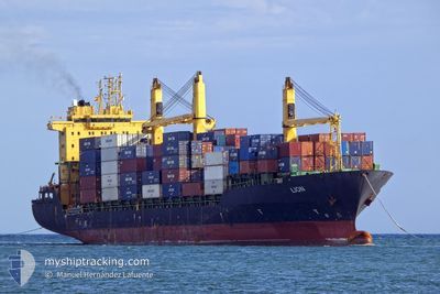
LION
Container Ship
Current Trip
| Time Travelled | 5 days |
|---|---|
| Remaining Time | --- |
| Distance Travelled | 1208.03 nm |
| Remaining Distance | --- |
| AVG Speed | 8.7 Knots |
| MAX Speed | 16.6 Knots |
| AVG Wind | 14.3 knots |
| MAX Wind | 32 knots |
| MIN Temp | 11.6°C / 52.88°F |
| MAX Temp | 23.1°C / 73.58°F |
| Dybgang | 6.5 m |
| Position Modtaget | 1 m siden |
Current Position
| Longitude | -5.41665° |
|---|---|
| Latitude | 36.15742° |
| Status | At anchor |
| Fart | 0.3 Knots |
| Kurs | 283° |
| Område | Strait of Gibraltar |
| Station | T-AIS |
| Position Modtaget | 1 m siden |
Info
Information
The current position of LION is in Strait of Gibraltar with coordinates 36.15742° / -5.41665° as reported on 2024-05-19 18:13 by AIS to our vessel tracker app. The vessel's current speed is 0.3 Knots and is heading at the port of ALGECIRAS. The estimated time of arrival as calculated by MyShipTracking vessel tracking app is 2024-05-17 20:00 LT
The vessel LION (IMO: 9208356, MMSI: 229247000) is a Container Ship that was built in 2000 ( 24 år gamle ). It's sailing under the flag of [MT] Malta.
In this page you can find informations about the vessels current position, last detected port calls, and current voyage information. If the vessels is not in coverage by AIS you will find the latest position.
The current position of LION is detected by our AIS receivers and we are not responsible for the reliability of the data. The last position was recorded while the vessel was in Coverage by the Ais receivers of our vessel tracking app.
The current draught of LION as reported by AIS is 6.5 meters
Weather
| Temperature | 17.2°C / 62.96°F |
|---|---|
| Wind Speed | 10 knots |
| Direction | 265° W |
| Pressure | 1012.1 hPa |
| Humidity | 57.4 % |
| Cloud Coverage | 100 % |
Featured Company
Last Port Calls
| Port | Arrival | Departure | Time In Port |
|---|---|---|---|
| 2024-05-12 10:42 | 2024-05-14 14:12 | 2 d | |
| 2024-05-02 16:25 | 2024-05-06 14:04 | 3 d | |
| 2024-04-26 17:50 | 2024-04-29 01:02 | 2 d | |
| 2024-04-18 22:49 | 2024-04-20 02:35 | 1 d | |
| 2024-04-14 11:39 | 2024-04-15 05:49 | 18 h | |
| 2024-04-05 12:39 | 2024-04-06 17:15 | 1 d | |
| 2024-04-03 09:35 | 2024-04-03 23:39 | 14 h | |
| 2024-03-26 12:01 | 2024-03-27 21:49 | 1 d | |
| 2024-03-13 20:29 | |||
| 2024-03-01 21:32 |
Last Trips
| Origin | Departure | Destination | Arrival | Distance | |
|---|---|---|---|---|---|
| 2024-05-06 14:04 | 2024-05-12 10:42 | 667.74 nm | |||
| 2024-04-29 01:02 | 2024-05-02 16:25 | 502.05 nm | |||
| 2024-04-20 02:35 | 2024-04-26 17:50 | 1345.76 nm | |||
| 2024-04-15 05:49 | 2024-04-18 22:49 | 62.25 nm | |||
| 2024-04-06 17:15 | 2024-04-14 11:39 | 1429.61 nm | |||
| 2024-04-03 23:39 | 2024-04-05 12:39 | 241.40 nm | |||
| 2024-03-27 21:49 | 2024-04-03 09:35 | 1610.03 nm | |||
| 2024-02-21 17:19 | 2024-03-01 21:32 | 200.37 nm |
Events
| Tid | Hændelsen | Detaljer | Position / Dest | Info |
|---|---|---|---|---|
| 2024-05-19 16:04 | Status er ændret | At anchor Default |
36.15686 / -5.41678
ALGECIRAS
|
Fart: 0.4 kn Kurs: 252° |
| 2024-05-19 16:01 | Status er ændret | Default At anchor |
36.15734 / -5.41685
ALGECIRAS
|
Fart: 0.1 kn Kurs: 245° |
| 2024-05-18 11:13 | Status er ændret | At anchor Under way using engine |
36.15821 / -5.41709
ALGECIRAS
|
Fart: 0.4 kn Kurs: 247° |
| 2024-05-18 10:47 | STOP Sejllads | 1.12 nm, South of PALMONES |
36.15726 / -5.41861
ALGECIRAS
|
Fart: 0.3 kn Kurs: 264° |
| 2024-05-18 10:31 | Ændre havområde | Spanish part of the Strait of Gibraltar Gibraltarian part of the Strait of Gibraltar |
36.14992 / -5.39705
Strait of Gibraltar
|
Fart: 6.7 kn Kurs: 347.4° |
| 2024-05-18 09:31 | Ændre havområde | Gibraltarian part of the Strait of Gibraltar Gibraltarian part of the Alboran Sea |
36.07483 / -5.34306
Strait of Gibraltar
|
Fart: 10.2 kn Kurs: 280.6° |
| 2024-05-18 07:42 | START Sejllads | 5.45 nm, South of GIBRALTAR |
36.06148 / -5.32644
ALGECIRAS
|
Fart: 3.1 kn Kurs: 304° |
| 2024-05-18 07:37 | Ændre havområde | Gibraltarian part of the Alboran Sea Gibraltarian part of the Strait of Gibraltar |
36.06049 / -5.33071
Alboran Sea
|
Fart: 1.8 kn Kurs: 72.1° |
| 2024-05-18 07:31 | Ændre havområde | Gibraltarian part of the Strait of Gibraltar Gibraltarian part of the Alboran Sea |
36.05951 / -5.33201
Strait of Gibraltar
|
Fart: 0.9 kn Kurs: 302.7° |
| 2024-05-18 06:24 | STOP Sejllads | 6.4 nm, South East of GIBRALTAR |
36.06483 / -5.27927
ALGECIRAS
|
Fart: 0.2 kn Kurs: 260° |