
LINTAN
Cargo
Current Trip
YALOVA ANCH. NO. 1
| Time Travelled | 22 h, 40 mins |
|---|---|
| Remaining Time | --- |
| Distance Travelled | 8.69 nm |
| Remaining Distance | --- |
| AVG Speed | 4 Knots |
| MAX Speed | 7.5 Knots |
| AVG Wind | 5.1 knots |
| MAX Wind | 5.9 knots |
| MIN Temp | 10.4°C / 50.72°F |
| MAX Temp | 14.8°C / 58.64°F |
| Dybgang | 6.7 m |
| Position Modtaget | 5 h, 19 m siden |
Current Position
| Longitude | 29.32094° |
|---|---|
| Latitude | 40.68672° |
| Status | At anchor |
| Fart | 0.1 Knots |
| Kurs | 315° |
| Område | Sea of Marmara |
| Station | T-AIS |
| Position Modtaget | 5 h, 19 m siden |
Info
Information
The current position of LINTAN is in Sea of Marmara with coordinates 40.68672° / 29.32094° as reported on 2024-05-14 12:38 by AIS to our vessel tracker app. The vessel's current speed is 0.1 Knots
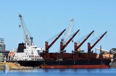
The vessel LINTAN (IMO: 9715206, MMSI: 477737100) is a Cargo It's sailing under the flag of [HK] Hong Kong.
In this page you can find informations about the vessels current position, last detected port calls, and current voyage information. If the vessels is not in coverage by AIS you will find the latest position.
The current position of LINTAN is detected by our AIS receivers and we are not responsible for the reliability of the data. The last position was recorded while the vessel was in Coverage by the Ais receivers of our vessel tracking app.
The current draught of LINTAN as reported by AIS is 6.7 meters
Weather
| Temperature | 14.6°C / 58.28°F |
|---|---|
| Wind Speed | 1 knots |
| Direction | 167° SSE |
| Pressure | 1017.2 hPa |
| Humidity | 46.8 % |
| Cloud Coverage | 19 % |
Featured Company
Events
| Tid | Hændelsen | Detaljer | Position / Dest | Info |
|---|---|---|---|---|
| 2024-05-14 12:38 | Status er ændret | Default At anchor |
40.68672 / 29.32094
YALOVA ANCH. NO. 1
|
Fart: 0.1 kn Kurs: 315° |
| 2024-05-14 12:38 | Udenfor Dækning |
40.68672 / 29.32094
Sea of Marmara
|
Fart: 0.1 kn Kurs: 182.5° |
|
| 2024-05-14 12:35 | Status er ændret | At anchor Default |
40.68679 / 29.32100
YALOVA ANCH. NO. 1
|
Fart: 0.1 kn Kurs: 307° |
| 2024-05-14 12:32 | Status er ændret | Default At anchor |
40.68686 / 29.32112
YALOVA ANCH. NO. 1
|
Fart: 0.1 kn Kurs: 300° |
| 2024-05-14 12:05 | Status er ændret | At anchor Default |
40.68753 / 29.32116
YALOVA ANCH. NO. 1
|
Fart: Kurs: 295° |
| 2024-05-14 12:02 | Status er ændret | Default At anchor |
40.68755 / 29.32111
YALOVA ANCH. NO. 1
|
Fart: Kurs: 297° |
| 2024-05-14 11:02 | Status er ændret | At anchor Default |
40.68783 / 29.32117
YALOVA ANCH. NO. 1
|
Fart: Kurs: 291° |
| 2024-05-14 10:53 | Status er ændret | Default At anchor |
40.68791 / 29.32111
YALOVA ANCH. NO. 1
|
Fart: Kurs: 289° |
| 2024-05-14 10:35 | Status er ændret | At anchor Default |
40.68807 / 29.32124
YALOVA ANCH. NO. 1
|
Fart: Kurs: 282° |
| 2024-05-14 10:20 | Status er ændret | Default At anchor |
40.68813 / 29.32118
YALOVA ANCH. NO. 1
|
Fart: Kurs: 285° |