
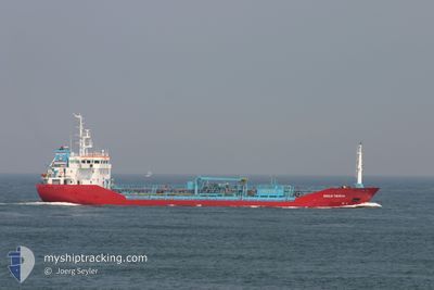
LIDYA
Oil/Chemical Tanker
Current Trip
| Time Travelled | 2 days |
|---|---|
| Remaining Time | 1 day |
| Distance Travelled | 333.26 nm |
| Remaining Distance | 357.14 nm |
| AVG Speed | 9 Knots |
| MAX Speed | 11.8 Knots |
| AVG Wind | 5 knots |
| MAX Wind | 12.9 knots |
| MIN Temp | 20.5°C / 68.9°F |
| MAX Temp | 34.2°C / 93.56°F |
| Dybgang | 5.2 m |
| Position Modtaget | 35 m siden |
Current Position
| Longitude | 26.45532° |
|---|---|
| Latitude | 37.76517° |
| Status | Under way using engine |
| Fart | 0.7 Knots |
| Kurs | 357° |
| Område | Aegean Sea |
| Station | T-AIS |
| Position Modtaget | 35 m siden |
Info
Information
The current position of LIDYA is in Aegean Sea with coordinates 37.76517° / 26.45532° as reported on 2024-06-03 15:45 by AIS to our vessel tracker app. The vessel's current speed is 0.7 Knots and is heading at the port of ANTALYA. The estimated time of arrival as calculated by MyShipTracking vessel tracking app is 2024-06-05 06:51 LT
The vessel LIDYA (IMO: 9260550, MMSI: 271045665) is a Oil/Chemical Tanker that was built in 2003 ( 21 år gamle ). It's sailing under the flag of [TR] Turkey.
In this page you can find informations about the vessels current position, last detected port calls, and current voyage information. If the vessels is not in coverage by AIS you will find the latest position.
The current position of LIDYA is detected by our AIS receivers and we are not responsible for the reliability of the data. The last position was recorded while the vessel was in Coverage by the Ais receivers of our vessel tracking app.
The current draught of LIDYA as reported by AIS is 5.2 meters
Weather
| Temperature | 23.6°C / 74.48°F |
|---|---|
| Wind Speed | 11 knots |
| Direction | 295° WNW |
| Pressure | 1012 hPa |
| Humidity | 80 % |
| Cloud Coverage | 100 % |
Featured Company
Last Port Calls
| Port | Arrival | Departure | Time In Port |
|---|---|---|---|
| 2024-05-31 17:56 | 2024-06-01 11:07 | 17 h | |
| 2024-05-20 01:42 | 2024-05-22 03:48 | 2 d | |
| 2024-05-16 06:45 | 2024-05-17 04:55 | 22 h | |
| 2024-05-09 00:32 | 2024-05-12 04:56 | 3 d | |
| 2024-04-23 23:02 | 2024-05-01 15:24 | 7 d | |
| 2024-04-20 16:29 | 2024-04-20 18:10 | 1 h | |
| 2024-04-10 22:09 | 2024-04-15 16:52 | 4 d | |
| 2024-04-02 17:13 | 2024-04-05 09:02 | 2 d |
Last Trips
| Origin | Departure | Destination | Arrival | Distance | |
|---|---|---|---|---|---|
| 2024-05-22 06:48 | 2024-05-31 20:56 | 778.21 nm | |||
| 2024-05-17 07:55 | 2024-05-20 04:42 | 496.56 nm | |||
| 2024-05-12 07:56 | 2024-05-16 09:45 | 506.37 nm | |||
| 2024-05-01 18:24 | 2024-05-09 03:32 | 570.61 nm | |||
| 2024-04-20 21:10 | 2024-04-24 02:02 | 497.63 nm | |||
| 2024-04-15 19:52 | 2024-04-20 19:29 | 516.10 nm | |||
| 2024-04-05 12:02 | 2024-04-11 01:09 | 775.01 nm | |||
| 2024-03-31 09:29 | 2024-04-02 20:13 | 564.51 nm |
Events
| Tid | Hændelsen | Detaljer | Position / Dest | Info |
|---|---|---|---|---|
| 2024-06-03 15:54 | Status er ændret | Default Under way using engine |
37.76397 / 26.45725
TR AYT
|
Fart: 0.7 kn Kurs: 357° |
| 2024-06-03 15:24 | Status er ændret | Under way using engine Default |
37.76784 / 26.45098
TR AYT
|
Fart: Kurs: -1° |
| 2024-06-03 14:53 | Status er ændret | Default Under way using engine |
37.77173 / 26.44272
TR AYT
|
Fart: 0.9 kn Kurs: 4° |
| 2024-06-03 14:33 | Status er ændret | Under way using engine Default |
37.77333 / 26.43659
TR AYT
|
Fart: 0.9 kn Kurs: 1° |
| 2024-06-03 14:24 | Status er ændret | Default Under way using engine |
37.77380 / 26.43382
TR AYT
|
Fart: 0.9 kn Kurs: 357° |
| 2024-06-03 14:07 | Status er ændret | Under way using engine Default |
37.77433 / 26.42825
TR AYT
|
Fart: 0.8 kn Kurs: 4° |
| 2024-06-03 14:07 | Indenfor Dækning |
37.77433 / 26.42825
Aegean Sea
TR AYT
|
Fart: 0.9 kn Kurs: 94.6° |
|
| 2024-06-03 13:12 | STOP Sejllads | 9.99 nm, North West of CHRISOMILIA |
37.77500 / 26.41167
TR AYT
|
Fart: Kurs: -1° |
| 2024-06-03 12:47 | Status er ændret | Default Under way using engine |
37.78530 / 26.40387
TR AYT
|
Fart: 6.6 kn Kurs: 133.2° |
| 2024-06-03 12:41 | Udenfor Dækning |
37.79212 / 26.39315
Aegean Sea
TR AYT
|
Fart: 6.6 kn Kurs: 133.2° |