
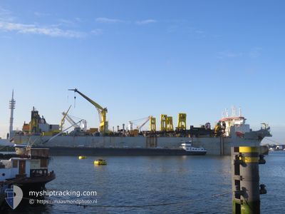
LEIV EIRIKSSON
Trailing Suction Hopper Dredger
Current Trip
UAE NMDC
| Time Travelled | --- |
|---|---|
| Remaining Time | --- |
| Distance Travelled | 4957.57 nm |
| Remaining Distance | --- |
| AVG Speed | 11.4 Knots |
| MAX Speed | 18.5 Knots |
| AVG Wind | 8.6 knots |
| MAX Wind | 30 knots |
| MIN Temp | 18.5°C / 65.3°F |
| MAX Temp | 27.4°C / 81.32°F |
| Dybgang | 8 m |
| Position Modtaget | 1 m siden |
Current Position
| Longitude | 54.52545° |
|---|---|
| Latitude | 24.86359° |
| Status | Restricted manoeuverability |
| Fart | 1.7 Knots |
| Kurs | 118° |
| Område | Persian Gulf |
| Station | T-AIS |
| Position Modtaget | 1 m siden |
Info
Information
The current position of LEIV EIRIKSSON is in Persian Gulf with coordinates 24.86359° / 54.52545° as reported on 2024-09-06 20:24 by AIS to our vessel tracker app. The vessel's current speed is 1.7 Knots
The vessel LEIV EIRIKSSON (IMO: 9429584, MMSI: 253403000) is a Trailing Suction Hopper Dredger that was built in 2010 ( 14 år gamle ). It's sailing under the flag of [LU] Luxembourg.
In this page you can find informations about the vessels current position, last detected port calls, and current voyage information. If the vessels is not in coverage by AIS you will find the latest position.
The current position of LEIV EIRIKSSON is detected by our AIS receivers and we are not responsible for the reliability of the data. The last position was recorded while the vessel was in Coverage by the Ais receivers of our vessel tracking app.
The current draught of LEIV EIRIKSSON as reported by AIS is 8 meters
Weather
| Temperature | --- |
|---|---|
| Wind Speed | --- |
| Direction | --- |
| Pressure | --- |
| Humidity | --- |
| Cloud Coverage | --- |
Featured Company
Last Port Calls
Most Visited Ports (Last year)
| Port | Arrivals | |
|---|---|---|
| 1 |
Last Trips
| Origin | Departure | Destination | Arrival | Distance |
|---|
Events
| Tid | Hændelsen | Detaljer | Position / Dest | Info |
|---|---|---|---|---|
| 2024-09-06 18:09 | START Sejllads | 11.01 nm, South West of KHALIFA |
24.70203 / 54.50279
UAE NMDC
|
Fart: 4.9 kn Kurs: 268° |
| 2024-09-06 13:38 | STOP Sejllads | 10.95 nm, South West of KHALIFA |
24.70130 / 54.50473
UAE NMDC
|
Fart: 0.3 kn Kurs: 145° |
| 2024-09-06 13:34 | Status er ændret | Restricted manoeuverability Default |
24.70222 / 54.50417
UAE NMDC
|
Fart: 1.7 kn Kurs: 118° |
| 2024-09-06 13:32 | Status er ændret | Default Restricted manoeuverability |
24.70279 / 54.50348
UAE NMDC
|
Fart: 1.9 kn Kurs: 114° |
| 2024-09-06 11:18 | Status er ændret | Restricted manoeuverability Default |
24.86329 / 54.53132
UAE NMDC
|
Fart: 1.6 kn Kurs: 97° |
| 2024-09-06 11:15 | Status er ændret | Default Restricted manoeuverability |
24.86383 / 54.53009
UAE NMDC
|
Fart: 1.6 kn Kurs: 83° |
| 2024-09-06 08:51 | START Sejllads | 10.84 nm, South West of KHALIFA |
24.70125 / 54.50724
UAE NMDC
|
Fart: 3.1 kn Kurs: 320° |
| 2024-09-06 05:08 | STOP Sejllads | 10.94 nm, South West of KHALIFA |
24.70137 / 54.50479
UAE NMDC
|
Fart: 0.2 kn Kurs: 151° |
| 2024-09-06 03:52 | START Sejllads | 8.11 nm, West of KHALIFA |
24.85236 / 54.52747
UAE NMDC
|
Fart: 3.1 kn Kurs: 227° |
| 2024-09-06 00:22 | STOP Sejllads | 8.5 nm, West of KHALIFA |
24.83752 / 54.51546
UAE NMDC
|
Fart: 0.3 kn Kurs: 31° |