
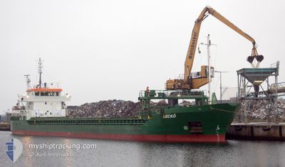
LECKO
General Cargo
Current Trip
| Trip Time | 2 days |
|---|---|
| Trip Distance | 557.39 nm |
| AVG Speed | 9.2 Knots |
| MAX Speed | 12.9 Knots |
| Dybgang | 3.7 m |
| AVG Wind | 12.8 knots |
| MAX Wind | 26.6 knots |
| MIN Temp | -6.5°C / 20.3°F |
| MAX Temp | -0.7°C / 30.74°F |
| Position Modtaget | 8 m siden |
Current Position
| Longitude | --- |
|---|---|
| Latitude | --- |
| Status | Moored |
| Fart | |
| Kurs | 41° |
| Område | Gulf of Finland |
| Station | T-AIS |
| Position Modtaget | 8 m siden |
Info
Information
The current position of LECKO is in Gulf of Finland with coordinates 59.49675° / 24.94788° as reported on 2025-02-17 18:34 by AIS to our vessel tracker app. The vessel's current speed is 0 Knots and is currently inside the port of MUUGA.
The vessel LECKO (IMO: 9263576, MMSI: 244063000) is a General Cargo that was built in 2003 ( 22 år gamle ). It's sailing under the flag of [NL] Netherlands.
In this page you can find informations about the vessels current position, last detected port calls, and current voyage information. If the vessels is not in coverage by AIS you will find the latest position.
The current position of LECKO is detected by our AIS receivers and we are not responsible for the reliability of the data. The last position was recorded while the vessel was in Coverage by the Ais receivers of our vessel tracking app.
The current draught of LECKO as reported by AIS is 3.7 meters
Weather
| Temperature | -7.1°C / 19.22°F |
|---|---|
| Wind Speed | 4 knots |
| Direction | 330° NNW |
| Pressure | 1017.1 hPa |
| Humidity | 78.8 % |
| Cloud Coverage | 80 % |
Featured Company
Last Port Calls
| Port | Arrival | Departure | Time In Port |
|---|---|---|---|
| 2025-02-17 14:03 | |||
| 2025-02-13 15:29 | 2025-02-14 13:41 | 22 h | |
| 2025-02-12 11:42 | 2025-02-13 02:49 | 15 h | |
| 2025-02-08 23:07 | 2025-02-09 13:17 | 14 h | |
| 2025-01-24 09:08 | 2025-02-07 20:01 | 14 d | |
| 2025-01-18 00:41 | 2025-01-18 15:37 | 14 h | |
| 2025-01-16 22:25 | 2025-01-17 21:25 | 23 h | |
| 2025-01-13 17:36 | 2025-01-14 20:04 | 1 d | |
| 2025-01-09 03:05 | 2025-01-11 18:35 | 2 d | |
| 2025-01-08 20:45 | 2025-01-08 22:53 | 2 h |
Last Trips
| Origin | Departure | Destination | Arrival | Distance | |
|---|---|---|---|---|---|
| 2025-02-14 13:41 | 2025-02-17 14:03 | 557.39 nm | |||
| 2025-02-13 02:49 | 2025-02-13 15:29 | 157.04 nm | |||
| 2025-02-09 13:17 | 2025-02-12 11:42 | 650.70 nm | |||
| 2025-02-07 20:01 | 2025-02-08 23:07 | 311.86 nm | |||
| 2025-01-18 15:37 | 2025-01-24 09:08 | 499.85 nm | |||
| 2025-01-17 21:25 | 2025-01-18 00:41 | 35.64 nm | |||
| 2025-01-14 20:04 | 2025-01-16 22:25 | 388.54 nm | |||
| 2025-01-11 18:35 | 2025-01-13 17:36 | 175.46 nm | |||
| 2025-01-08 22:53 | 2025-01-09 03:05 | 36.27 nm | |||
| 2025-01-07 18:46 | 2025-01-08 20:45 | 211.66 nm |
Events
| Tid | Hændelsen | Detaljer | Position / Dest | Info |
|---|---|---|---|---|
| 2025-02-17 13:43 | Status er ændret | Moored Default |
59.49674 / 24.94781
[EE] MUUGA
|
Fart: Kurs: 41° |
| 2025-02-17 13:41 | Status er ændret | Default Moored |
59.49672 / 24.94783
[EE] MUUGA
|
Fart: Kurs: 41° |
| 2025-02-17 12:22 | Status er ændret | Moored Under way using engine |
59.49671 / 24.94789
[EE] MUUGA
|
Fart: Kurs: 39° |
| 2025-02-17 12:10 | STOP Sejllads |
59.49687 / 24.94703
[EE] MUUGA
|
Fart: 0.3 kn Kurs: 14° |
|
| 2025-02-17 12:03 | Skibe i havn |
|
59.50140 / 24.95403
[EE] MUUGA
|
Fart: 5.7 kn Kurs: 218.8° |
| 2025-02-17 11:49 | Dybgangen er ændret | 3.7 3.4 |
59.53680 / 24.94562
EE MUU
|
Fart: 11.8 kn Kurs: 148.1° |
| 2025-02-17 11:49 | Destination er ændret | EE MUU EE MUG |
59.53680 / 24.94562
EE MUU
|
Fart: 11.8 kn Kurs: 148.1° |
| 2025-02-17 08:31 | Ændre havområde | Estonian part of the Gulf of Finland Finnish part of the Gulf of Finland |
59.59234 / 23.80206
Gulf of Finland
EE MUG
|
Fart: 12.4 kn Kurs: 83.6° |
| 2025-02-17 08:13 | Status er ændret | Under way using engine Default |
59.58114 / 23.67911
EE MUG
|
Fart: 12.5 kn Kurs: 71° |
| 2025-02-17 08:08 | Status er ændret | Default Under way using engine |
59.57541 / 23.64663
EE MUG
|
Fart: 12.6 kn Kurs: 70.1° |