

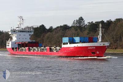
LAURA
General Cargo

Current Trip
| Time Travelled | 1 day |
|---|---|
| Remaining Time | 2 days |
| Distance Travelled | 547.34 nm |
| Remaining Distance | 943.62 nm |
| AVG Speed | 14.9 Knots |
| MAX Speed | 16.2 Knots |
| AVG Wind | 10.1 knots |
| MAX Wind | 14 knots |
| MIN Temp | -10.5°C / 13.1°F |
| MAX Temp | 3°C / 37.4°F |
| Dybgang | 7.2 m |
| Position Modtaget | 1 m siden |
Current Position
| Longitude | --- |
|---|---|
| Latitude | --- |
| Status | Under way using engine |
| Fart | 15.7 Knots |
| Kurs | 211.4° |
| Område | Baltic Sea |
| Station | T-AIS |
| Position Modtaget | 1 m siden |
Information
The current position of LAURA is in Baltic Sea with coordinates 57.98722° / 18.23836° as reported on 2025-03-21 07:02 by AIS to our vessel tracker app. The vessel's current speed is 15.7 Knots and is heading at the port of TERNEUZEN. The estimated time of arrival as calculated by MyShipTracking vessel tracking app is 2025-03-23 19:40 LT
The vessel LAURA (IMO: 9126223, MMSI: 230350000) is a General Cargo that was built in 1996 ( 29 år gamle ). It's sailing under the flag of [FI] Finland.
In this page you can find informations about the vessels current position, last detected port calls, and current voyage information. If the vessels is not in coverage by AIS you will find the latest position.
The current position of LAURA is detected by our AIS receivers and we are not responsible for the reliability of the data. The last position was recorded while the vessel was in Coverage by the Ais receivers of our vessel tracking app.
The current draught of LAURA as reported by AIS is 7.2 meters
Weather
| Temperature | 2.9°C / 37.22°F |
|---|---|
| Wind Speed | 14 knots |
| Direction | 21° NNE |
| Pressure | 1024.2 hPa |
| Humidity | 88.3 % |
| Cloud Coverage | 1 % |


Featured Company
Last Port Calls
| Port | Arrival | Departure | Time In Port |
|---|---|---|---|
| 2025-03-16 18:14 | 2025-03-19 20:34 | 3 d | |
| 2025-03-11 12:40 | 2025-03-11 20:26 | 7 h | |
| 2025-03-09 15:19 | 2025-03-11 11:23 | 1 d | |
| 2025-03-05 10:45 | 2025-03-09 14:34 | 4 d | |
| 2025-03-05 10:24 | 2025-03-05 10:38 | 13 m | |
| 2025-03-03 12:58 | 2025-03-03 13:44 | 45 m | |
| 2025-02-26 16:45 | 2025-02-28 21:41 | 2 d | |
| 2025-02-20 11:54 | 2025-02-22 01:48 | 1 d | |
| 2025-02-19 11:56 | 2025-02-20 03:02 | 15 h | |
| 2025-02-19 11:26 | 2025-02-19 11:41 | 15 m |
Last Trips
| Origin | Departure | Destination | Arrival | Distance | |
|---|---|---|---|---|---|
| 2025-03-11 20:26 | 2025-03-16 18:14 | 1517.87 nm | |||
| 2025-03-11 11:23 | 2025-03-11 12:40 | 6.50 nm | |||
| 2025-03-09 14:34 | 2025-03-09 15:19 | 4.72 nm | |||
| 2025-03-05 10:38 | 2025-03-05 10:45 | 0.65 nm | |||
| 2025-03-03 13:44 | 2025-03-05 10:24 | 379.37 nm | |||
| 2025-02-28 21:41 | 2025-03-03 12:58 | 933.80 nm | |||
| 2025-02-22 01:48 | 2025-02-26 16:45 | 1286.03 nm | |||
| 2025-02-20 03:02 | 2025-02-20 11:54 | 100.43 nm | |||
| 2025-02-19 11:41 | 2025-02-19 11:56 | 0.57 nm | |||
| 2025-02-17 10:15 | 2025-02-19 11:26 | 635.83 nm |
Events
| Tid | Hændelsen | Detaljer | Position / Dest | Info |
|---|---|---|---|---|
| 2025-03-21 06:36 | Status er ændret | Under way using engine Default |
58.08453 / 18.35072
NLTNZ
|
Fart: 15.7 kn Kurs: 211° |
| 2025-03-21 06:34 | Status er ændret | Default Under way using engine |
58.09309 / 18.36055
NLTNZ
|
Fart: 15.6 kn Kurs: 210.6° |
| 2025-03-21 06:14 | Status er ændret | Under way using engine Default |
58.16613 / 18.44260
NLTNZ
|
Fart: 15.8 kn Kurs: 210° |
| 2025-03-21 05:58 | Status er ændret | Default Under way using engine |
58.22892 / 18.51040
NLTNZ
|
Fart: 15.9 kn Kurs: 210.4° |
| 2025-03-21 05:51 | Status er ændret | Under way using engine Default |
58.25519 / 18.53903
NLTNZ
|
Fart: 15.9 kn Kurs: 210° |
| 2025-03-21 05:34 | Indenfor Dækning |
58.25366 / 18.53734
Baltic Sea
NLTNZ
|
Fart: 15.9 kn Kurs: 210.4° |
|
| 2025-03-21 00:30 | Status er ændret | Default Under way using engine |
59.47786 / 19.91289
NLTNZ
|
Fart: 15.6 kn Kurs: 202.4° |
| 2025-03-21 00:24 | Udenfor Dækning |
59.49921 / 19.93664
Baltic Sea
NLTNZ
|
Fart: 15.6 kn Kurs: 202.4° |
|
| 2025-03-21 00:20 | Ændre havområde | Swedish part of the Baltic Sea Finnish part of the Baltic Sea |
59.51692 / 19.94776
Baltic Sea
NLTNZ
|
Fart: 15.7 kn Kurs: 189° |
| 2025-03-21 00:20 | Status er ændret | Under way using engine Default |
59.51692 / 19.94776
NLTNZ
|
Fart: 15.7 kn Kurs: 189° |