
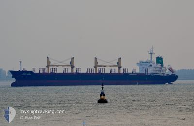
LATIKA NAREE
Bulk Carrier
Current Trip
| Time Travelled | 10 days |
|---|---|
| Remaining Time | --- |
| Distance Travelled | 2528.61 nm |
| Remaining Distance | --- |
| AVG Speed | 10.2 Knots |
| MAX Speed | 17.5 Knots |
| AVG Wind | 15 knots |
| MAX Wind | 38.8 knots |
| MIN Temp | -0.9°C / 30.38°F |
| MAX Temp | 22.1°C / 71.78°F |
| Dybgang | 9.9 m |
| Position Modtaget | 7 d siden |
Current Position
| Longitude | -57.36433° |
|---|---|
| Latitude | -38.54351° |
| Status | Under way using engine |
| Fart | 10.9 Knots |
| Kurs | 214.8° |
| Område | South Atlantic Ocean |
| Station | T-AIS |
| Position Modtaget | 7 d siden |
Info
Information
The current position of LATIKA NAREE is in South Atlantic Ocean with coordinates -38.54351° / -57.36433° as reported on 2024-04-21 18:38 by AIS to our vessel tracker app. The vessel's current speed is 10.9 Knots and is heading at the port of PUERTO QUETZAL. The estimated time of arrival as calculated by MyShipTracking vessel tracking app is 2024-05-08 08:00 LT
The vessel LATIKA NAREE (IMO: 9496941, MMSI: 567049000) is a Bulk Carrier that was built in 2012 ( 12 år gamle ). It's sailing under the flag of [TH] Thailand.
In this page you can find informations about the vessels current position, last detected port calls, and current voyage information. If the vessels is not in coverage by AIS you will find the latest position.
The current position of LATIKA NAREE is detected by our AIS receivers and we are not responsible for the reliability of the data. The last position was recorded while the vessel was in Coverage by the Ais receivers of our vessel tracking app.
The current draught of LATIKA NAREE as reported by AIS is 9.9 meters
Weather
| Temperature | 9.5°C / 49.1°F |
|---|---|
| Wind Speed | 26 knots |
| Direction | 229° SW |
| Pressure | 995.2 hPa |
| Humidity | 66.7 % |
| Cloud Coverage | 97 % |
Featured Company
Last Port Calls
| Port | Arrival | Departure | Time In Port |
|---|---|---|---|
| 2024-04-15 11:26 | 2024-04-18 22:46 | 3 d | |
| 2024-02-19 04:46 | 2024-02-21 11:48 | 2 d | |
| 2024-02-17 15:35 | 2024-02-18 13:18 | 21 h | |
| 2024-02-07 15:57 | 2024-02-11 05:37 | 3 d |
Last Trips
| Origin | Departure | Destination | Arrival | Distance | |
|---|---|---|---|---|---|
| 2024-02-21 05:48 | 2024-04-15 08:26 | 4499.43 nm | |||
| 2024-02-18 07:18 | 2024-02-18 22:46 | 114.18 nm | |||
| 2024-02-11 00:37 | 2024-02-17 09:35 | 1394.77 nm | |||
| 2024-01-27 22:11 | 2024-02-07 10:57 | 2888.65 nm |
Events
| Tid | Hændelsen | Detaljer | Position / Dest | Info |
|---|---|---|---|---|
| 2024-04-21 18:42 | Status er ændret | Default Under way using engine |
-38.55322 / -57.37373
GTPRQ
|
Fart: 10.9 kn Kurs: 214.8° |
| 2024-04-21 18:38 | Udenfor Dækning |
-38.54351 / -57.36433
South Atlantic Ocean
GTPRQ
|
Fart: 10.9 kn Kurs: 214.8° |
|
| 2024-04-21 16:06 | Status er ændret | Under way using engine Default |
-38.15124 / -57.02746
GTPRQ
|
Fart: 11.4 kn Kurs: 214° |
| 2024-04-21 15:58 | Status er ændret | Default Under way using engine |
-38.13020 / -57.00872
GTPRQ
|
Fart: 11.4 kn Kurs: 216.1° |
| 2024-04-21 14:24 | Status er ændret | Under way using engine Default |
-37.92373 / -56.74970
GTPRQ
|
Fart: 11.4 kn Kurs: 237° |
| 2024-04-21 14:05 | Status er ændret | Default Under way using engine |
-37.89083 / -56.68473
GTPRQ
|
Fart: 11.4 kn Kurs: 235.8° |
| 2024-04-21 12:58 | Status er ændret | Under way using engine Default |
-37.77853 / -56.46406
GTPRQ
|
Fart: 11.1 kn Kurs: 237° |
| 2024-04-21 12:51 | Status er ændret | Default Under way using engine |
-37.76575 / -56.44025
GTPRQ
|
Fart: 11.1 kn Kurs: 235.3° |
| 2024-04-21 12:45 | Status er ændret | Under way using engine Default |
-37.75476 / -56.41987
GTPRQ
|
Fart: 11.1 kn Kurs: 236° |
| 2024-04-21 12:26 | Status er ændret | Default Under way using engine |
-37.72369 / -56.35872
GTPRQ
|
Fart: 11 kn Kurs: 238.5° |