

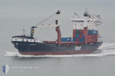
LAGARFOSS
Container Ship

Current Trip
| Trip Time | 16 h, 13 mins |
|---|---|
| Trip Distance | 236.26 nm |
| AVG Speed | 14.2 Knots |
| MAX Speed | 15.6 Knots |
| Dybgang | 7.3 m |
| AVG Wind | 13.8 knots |
| MAX Wind | 21 knots |
| MIN Temp | 4.6°C / 40.28°F |
| MAX Temp | 10.4°C / 50.72°F |
| Position Modtaget | 3 m siden |
Current Position
| Longitude | --- |
|---|---|
| Latitude | --- |
| Status | Moored |
| Fart | |
| Kurs | 41° |
| Område | Kattegat |
| Station | T-AIS |
| Position Modtaget | 3 m siden |
Information
The current position of LAGARFOSS is in Kattegat with coordinates 56.15405° / 10.24029° as reported on 2025-03-28 06:18 by AIS to our vessel tracker app. The vessel's current speed is 0 Knots and is currently inside the port of AARHUS.
The vessel LAGARFOSS (IMO: 9641314, MMSI: 231789000) is a Container Ship that was built in 2014 ( 11 år gamle ). It's sailing under the flag of [FO] Faroe Is.
In this page you can find informations about the vessels current position, last detected port calls, and current voyage information. If the vessels is not in coverage by AIS you will find the latest position.
The current position of LAGARFOSS is detected by our AIS receivers and we are not responsible for the reliability of the data. The last position was recorded while the vessel was in Coverage by the Ais receivers of our vessel tracking app.
The current draught of LAGARFOSS as reported by AIS is 7.3 meters
Weather
| Temperature | 6.2°C / 43.16°F |
|---|---|
| Wind Speed | 10 knots |
| Direction | 208° SSW |
| Pressure | 1009.3 hPa |
| Humidity | 79.7 % |
| Cloud Coverage | 45 % |


Featured Company
Last Port Calls
| Port | Arrival | Departure | Time In Port |
|---|---|---|---|
| 2025-03-27 10:52 | |||
| 2025-03-26 06:27 | 2025-03-26 18:39 | 12 h | |
| 2025-03-24 01:34 | 2025-03-24 17:13 | 15 h | |
| 2025-03-21 13:33 | 2025-03-21 22:20 | 8 h | |
| 2025-03-18 15:56 | 2025-03-19 19:17 | 1 d | |
| 2025-03-17 00:04 | 2025-03-17 07:24 | 7 h | |
| 2025-03-13 10:15 | 2025-03-14 20:13 | 1 d | |
| 2025-03-12 06:23 | 2025-03-12 17:00 | 10 h | |
| 2025-03-09 16:33 | 2025-03-10 04:02 | 11 h | |
| 2025-03-07 15:15 | 2025-03-07 21:06 | 5 h |
Most Visited Ports (Last year)
| Port | Arrivals | |
|---|---|---|
| 41 | ||
| 28 | ||
| 23 | ||
| 21 | ||
| 20 | ||
| 15 |
Last Trips
| Origin | Departure | Destination | Arrival | Distance | |
|---|---|---|---|---|---|
| 2025-03-26 18:39 | 2025-03-27 10:52 | 236.26 nm | |||
| 2025-03-24 17:13 | 2025-03-26 06:27 | 561.97 nm | |||
| 2025-03-21 22:20 | 2025-03-24 01:34 | 582.76 nm | |||
| 2025-03-19 19:17 | 2025-03-21 13:33 | 514.15 nm | |||
| 2025-03-17 07:24 | 2025-03-18 15:56 | 506.44 nm | |||
| 2025-03-14 20:13 | 2025-03-17 00:04 | 802.95 nm | |||
| 2025-03-12 17:00 | 2025-03-13 10:15 | 236.18 nm | |||
| 2025-03-10 04:02 | 2025-03-12 06:23 | 562.16 nm | |||
| 2025-03-07 21:06 | 2025-03-09 16:33 | 581.12 nm | |||
| 2025-03-06 12:51 | 2025-03-07 15:15 | 340.97 nm |
Events
| Tid | Hændelsen | Detaljer | Position / Dest | Info |
|---|---|---|---|---|
| 2025-03-28 02:39 | Status er ændret | Moored Default |
56.15411 / 10.24015
[DK] AARHUS
|
Fart: Kurs: 41° |
| 2025-03-28 02:36 | Status er ændret | Default Moored |
56.15413 / 10.24007
[DK] AARHUS
|
Fart: Kurs: 41° |
| 2025-03-27 22:03 | STOP Sejllads |
56.15417 / 10.23987
[DK] AARHUS
|
Fart: 0.2 kn Kurs: 39° |
|
| 2025-03-27 21:52 | START Sejllads |
56.15186 / 10.23281
[DK] AARHUS
|
Fart: 3.1 kn Kurs: 51° |
|
| 2025-03-27 10:30 | Status er ændret | Moored Under way using engine |
56.15098 / 10.22948
[DK] AARHUS
|
Fart: Kurs: 41° |
| 2025-03-27 10:17 | STOP Sejllads |
56.15065 / 10.22984
[DK] AARHUS
|
Fart: 0.3 kn Kurs: 52° |
|
| 2025-03-27 09:52 | Skibe i havn |
|
56.15964 / 10.24731
[DK] AARHUS
|
Fart: 3.9 kn Kurs: 258° |
| 2025-03-27 02:02 | Ændre havområde | Danish part of the Kattegat Swedish part of the Kattegat |
57.37162 / 11.46124
Kattegat
DKAAR
|
Fart: 14.9 kn Kurs: 158.8° |
| 2025-03-27 00:02 | Ændre havområde | Swedish part of the Kattegat Swedish part of the Skaggerak |
57.84673 / 11.20974
Kattegat
DKAAR
|
Fart: 14.9 kn Kurs: 166.7° |
| 2025-03-26 19:18 | Ændre havområde | Swedish part of the Skaggerak Norwegian part of the Skaggerak |
58.90608 / 10.72701
Skaggerak
DKAAR
|
Fart: 14.6 kn Kurs: 176.2° |