
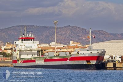
LAGANBORG
General Cargo
Current Trip
| Time Travelled | 7 h, 48 mins |
|---|---|
| Remaining Time | 4 days |
| Distance Travelled | 67.86 nm |
| Remaining Distance | 1067.38 nm |
| AVG Speed | 10.4 Knots |
| MAX Speed | 10.9 Knots |
| AVG Wind | 8.1 knots |
| MAX Wind | 16 knots |
| MIN Temp | 4.1°C / 39.38°F |
| MAX Temp | 5.2°C / 41.36°F |
| Dybgang | 6.5 m |
| Position Modtaget | 1 h, 25 m siden |
Current Position
| Longitude | --- |
|---|---|
| Latitude | --- |
| Status | Under way using engine |
| Fart | 10.8 Knots |
| Kurs | 231.2° |
| Område | Baltic Sea |
| Station | T-AIS |
| Position Modtaget | 1 h, 25 m siden |
Info
Information
The current position of LAGANBORG is in Baltic Sea with coordinates 59.49209° / 22.53518° as reported on 2025-12-12 02:27 by AIS to our vessel tracker app. The vessel's current speed is 10.8 Knots and is heading at the port of HULL. The estimated time of arrival as calculated by MyShipTracking vessel tracking app is 2025-12-16 06:06 LT
The vessel LAGANBORG (IMO: 9407419, MMSI: 244297000) is a General Cargo that was built in 2008 ( 17 år gamle ). It's sailing under the flag of [NL] Netherlands.
In this page you can find informations about the vessels current position, last detected port calls, and current voyage information. If the vessels is not in coverage by AIS you will find the latest position.
The current position of LAGANBORG is detected by our AIS receivers and we are not responsible for the reliability of the data. The last position was recorded while the vessel was in Coverage by the Ais receivers of our vessel tracking app.
The current draught of LAGANBORG as reported by AIS is 6.5 meters
Weather
| Temperature | 4.6°C / 40.28°F |
|---|---|
| Wind Speed | 16 knots |
| Direction | 18° NNE |
| Pressure | 1011.5 hPa |
| Humidity | 84.9 % |
| Cloud Coverage | 100 % |
Featured Company
Last Port Calls
| Port | Arrival | Departure | Time In Port |
|---|---|---|---|
| 2025-12-10 16:41 | 2025-12-11 22:04 | 1 d | |
| 2025-12-08 15:43 | 2025-12-10 11:32 | 1 d | |
| 2025-12-03 11:11 | 2025-12-03 14:05 | 2 h | |
| 2025-11-23 09:18 | 2025-11-25 13:23 | 2 d | |
| 2025-11-18 22:08 | 2025-11-20 22:04 | 1 d | |
| 2025-10-31 06:33 | 2025-11-03 22:25 | 3 d | |
| 2025-10-20 09:00 | 2025-10-28 12:12 | 8 d | |
| 2025-10-12 18:21 | 2025-10-14 10:08 | 1 d | |
| 2025-10-03 16:55 | 2025-10-09 15:56 | 5 d |
Last Trips
| Origin | Departure | Destination | Arrival | Distance | |
|---|---|---|---|---|---|
| 2025-12-10 11:32 | 2025-12-10 16:41 | 52.58 nm | |||
| 2025-12-03 14:05 | 2025-12-08 15:43 | 740.92 nm | |||
| 2025-11-25 13:23 | 2025-12-03 11:11 | 1839.85 nm | |||
| 2025-11-20 22:04 | 2025-11-23 09:18 | 300.25 nm | |||
| 2025-11-03 22:25 | 2025-11-18 22:08 | 3236.71 nm | |||
| 2025-10-28 12:12 | 2025-10-31 06:33 | 566.42 nm | |||
| 2025-10-14 10:08 | 2025-10-20 09:00 | 1455.38 nm | |||
| 2025-10-09 15:56 | 2025-10-12 18:21 | 664.77 nm | |||
| 2025-09-25 15:24 | 2025-10-03 16:55 | 1473.96 nm |
Events
| Tid | Hændelsen | Detaljer | Position / Dest | Info |
|---|---|---|---|---|
| 2025-12-12 02:40 | Status er ændret | Default Under way using engine |
59.46667 / 22.47167
GBHUL
|
Fart: 10.8 kn Kurs: 231.2° |
| 2025-12-12 02:27 | Udenfor Dækning |
59.49209 / 22.53518
Baltic Sea
GBHUL
|
Fart: 10.8 kn Kurs: 231.2° |
|
| 2025-12-12 00:46 | Ændre havområde | Finnish part of the Baltic Sea Finnish part of the Gulf of Finland |
59.60502 / 23.07693
Baltic Sea
GBHUL
|
Fart: 10.6 kn Kurs: 249.3° |
| 2025-12-11 22:32 | Status er ændret | Under way using engine Default |
59.74303 / 23.81351
GBHUL
|
Fart: 10.9 kn Kurs: 248° |
| 2025-12-11 22:28 | Status er ændret | Default Under way using engine |
59.74777 / 23.83760
GBHUL
|
Fart: 10.7 kn Kurs: 247.5° |
| 2025-12-11 22:17 | Status er ændret | Under way using engine Default |
59.76011 / 23.89746
GBHUL
|
Fart: 10.9 kn Kurs: 249° |
| 2025-12-11 22:00 | Status er ændret | Default Under way using engine |
59.77928 / 23.99060
GBHUL
|
Fart: 10.8 kn Kurs: 246.3° |
| 2025-12-11 21:52 | Status er ændret | Under way using engine Default |
59.78942 / 24.03831
GBHUL
|
Fart: 10.8 kn Kurs: 224° |
| 2025-12-11 21:21 | Status er ændret | Default Under way using engine |
59.86358 / 24.14496
GBHUL
|
Fart: 10.6 kn Kurs: 215.4° |
| 2025-12-11 21:06 | Status er ændret | Under way using engine Default |
59.89647 / 24.19139
GBHUL
|
Fart: 8.7 kn Kurs: 178° |