
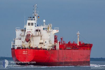
LADYBUG
Oil/Chemical Tanker
Current Trip
| Time Travelled | 16 days |
|---|---|
| Remaining Time | --- |
| Distance Travelled | 2304.16 nm |
| Remaining Distance | --- |
| AVG Speed | 10.8 Knots |
| MAX Speed | 13.1 Knots |
| AVG Wind | 12.5 knots |
| MAX Wind | 30.5 knots |
| MIN Temp | 7.1°C / 44.78°F |
| MAX Temp | 21.1°C / 69.98°F |
| Dybgang | 7.5 m |
| Position Modtaget | 1 m siden |
Current Position
| Longitude | --- |
|---|---|
| Latitude | --- |
| Status | Under way using engine |
| Fart | 8.3 Knots |
| Kurs | 44.9° |
| Område | Aegean Sea |
| Station | T-AIS |
| Position Modtaget | 1 m siden |
Information
The current position of LADYBUG is in Aegean Sea with coordinates 37.77644° / 24.37790° as reported on 2025-03-24 15:10 by AIS to our vessel tracker app. The vessel's current speed is 8.3 Knots and is heading at the port of NOVOROSSIYSK. The estimated time of arrival as calculated by MyShipTracking vessel tracking app is 2025-03-28 15:00 LT
The vessel LADYBUG (IMO: 9391385, MMSI: 636021850) is a Oil/Chemical Tanker that was built in 2008 ( 17 år gamle ). It's sailing under the flag of [LR] Liberia.
In this page you can find informations about the vessels current position, last detected port calls, and current voyage information. If the vessels is not in coverage by AIS you will find the latest position.
The current position of LADYBUG is detected by our AIS receivers and we are not responsible for the reliability of the data. The last position was recorded while the vessel was in Coverage by the Ais receivers of our vessel tracking app.
The current draught of LADYBUG as reported by AIS is 7.5 meters
Weather
| Temperature | 16.5°C / 61.7°F |
|---|---|
| Wind Speed | 9 knots |
| Direction | 166° SSE |
| Pressure | 1024.7 hPa |
| Humidity | 75.7 % |
| Cloud Coverage | 100 % |
Featured Company
Last Port Calls
| Port | Arrival | Departure | Time In Port |
|---|---|---|---|
| 2025-03-04 14:21 | 2025-03-08 13:29 | 3 d | |
| 2025-02-10 14:16 | |||
| 2025-02-10 09:15 | 2025-02-10 11:49 | 2 h | |
| 2025-01-14 05:14 | 2025-01-14 19:09 | 13 h |
Most Visited Ports (Last year)
| Port | Arrivals | |
|---|---|---|
| 12 | ||
| 7 | ||
| 2 | ||
| 1 | ||
| 1 | ||
| 1 |
Events
| Tid | Hændelsen | Detaljer | Position / Dest | Info |
|---|---|---|---|---|
| 2025-03-24 14:11 | Destination er ændret | RU NVS TR CKZ |
37.76248 / 24.20666
RU NVS
|
Fart: 7.2 kn Kurs: 72.3° |
| 2025-03-24 14:11 | ETA er ændret | 2025/03/28 15:00 2025/03/25 16:00 |
37.76248 / 24.20666
RU NVS
|
Fart: 7.2 kn Kurs: 72.3° |
| 2025-03-24 05:37 | Status er ændret | Under way using engine Default |
36.64720 / 23.44316
TR CKZ
|
Fart: 10.7 kn Kurs: 33° |
| 2025-03-24 05:27 | Status er ændret | Default Under way using engine |
36.62151 / 23.42242
TR CKZ
|
Fart: 10.8 kn Kurs: 32.8° |
| 2025-03-24 03:29 | Ændre havområde | Greek part of the Aegean Sea Greek part of the Ionian Sea |
36.38664 / 23.13191
Aegean Sea
TR CKZ
|
Fart: 10.8 kn Kurs: 95.8° |
| 2025-03-24 03:28 | Status er ændret | Under way using engine Default |
36.38683 / 23.12942
TR CKZ
|
Fart: 10.9 kn Kurs: 101° |
| 2025-03-24 03:22 | Indenfor Dækning |
36.38664 / 23.13191
Aegean Sea
TR CKZ
|
Fart: 10.8 kn Kurs: 95.8° |
|
| 2025-03-23 16:11 | Status er ændret | Default Under way using engine |
37.14574 / 20.88046
TR CKZ
|
Fart: 11.5 kn Kurs: 130.2° |
| 2025-03-23 16:11 | Udenfor Dækning |
37.14705 / 20.87844
Ionian Sea
TR CKZ
|
Fart: 11.5 kn Kurs: 130.2° |
|
| 2025-03-23 08:34 | Destination er ændret | TR CKZ TR DAN |
38.42178 / 19.96445
TR CKZ
|
Fart: 11.1 kn Kurs: 155.2° |