
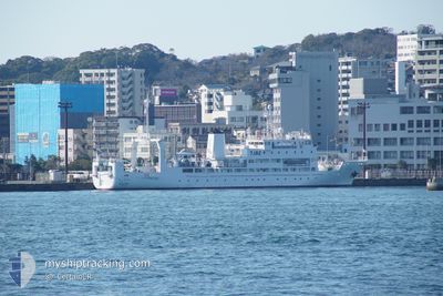
KOYO MARU
Training Ship
Current Trip
| Trip Time | 4 days |
|---|---|
| Trip Distance | 575.14 nm |
| AVG Speed | 7 Knots |
| MAX Speed | 7 Knots |
| Dybgang | 6.2 m |
| AVG Wind | 14.3 knots |
| MAX Wind | 37.8 knots |
| MIN Temp | 14.4°C / 57.92°F |
| MAX Temp | 23°C / 73.4°F |
| Position Modtaget | 1 d siden |
Current Position
| Longitude | 130.72288° |
|---|---|
| Latitude | 34.11336° |
| Status | Under way using engine |
| Fart | 9.8 Knots |
| Kurs | 147.9° |
| Område | Japan Sea |
| Station | T-AIS |
| Position Modtaget | 1 d siden |
Info
Information
The current position of KOYO MARU is in Japan Sea with coordinates 34.11336° / 130.72288° as reported on 2024-05-19 23:05 by AIS to our vessel tracker app. The vessel's current speed is 9.8 Knots and is currently inside the port of SHIMONOSEKI.
The vessel KOYO MARU (IMO: 9392688, MMSI: 432596000) is a Training Ship that was built in 2007 ( 17 år gamle ). It's sailing under the flag of [JP] Japan.
In this page you can find informations about the vessels current position, last detected port calls, and current voyage information. If the vessels is not in coverage by AIS you will find the latest position.
The current position of KOYO MARU is detected by our AIS receivers and we are not responsible for the reliability of the data. The last position was recorded while the vessel was in Coverage by the Ais receivers of our vessel tracking app.
The current draught of KOYO MARU as reported by AIS is 6.2 meters
Weather
| Temperature | 15.9°C / 60.62°F |
|---|---|
| Wind Speed | 3 knots |
| Direction | 19° NNE |
| Pressure | 1018.2 hPa |
| Humidity | 83 % |
| Cloud Coverage | 58 % |
Featured Company
Last Port Calls
| Port | Arrival | Departure | Time In Port |
|---|---|---|---|
| 2024-05-20 01:04 | |||
| 2024-04-23 03:04 | 2024-05-15 05:00 | 22 d | |
| 2024-04-16 00:39 | |||
| 2024-04-14 01:18 |
Last Trips
| Origin | Departure | Destination | Arrival | Distance | |
|---|---|---|---|---|---|
| 2024-05-15 14:00 | 2024-05-20 10:04 | 575.14 nm | |||
| 2024-04-14 10:18 | 2024-04-16 09:39 | 296.51 nm |
Events
| Tid | Hændelsen | Detaljer | Position / Dest | Info |
|---|---|---|---|---|
| 2024-05-20 01:04 | STOP Sejllads |
33.95013 / 130.93831
[JP] SHIMONOSEKI
|
Fart: 0.3 kn Kurs: 346° |
|
| 2024-05-20 01:04 | Skibe i havn |
|
33.95013 / 130.93831
[JP] SHIMONOSEKI
|
Fart: 1.8 kn Kurs: 329° |
| 2024-05-19 23:13 | Status er ændret | Default Under way using engine |
34.09973 / 130.73865
>JP KNM S
|
Fart: 9.8 kn Kurs: 147.9° |
| 2024-05-19 23:05 | Udenfor Dækning |
34.11336 / 130.72288
Japan Sea
>JP KNM S
|
Fart: 9.8 kn Kurs: 147.9° |
|
| 2024-05-19 23:02 | Status er ændret | Under way using engine Default |
34.12067 / 130.71848
>JP KNM S
|
Fart: 9.6 kn Kurs: 169° |
| 2024-05-19 22:56 | Indenfor Dækning |
34.11413 / 130.72228
Japan Sea
>JP KNM S
|
Fart: 9.8 kn Kurs: 147.1° |
|
| 2024-05-19 17:16 | START Sejllads | 15.37 nm, West of TSUNOSHIMA |
34.25400 / 130.56781
>JP KNM S
|
Fart: 7.5 kn Kurs: 105° |
| 2024-05-19 07:08 | STOP Sejllads | 11.71 nm, North West of KITAKYUSHU |
34.10166 / 130.65500
>JP KNM S
|
Fart: Kurs: -1° |
| 2024-05-19 06:56 | Status er ændret | Default Under way using engine |
34.10159 / 130.65909
>JP KNM S
|
Fart: 0.7 kn Kurs: 184° |
| 2024-05-19 06:51 | Udenfor Dækning |
34.10125 / 130.66062
Japan Sea
>JP KNM S
|
Fart: 0.7 kn Kurs: 275.9° |