
KIRKUK
Tanker
Current Trip
ADR OPL
| Time Travelled | --- |
|---|---|
| Remaining Time | --- |
| Distance Travelled | 562.42 nm |
| Remaining Distance | --- |
| AVG Speed | 7.4 Knots |
| MAX Speed | 10 Knots |
| AVG Wind | 11.4 knots |
| MAX Wind | 31.7 knots |
| MIN Temp | 17.1°C / 62.78°F |
| MAX Temp | 26.7°C / 80.06°F |
| Dybgang | 11 m |
| Position Modtaget | 4 d siden |
Current Position
| Longitude | --- |
|---|---|
| Latitude | --- |
| Status | At anchor |
| Fart | 0.2 Knots |
| Kurs | 76° |
| Område | South Atlantic Ocean |
| Station | T-AIS |
| Position Modtaget | 4 d siden |
Info
Information
The current position of KIRKUK is in South Atlantic Ocean with coordinates -23.73295° / -44.32243° as reported on 2025-12-31 06:20 by AIS to our vessel tracker app. The vessel's current speed is 0.2 Knots
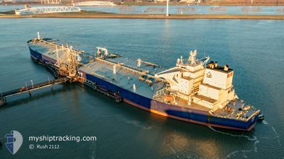
The vessel KIRKUK (IMO: 9829655, MMSI: 538008148) is a Tanker It's sailing under the flag of [MH] Marshall Is.
In this page you can find informations about the vessels current position, last detected port calls, and current voyage information. If the vessels is not in coverage by AIS you will find the latest position.
The current position of KIRKUK is detected by our AIS receivers and we are not responsible for the reliability of the data. The last position was recorded while the vessel was in Coverage by the Ais receivers of our vessel tracking app.
The current draught of KIRKUK as reported by AIS is 11 meters
Weather
| Temperature | 22.7°C / 72.86°F |
|---|---|
| Wind Speed | 15 knots |
| Direction | 140° SE |
| Pressure | 1015.7 hPa |
| Humidity | 83.6 % |
| Cloud Coverage | 100 % |
Featured Company
Last Port Calls
Most Visited Ports (Last year)
| Port | Arrivals | |
|---|---|---|
| 2 | ||
| 1 | ||
| 1 |
Last Trips
| Origin | Departure | Destination | Arrival | Distance |
|---|
Events
| Tid | Hændelsen | Detaljer | Position / Dest | Info |
|---|---|---|---|---|
| 2025-12-31 06:23 | Status er ændret | Default At anchor |
-23.73167 / -44.32167
ADR OPL
|
Fart: 0.2 kn Kurs: 76° |
| 2025-12-31 06:20 | Status er ændret | At anchor Default |
-23.73295 / -44.32243
ADR OPL
|
Fart: Kurs: -1° |
| 2025-12-31 06:20 | Udenfor Dækning |
-23.73295 / -44.32243
South Atlantic Ocean
|
Fart: 0.2 kn Kurs: 357.2° |
|
| 2025-12-31 06:17 | Indenfor Dækning |
-23.73295 / -44.32243
South Atlantic Ocean
|
Fart: 0.2 kn Kurs: 357.2° |
|
| 2025-12-31 02:05 | Status er ændret | Default At anchor |
-23.73004 / -44.32128
ADR OPL
|
Fart: 0.1 kn Kurs: 135° |
| 2025-12-31 01:53 | Status er ændret | At anchor Default |
-23.73036 / -44.32123
ADR OPL
|
Fart: 0.1 kn Kurs: 145° |
| 2025-12-31 01:53 | Udenfor Dækning |
-23.73036 / -44.32123
South Atlantic Ocean
|
Fart: 0.1 kn Kurs: 248° |
|
| 2025-12-31 01:41 | Indenfor Dækning |
-23.73036 / -44.32123
South Atlantic Ocean
|
Fart: 0.1 kn Kurs: 248° |
|
| 2025-12-29 08:59 | Status er ændret | Default At anchor |
-23.73088 / -44.32832
ADR OPL
|
Fart: 0.1 kn Kurs: 76° |
| 2025-12-29 08:53 | Udenfor Dækning |
-23.73084 / -44.32844
South Atlantic Ocean
|
Fart: 0.1 kn Kurs: 6.5° |