
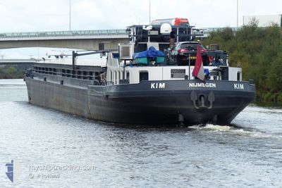
KIM
Cargo
Current Trip
XX
| Time Travelled | 7 days |
|---|---|
| Remaining Time | --- |
| Distance Travelled | 243.61 nm |
| Remaining Distance | --- |
| AVG Speed | 4.9 Knots |
| MAX Speed | 7.5 Knots |
| AVG Wind | 5.7 knots |
| MAX Wind | 14.4 knots |
| MIN Temp | 10.1°C / 50.18°F |
| MAX Temp | 24.1°C / 75.38°F |
| Dybgang | 0.2 m |
| Position Modtaget | 16 m siden |
Current Position
| Longitude | 13.51555° |
|---|---|
| Latitude | 52.42636° |
| Status | Moored |
| Fart | |
| Kurs | --- |
| Område | North Sea |
| Station | T-AIS |
| Position Modtaget | 16 m siden |
Info
Information
The current position of KIM is in North Sea with coordinates 52.42636° / 13.51555° as reported on 2024-05-06 16:45 by AIS to our vessel tracker app. The vessel's current speed is 0 Knots
The vessel KIM (MMSI: 244710655) is a Cargo It's sailing under the flag of [NL] Netherlands.
In this page you can find informations about the vessels current position, last detected port calls, and current voyage information. If the vessels is not in coverage by AIS you will find the latest position.
The current position of KIM is detected by our AIS receivers and we are not responsible for the reliability of the data. The last position was recorded while the vessel was in Coverage by the Ais receivers of our vessel tracking app.
The current draught of KIM as reported by AIS is 0.2 meters
Weather
| Temperature | 17.6°C / 63.68°F |
|---|---|
| Wind Speed | 9 knots |
| Direction | 339° NNW |
| Pressure | 1008.5 hPa |
| Humidity | 46.2 % |
| Cloud Coverage | 90 % |
Featured Company
Last Port Calls
| Port | Arrival | Departure | Time In Port |
|---|---|---|---|
| 2024-04-29 08:48 | 2024-04-29 09:11 | 23 m | |
| 2024-04-28 05:05 | 2024-04-28 05:27 | 22 m | |
| 2024-04-25 18:24 | 2024-04-26 05:37 | 11 h | |
| 2024-04-24 06:46 | 2024-04-24 07:23 | 36 m | |
| 2024-04-21 08:24 | 2024-04-23 17:44 | 2 d | |
| 2024-04-21 06:08 | 2024-04-21 06:28 | 19 m | |
| 2024-04-19 11:51 | 2024-04-19 13:01 | 1 h | |
| 2024-03-27 13:20 | 2024-03-27 14:13 | 53 m | |
| 2024-03-26 18:33 | 2024-03-27 05:24 | 10 h | |
| 2024-03-26 17:54 | 2024-03-26 18:28 | 34 m |
Most Visited Ports (Last year)
| Port | Arrivals | |
|---|---|---|
| 13 | ||
| 13 | ||
| 12 | ||
| 8 | ||
| 6 | ||
| 6 |
Last Trips
| Origin | Departure | Destination | Arrival | Distance | |
|---|---|---|---|---|---|
| 2024-04-28 07:27 | 2024-04-29 10:48 | 72.42 nm | |||
| 2024-04-26 07:37 | 2024-04-28 07:05 | 11.84 nm | |||
| 2024-04-24 09:23 | 2024-04-25 20:24 | 48.55 nm | |||
| 2024-04-23 19:44 | 2024-04-24 08:46 | 5.15 nm | |||
| 2024-04-21 08:28 | 2024-04-21 10:24 | 7.01 nm | |||
| 2024-04-19 15:01 | 2024-04-21 08:08 | 99.30 nm | |||
| 2024-03-27 15:13 | 2024-04-19 13:51 | 631.69 nm | |||
| 2024-03-27 06:24 | 2024-03-27 14:20 | 54.43 nm | |||
| 2024-03-26 19:28 | 2024-03-26 19:33 | 0.61 nm | |||
| 2024-03-26 16:43 | 2024-03-26 18:54 | 11.79 nm |
Events
| Tid | Hændelsen | Detaljer | Position / Dest | Info |
|---|---|---|---|---|
| 2024-05-05 17:21 | Status er ændret | Moored Under way using engine |
52.42646 / 13.51555
XX
|
Fart: Kurs: 511° |
| 2024-05-05 17:01 | STOP Sejllads | 6.78 nm, South East of BERLIN |
52.42660 / 13.51547
XX
|
Fart: 0.3 kn Kurs: 511° |
| 2024-05-05 16:07 | START Sejllads | 3.9 nm, South East of BERLIN |
52.45941 / 13.45409
XX
|
Fart: 3.7 kn Kurs: 105.9° |
| 2024-05-05 16:05 | Status er ændret | Under way using engine Moored |
52.45977 / 13.45133
XX
|
Fart: Kurs: 511° |
| 2024-05-03 09:16 | Status er ændret | Moored Under way using engine |
52.45974 / 13.45104
XX
|
Fart: Kurs: 511° |
| 2024-05-03 08:58 | STOP Sejllads | 3.83 nm, South East of BERLIN |
52.45972 / 13.45096
XX
|
Fart: 0.1 kn Kurs: 511° |
| 2024-05-03 05:58 | Indenfor Dækning |
52.39698 / 13.21765
North Sea
|
Fart: 4.7 kn Kurs: 76.1° |
|
| 2024-05-02 14:41 | Udenfor Dækning |
52.41692 / 13.08739
North Sea
|
Fart: 6.2 kn Kurs: 142.8° |
|
| 2024-05-02 14:01 | Indenfor Dækning |
52.44680 / 13.00000
North Sea
|
Fart: 5.5 kn Kurs: 113° |
|
| 2024-05-02 04:45 | Udenfor Dækning |
52.27703 / 11.83206
North Sea
|
Fart: 6.1 kn Kurs: 74.7° |