
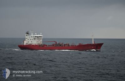
KEY FIGHTER
Oil/Chemical Tanker
Current Trip
| Time Travelled | 1 day |
|---|---|
| Remaining Time | 17 h, 8 mins |
| Distance Travelled | 494.70 nm |
| Remaining Distance | 231.15 nm |
| AVG Speed | 12.6 Knots |
| MAX Speed | 14.1 Knots |
| AVG Wind | 12.9 knots |
| MAX Wind | 21 knots |
| MIN Temp | 6°C / 42.8°F |
| MAX Temp | 13.4°C / 56.12°F |
| Dybgang | 5 m |
| Position Modtaget | 1 m siden |
Current Position
| Longitude | 14.57713° |
|---|---|
| Latitude | 55.33210° |
| Status | Under way using engine |
| Fart | 13.7 Knots |
| Kurs | 40.8° |
| Område | Kattegat |
| Station | T-AIS |
| Position Modtaget | 1 m siden |
Info
Information
The current position of KEY FIGHTER is in Kattegat with coordinates 55.33210° / 14.57713° as reported on 2024-04-28 18:06 by AIS to our vessel tracker app. The vessel's current speed is 13.7 Knots and is heading at the port of LIEPAJA. The estimated time of arrival as calculated by MyShipTracking vessel tracking app is 2024-04-29 11:15 LT
The vessel KEY FIGHTER (IMO: 8712166, MMSI: 215211000) is a Oil/Chemical Tanker that was built in 1989 ( 35 år gamle ). It's sailing under the flag of [MT] Malta.
In this page you can find informations about the vessels current position, last detected port calls, and current voyage information. If the vessels is not in coverage by AIS you will find the latest position.
The current position of KEY FIGHTER is detected by our AIS receivers and we are not responsible for the reliability of the data. The last position was recorded while the vessel was in Coverage by the Ais receivers of our vessel tracking app.
The current draught of KEY FIGHTER as reported by AIS is 5 meters
Weather
| Temperature | 10.5°C / 50.9°F |
|---|---|
| Wind Speed | 14 knots |
| Direction | 145° SE |
| Pressure | 1014.2 hPa |
| Humidity | 80.9 % |
| Cloud Coverage | 98 % |
Featured Company
Last Port Calls
| Port | Arrival | Departure | Time In Port |
|---|---|---|---|
| 2024-04-26 20:40 | 2024-04-27 03:42 | 7 h | |
| 2024-04-22 21:45 | 2024-04-23 21:23 | 23 h | |
| 2024-04-15 09:16 | 2024-04-16 05:34 | 20 h | |
| 2024-04-10 09:47 | 2024-04-11 22:00 | 1 d | |
| 2024-04-06 07:55 | 2024-04-06 22:56 | 15 h | |
| 2024-04-02 06:22 | 2024-04-02 20:00 | 13 h | |
| 2024-03-30 02:29 | 2024-03-30 09:56 | 7 h | |
| 2024-03-27 08:51 | 2024-03-27 19:04 | 10 h | |
| 2024-03-24 18:54 | 2024-03-26 17:13 | 1 d | |
| 2024-03-23 22:47 | 2024-03-24 09:52 | 11 h |
Last Trips
| Origin | Departure | Destination | Arrival | Distance | |
|---|---|---|---|---|---|
| 2024-04-24 00:23 | 2024-04-26 22:40 | 719.46 nm | |||
| 2024-04-16 07:34 | 2024-04-23 00:45 | 1060.09 nm | |||
| 2024-04-12 01:00 | 2024-04-15 11:16 | 1022.47 nm | |||
| 2024-04-06 23:56 | 2024-04-10 12:47 | 1022.83 nm | |||
| 2024-04-02 21:00 | 2024-04-06 08:55 | 637.96 nm | |||
| 2024-03-30 10:56 | 2024-04-02 07:22 | 869.07 nm | |||
| 2024-03-27 20:04 | 2024-03-30 03:29 | 197.03 nm | |||
| 2024-03-26 18:13 | 2024-03-27 09:51 | 156.89 nm | |||
| 2024-03-24 10:52 | 2024-03-24 19:54 | 114.41 nm | |||
| 2024-03-20 15:13 | 2024-03-23 23:47 | 766.46 nm |
Events
| Tid | Hændelsen | Detaljer | Position / Dest | Info |
|---|---|---|---|---|
| 2024-04-28 18:07 | ETA er ændret | 2024/04/29 13:00 2024/04/29 14:00 |
55.33302 / 14.57851
LV LPX
|
Fart: 13.8 kn Kurs: 40.8° |
| 2024-04-28 17:46 | Dybgangen er ændret | 5 5.2 |
55.27526 / 14.48717
LV LPX
|
Fart: 13.5 kn Kurs: 41° |
| 2024-04-28 17:04 | Ændre havområde | Danish part of the Kattegat Swedish part of the Baltic Sea |
55.17896 / 14.28417
Kattegat
LV LPX
|
Fart: 13.2 kn Kurs: 79.6° |
| 2024-04-28 12:46 | Ændre havområde | Swedish part of the Baltic Sea Danish part of the Baltic Sea |
55.29911 / 12.64985
Baltic Sea
LV LPX
|
Fart: 12.9 kn Kurs: 114.2° |
| 2024-04-28 12:40 | Ændre havområde | Danish part of the Baltic Sea Danish part of the Kattegat |
55.31456 / 12.62840
Baltic Sea
LV LPX
|
Fart: 13.1 kn Kurs: 177.7° |
| 2024-04-28 12:31 | Ændre havområde | Danish part of the Kattegat Swedish part of the Kattegat |
55.34706 / 12.63541
Kattegat
LV LPX
|
Fart: 13.1 kn Kurs: 191.9° |
| 2024-04-28 11:58 | Ændre havområde | Swedish part of the Kattegat Danish part of the Kattegat |
55.46395 / 12.68349
Kattegat
LV LPX
|
Fart: 12.9 kn Kurs: 190.9° |
| 2024-04-28 09:25 | Ændre havområde | Danish part of the Kattegat Swedish part of the Kattegat |
55.93168 / 12.65212
Kattegat
LV LPX
|
Fart: 12.9 kn Kurs: 197.9° |
| 2024-04-28 09:01 | Ændre havområde | Swedish part of the Kattegat Danish part of the Kattegat |
56.01730 / 12.66190
Kattegat
LV LPX
|
Fart: 13 kn Kurs: 163.6° |
| 2024-04-28 07:46 | Ændre havområde | Danish part of the Kattegat Swedish part of the Kattegat |
56.20253 / 12.38621
Kattegat
LV LPX
|
Fart: 12.5 kn Kurs: 167° |