

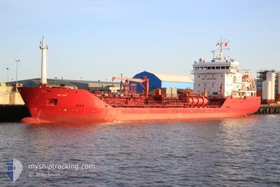
KEY BAY
Oil/Chemical Tanker

Current Trip
| Time Travelled | 3 days |
|---|---|
| Remaining Time | --- |
| Distance Travelled | 991.52 nm |
| Remaining Distance | --- |
| AVG Speed | 11.1 Knots |
| MAX Speed | 14.2 Knots |
| AVG Wind | 12.3 knots |
| MAX Wind | 18.5 knots |
| MIN Temp | 11.4°C / 52.52°F |
| MAX Temp | 16°C / 60.8°F |
| Dybgang | 5.1 m |
| Position Modtaget | 1 h, 26 m siden |
Current Position
| Longitude | --- |
|---|---|
| Latitude | --- |
| Status | Under way using engine |
| Fart | 13.9 Knots |
| Kurs | 28° |
| Område | Celtic Sea |
| Station | T-AIS |
| Position Modtaget | 1 h, 26 m siden |
Information
The current position of KEY BAY is in Celtic Sea with coordinates 48.45391° / -5.89379° as reported on 2025-03-27 11:41 by AIS to our vessel tracker app. The vessel's current speed is 13.9 Knots and is heading at the port of GRANGEMOUTH. The estimated time of arrival as calculated by MyShipTracking vessel tracking app is 2025-03-30 13:00 LT
The vessel KEY BAY (IMO: 9291561, MMSI: 236446000) is a Oil/Chemical Tanker that was built in 2004 ( 21 år gamle ). It's sailing under the flag of [GI] Gibraltar.
In this page you can find informations about the vessels current position, last detected port calls, and current voyage information. If the vessels is not in coverage by AIS you will find the latest position.
The current position of KEY BAY is detected by our AIS receivers and we are not responsible for the reliability of the data. The last position was recorded while the vessel was in Coverage by the Ais receivers of our vessel tracking app.
The current draught of KEY BAY as reported by AIS is 5.1 meters
Weather
| Temperature | 12.3°C / 54.14°F |
|---|---|
| Wind Speed | 2 knots |
| Direction | 260° W |
| Pressure | 1022 hPa |
| Humidity | 70.4 % |
| Cloud Coverage | --- |


Featured Company
Last Port Calls
| Port | Arrival | Departure | Time In Port |
|---|---|---|---|
| 2025-03-21 22:07 | 2025-03-23 17:40 | 1 d | |
| 2025-03-12 10:01 | 2025-03-13 21:33 | 1 d | |
| 2025-03-03 16:43 | 2025-03-04 20:20 | 1 d | |
| 2025-02-27 19:10 | 2025-02-28 18:52 | 23 h | |
| 2025-02-19 19:57 | 2025-02-21 22:41 | 2 d | |
| 2025-02-18 07:25 | 2025-02-19 00:49 | 17 h | |
| 2025-02-15 23:13 | 2025-02-16 13:37 | 14 h | |
| 2025-02-14 05:21 | 2025-02-15 00:03 | 18 h | |
| 2025-02-09 17:00 | 2025-02-10 17:40 | 1 d | |
| 2025-02-08 14:36 | 2025-02-09 09:07 | 18 h |
Most Visited Ports (Last year)
| Port | Arrivals | |
|---|---|---|
| 5 | ||
| 5 | ||
| 5 | ||
| 5 | ||
| 4 | ||
| 3 |
Last Trips
| Origin | Departure | Destination | Arrival | Distance | |
|---|---|---|---|---|---|
| 2025-03-13 21:33 | 2025-03-21 22:07 | 967.43 nm | |||
| 2025-03-04 20:20 | 2025-03-12 10:01 | 1453.99 nm | |||
| 2025-02-28 18:52 | 2025-03-03 16:43 | 800.73 nm | |||
| 2025-02-21 22:41 | 2025-02-27 19:10 | 935.31 nm | |||
| 2025-02-19 00:49 | 2025-02-19 19:57 | 143.93 nm | |||
| 2025-02-16 13:37 | 2025-02-18 07:25 | 371.88 nm | |||
| 2025-02-15 00:03 | 2025-02-15 23:13 | 246.78 nm | |||
| 2025-02-10 17:40 | 2025-02-14 05:21 | 813.21 nm | |||
| 2025-02-09 09:07 | 2025-02-09 17:00 | 72.70 nm | |||
| 2025-02-07 02:01 | 2025-02-08 14:36 | 415.57 nm |
Events
| Tid | Hændelsen | Detaljer | Position / Dest | Info |
|---|---|---|---|---|
| 2025-03-27 11:48 | Status er ændret | Default Under way using engine |
48.47648 / -5.87493
GBGRG
|
Fart: 13.9 kn Kurs: 28° |
| 2025-03-27 11:41 | Udenfor Dækning |
48.45391 / -5.89379
Celtic Sea
GBGRG
|
Fart: 13.9 kn Kurs: 28° |
|
| 2025-03-27 11:39 | Status er ændret | Under way using engine Default |
48.44592 / -5.90030
GBGRG
|
Fart: 13.7 kn Kurs: 26° |
| 2025-03-27 11:15 | Status er ændret | Default Under way using engine |
48.36574 / -5.96439
GBGRG
|
Fart: 13.3 kn Kurs: 28° |
| 2025-03-27 11:13 | Fundet i havområde | French part of the Celtic Sea |
48.35863 / -5.97015
Celtic Sea
GBGRG
|
Fart: 13.3 kn Kurs: 28° |
| 2025-03-27 11:11 | Status er ændret | Under way using engine Default |
48.35090 / -5.97628
GBGRG
|
Fart: 13 kn Kurs: 25° |
| 2025-03-27 10:54 | Indenfor Dækning |
48.35863 / -5.97015
Celtic Sea
GBGRG
|
Fart: 13.3 kn Kurs: 28° |
|
| 2025-03-25 18:18 | Status er ændret | Default Under way using engine |
40.76899 / -9.91361
GBGRG
|
Fart: 11.7 kn Kurs: 1° |
| 2025-03-25 18:16 | Status er ændret | Under way using engine Default |
40.76143 / -9.91377
GBGRG
|
Fart: 11.3 kn Kurs: 358° |
| 2025-03-25 18:16 | Udenfor Dækning |
40.76143 / -9.91377
North Atlantic Ocean
GBGRG
|
Fart: 11.7 kn Kurs: 1° |