
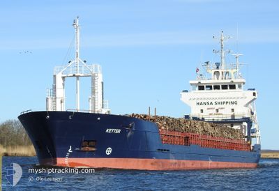
KETTER
General Cargo
Current Trip
| Time Travelled | 2 days |
|---|---|
| Remaining Time | --- |
| Distance Travelled | 569.16 nm |
| Remaining Distance | --- |
| AVG Speed | 9.6 Knots |
| MAX Speed | 10.6 Knots |
| AVG Wind | 12.3 knots |
| MAX Wind | 18 knots |
| MIN Temp | 0.1°C / 32.18°F |
| MAX Temp | 6.4°C / 43.52°F |
| Dybgang | 5.5 m |
| Position Modtaget | 3 m siden |
Current Position
| Longitude | --- |
|---|---|
| Latitude | --- |
| Status | At anchor |
| Fart | |
| Kurs | 223° |
| Område | Baltic Sea |
| Station | T-AIS |
| Position Modtaget | 3 m siden |
Info
Information
The current position of KETTER is in Baltic Sea with coordinates 54.44304° / 18.65064° as reported on 2025-01-30 02:49 by AIS to our vessel tracker app. The vessel's current speed is 0 Knots
The vessel KETTER (IMO: 9195860, MMSI: 229344000) is a General Cargo that was built in 2000 ( 25 år gamle ). It's sailing under the flag of [MT] Malta.
In this page you can find informations about the vessels current position, last detected port calls, and current voyage information. If the vessels is not in coverage by AIS you will find the latest position.
The current position of KETTER is detected by our AIS receivers and we are not responsible for the reliability of the data. The last position was recorded while the vessel was in Coverage by the Ais receivers of our vessel tracking app.
The current draught of KETTER as reported by AIS is 5.5 meters
Weather
| Temperature | 6°C / 42.8°F |
|---|---|
| Wind Speed | 15 knots |
| Direction | 220° SW |
| Pressure | 1009.3 hPa |
| Humidity | 77.6 % |
| Cloud Coverage | 98 % |
Featured Company
Last Port Calls
| Port | Arrival | Departure | Time In Port |
|---|---|---|---|
| 2025-01-23 03:45 | 2025-01-27 09:55 | 4 d | |
| 2025-01-06 11:42 | 2025-01-09 08:06 | 2 d | |
| 2025-01-02 07:01 | 2025-01-04 08:53 | 2 d | |
| 2024-12-24 15:08 | 2024-12-30 14:09 | 5 d | |
| 2024-12-10 23:13 | 2024-12-12 09:29 | 1 d | |
| 2024-12-10 22:38 | 2024-12-10 22:50 | 12 m | |
| 2024-12-05 05:55 | 2024-12-07 07:45 | 2 d | |
| 2024-11-25 14:22 | 2024-11-27 01:13 | 1 d | |
| 2024-11-21 19:56 | 2024-11-23 06:28 | 1 d | |
| 2024-11-17 11:47 | 2024-11-20 22:23 | 3 d |
Last Trips
| Origin | Departure | Destination | Arrival | Distance | |
|---|---|---|---|---|---|
| 2025-01-09 09:06 | 2025-01-23 06:45 | 1173.16 nm | |||
| 2025-01-04 10:53 | 2025-01-06 12:42 | 538.82 nm | |||
| 2024-12-30 15:09 | 2025-01-02 09:01 | 497.61 nm | |||
| 2024-12-12 10:29 | 2024-12-24 16:08 | 1508.07 nm | |||
| 2024-12-10 23:50 | 2024-12-11 00:13 | 1.15 nm | |||
| 2024-12-07 07:45 | 2024-12-10 23:38 | 366.27 nm | |||
| 2024-11-27 03:13 | 2024-12-05 05:55 | 1427.36 nm | |||
| 2024-11-23 07:28 | 2024-11-25 16:22 | 474.60 nm | |||
| 2024-11-20 23:23 | 2024-11-21 20:56 | 241.19 nm | |||
| 2024-11-14 19:06 | 2024-11-17 12:47 | 340.59 nm |
Events
| Tid | Hændelsen | Detaljer | Position / Dest | Info |
|---|---|---|---|---|
| 2025-01-29 20:22 | Status er ændret | At anchor Under way using engine |
54.44199 / 18.65039
PLGDN
|
Fart: 0.8 kn Kurs: 296° |
| 2025-01-29 20:17 | STOP Sejllads | 3.69 nm, North of GDANSK |
54.44226 / 18.64921
PLGDN
|
Fart: 0.3 kn Kurs: 252° |
| 2025-01-29 16:26 | ETA er ændret | 2025/01/29 19:00 2025/01/29 17:00 |
54.93356 / 18.99667
PLGDN
|
Fart: 8.6 kn Kurs: 183.3° |
| 2025-01-29 15:45 | Fundet i havområde | Polish part of the Baltic Sea |
55.02948 / 19.00620
Baltic Sea
PLGDN
|
Fart: 8.8 kn Kurs: 183.2° |
| 2025-01-29 15:45 | Status er ændret | Under way using engine Default |
55.02948 / 19.00620
PLGDN
|
Fart: 8.7 kn Kurs: 179° |
| 2025-01-29 15:45 | Indenfor Dækning |
55.02948 / 19.00620
Baltic Sea
PLGDN
|
Fart: 8.8 kn Kurs: 183.2° |
|
| 2025-01-28 10:07 | Status er ændret | Default Under way using engine |
59.24401 / 22.84035
PLGDN
|
Fart: 10.3 kn Kurs: 241.3° |
| 2025-01-28 09:59 | Udenfor Dækning |
59.25591 / 22.88176
Baltic Sea
PLGDN
|
Fart: 10.3 kn Kurs: 241.3° |
|
| 2025-01-28 09:43 | Status er ændret | Under way using engine Default |
59.27599 / 22.95855
PLGDN
|
Fart: 10.2 kn Kurs: 242° |
| 2025-01-28 09:11 | Status er ændret | Default Under way using engine |
59.31750 / 23.11651
PLGDN
|
Fart: 10.1 kn Kurs: 244.9° |