
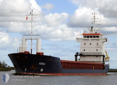
KERLI
General Cargo
Current Trip
| Time Travelled | 2 h, 1 mins |
|---|---|
| Remaining Time | 7 h, 41 mins |
| Distance Travelled | 13.19 nm |
| Remaining Distance | 81.02 nm |
| AVG Speed | 8.7 Knots |
| MAX Speed | 12.1 Knots |
| AVG Wind | 7.2 knots |
| MAX Wind | 8 knots |
| MIN Temp | 14.5°C / 58.1°F |
| MAX Temp | 16.2°C / 61.16°F |
| Dybgang | 5.5 m |
| Position Modtaget | 1 m siden |
Current Position
| Longitude | 8.80320° |
|---|---|
| Latitude | 53.84071° |
| Status | Under way using engine |
| Fart | 12.3 Knots |
| Kurs | 274.5° |
| Område | North Sea |
| Station | T-AIS |
| Position Modtaget | 1 m siden |
Info
Information
The current position of KERLI is in North Sea with coordinates 53.84071° / 8.80320° as reported on 2024-05-09 15:26 by AIS to our vessel tracker app. The vessel's current speed is 12.3 Knots and is heading at the port of BREMEN. The estimated time of arrival as calculated by MyShipTracking vessel tracking app is 2024-05-09 23:09 LT
The vessel KERLI (IMO: 9125695, MMSI: 229849000) is a General Cargo that was built in 1997 ( 27 år gamle ). It's sailing under the flag of [MT] Malta.
In this page you can find informations about the vessels current position, last detected port calls, and current voyage information. If the vessels is not in coverage by AIS you will find the latest position.
The current position of KERLI is detected by our AIS receivers and we are not responsible for the reliability of the data. The last position was recorded while the vessel was in Coverage by the Ais receivers of our vessel tracking app.
The current draught of KERLI as reported by AIS is 5.5 meters
Weather
| Temperature | 14.9°C / 58.82°F |
|---|---|
| Wind Speed | 7 knots |
| Direction | 325° NW |
| Pressure | 1025.6 hPa |
| Humidity | 69.6 % |
| Cloud Coverage | 98 % |
Featured Company
Last Port Calls
| Port | Arrival | Departure | Time In Port |
|---|---|---|---|
| 2024-05-09 10:20 | 2024-05-09 13:27 | 3 h | |
| 2024-05-06 09:01 | 2024-05-08 11:53 | 2 d | |
| 2024-05-04 12:20 | 2024-05-05 10:38 | 22 h | |
| 2024-04-28 16:35 | 2024-04-29 17:42 | 1 d | |
| 2024-04-25 18:49 | 2024-04-27 11:46 | 1 d | |
| 2024-04-18 11:46 | 2024-04-21 05:38 | 2 d | |
| 2024-04-17 07:59 | 2024-04-17 22:41 | 14 h | |
| 2024-04-15 01:19 | 2024-04-15 02:43 | 1 h | |
| 2024-04-12 05:08 | 2024-04-12 14:41 | 9 h | |
| 2024-04-06 08:05 | 2024-04-09 14:44 | 3 d |
Last Trips
| Origin | Departure | Destination | Arrival | Distance | |
|---|---|---|---|---|---|
| 2024-05-08 13:53 | 2024-05-09 12:20 | 199.24 nm | |||
| 2024-05-05 12:38 | 2024-05-06 11:01 | 260.47 nm | |||
| 2024-04-29 19:42 | 2024-05-04 14:20 | 403.70 nm | |||
| 2024-04-27 13:46 | 2024-04-28 18:35 | 264.50 nm | |||
| 2024-04-21 07:38 | 2024-04-25 20:49 | 651.06 nm | |||
| 2024-04-18 00:41 | 2024-04-18 13:46 | 125.04 nm | |||
| 2024-04-15 04:43 | 2024-04-17 09:59 | 353.81 nm | |||
| 2024-04-12 17:41 | 2024-04-15 03:19 | 582.27 nm | |||
| 2024-04-09 16:44 | 2024-04-12 08:08 | 619.08 nm | |||
| 2024-04-06 00:09 | 2024-04-06 10:05 | 103.10 nm |
Events
| Tid | Hændelsen | Detaljer | Position / Dest | Info |
|---|---|---|---|---|
| 2024-05-09 14:14 | START Sejllads | 0.88 nm, South West of BRUNSBUETTEL |
53.89079 / 9.14622
DE BRE
|
Fart: 3.7 kn Kurs: 223° |
| 2024-05-09 13:44 | STOP Sejllads | 0.77 nm, South West of BRUNSBUETTEL |
53.89223 / 9.14813
DE BRE
|
Fart: 0.1 kn Kurs: 221° |
| 2024-05-09 13:40 | Ændre havområde | German part of the North Sea German part of the Baltic Sea |
53.89300 / 9.14921
North Sea
DE BRE
|
Fart: 1.8 kn Kurs: 222.7° |
| 2024-05-09 13:27 | Afsejlet fra sidste havn |
|
53.90581 / 9.16817
DE BRE
|
Fart: 6.2 kn Kurs: 229° |
| 2024-05-09 13:22 | START Sejllads |
53.91205 / 9.18020
[DE] OSTERMOOR
|
Fart: 5.5 kn Kurs: 230° |
|
| 2024-05-09 10:23 | STOP Sejllads |
53.91355 / 9.18351
[DE] OSTERMOOR
|
Fart: 0.2 kn Kurs: 221° |
|
| 2024-05-09 10:20 | Skibe i havn |
|
53.91383 / 9.18392
[DE] OSTERMOOR
|
Fart: 0.6 kn Kurs: 223° |
| 2024-05-09 08:26 | Status er ændret | Under way using engine Default |
54.08735 / 9.32299
DE BRE
|
Fart: 7 kn Kurs: 198° |
| 2024-05-09 08:22 | Status er ændret | Default Under way using engine |
54.09476 / 9.32697
DE BRE
|
Fart: 7 kn Kurs: 175° |
| 2024-05-09 08:05 | Status er ændret | Under way using engine Default |
54.12677 / 9.32990
DE BRE
|
Fart: 6.9 kn Kurs: 233° |