

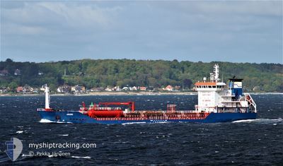
KARIA
Oil/Chemical Tanker

Current Trip
| Time Travelled | 2 days |
|---|---|
| Remaining Time | 10 h, 57 mins |
| Distance Travelled | 446.44 nm |
| Remaining Distance | 142.47 nm |
| AVG Speed | 10.4 Knots |
| MAX Speed | 11.7 Knots |
| AVG Wind | 8.3 knots |
| MAX Wind | 19.2 knots |
| MIN Temp | 15.3°C / 59.54°F |
| MAX Temp | 21.5°C / 70.7°F |
| Dybgang | 7 m |
| Position Modtaget | 5 h, 25 m siden |
Current Position
| Longitude | --- |
|---|---|
| Latitude | --- |
| Status | Under way using engine |
| Fart | 11 Knots |
| Kurs | 91° |
| Område | Mediterranean Sea - Eastern Basin |
| Station | T-AIS |
| Position Modtaget | 5 h, 25 m siden |
Information
The current position of KARIA is in Mediterranean Sea - Eastern Basin with coordinates 36.01208° / 31.45913° as reported on 2025-03-27 03:31 by AIS to our vessel tracker app. The vessel's current speed is 11 Knots and is heading at the port of MERSIN. The estimated time of arrival as calculated by MyShipTracking vessel tracking app is 2025-03-27 19:54 LT
The vessel KARIA (IMO: 9305362, MMSI: 271049852) is a Oil/Chemical Tanker that was built in 2005 ( 20 år gamle ). It's sailing under the flag of [TR] Turkey.
In this page you can find informations about the vessels current position, last detected port calls, and current voyage information. If the vessels is not in coverage by AIS you will find the latest position.
The current position of KARIA is detected by our AIS receivers and we are not responsible for the reliability of the data. The last position was recorded while the vessel was in Coverage by the Ais receivers of our vessel tracking app.
The current draught of KARIA as reported by AIS is 7 meters
Weather
| Temperature | 18.2°C / 64.76°F |
|---|---|
| Wind Speed | 13 knots |
| Direction | 122° ESE |
| Pressure | 1012.7 hPa |
| Humidity | 77 % |
| Cloud Coverage | 55 % |


Featured Company
Last Port Calls
| Port | Arrival | Departure | Time In Port |
|---|---|---|---|
| 2025-03-23 08:32 | 2025-03-24 09:47 | 1 d | |
| 2025-03-17 12:19 | 2025-03-18 10:12 | 21 h | |
| 2025-03-10 12:10 | 2025-03-11 10:01 | 21 h | |
| 2025-03-07 01:57 | 2025-03-08 05:14 | 1 d | |
| 2025-01-23 07:41 | 2025-03-02 19:00 | ||
| 2025-01-03 10:30 | 2025-01-09 17:34 | 6 d |
Most Visited Ports (Last year)
| Port | Arrivals | |
|---|---|---|
| 27 | ||
| 8 | ||
| 2 | ||
| 1 |
Last Trips
| Origin | Departure | Destination | Arrival | Distance | |
|---|---|---|---|---|---|
| 2025-03-18 13:12 | 2025-03-23 11:32 | 686.85 nm | |||
| 2025-03-11 13:01 | 2025-03-17 15:19 | 673.11 nm | |||
| 2025-03-08 08:14 | 2025-03-10 15:10 | 610.21 nm | |||
| 2025-03-02 22:00 | 2025-03-07 04:57 | 624.76 nm | |||
| 2025-01-09 20:34 | 2025-01-23 10:41 | 304.23 nm | |||
| 2024-12-22 01:01 | 2025-01-03 13:30 | 811.38 nm |
Events
| Tid | Hændelsen | Detaljer | Position / Dest | Info |
|---|---|---|---|---|
| 2025-03-27 03:34 | Status er ændret | Default Under way using engine |
36.01177 / 31.47107
TRALI>TRMER
|
Fart: 11 kn Kurs: 91° |
| 2025-03-27 03:31 | Status er ændret | Under way using engine Default |
36.01208 / 31.45913
TRALI>TRMER
|
Fart: 10.9 kn Kurs: 90° |
| 2025-03-27 03:31 | Udenfor Dækning |
36.01208 / 31.45913
Mediterranean Sea - Eastern Basin
TRALI>TRMER
|
Fart: 11 kn Kurs: 91° |
|
| 2025-03-27 03:23 | Status er ændret | Default Under way using engine |
36.01277 / 31.42652
TRALI>TRMER
|
Fart: 10.8 kn Kurs: 89° |
| 2025-03-27 02:28 | Status er ændret | Under way using engine Default |
36.01315 / 31.21863
TRALI>TRMER
|
Fart: 11.2 kn Kurs: 94° |
| 2025-03-27 01:34 | Status er ændret | Default Under way using engine |
36.02492 / 31.01560
TRALI>TRMER
|
Fart: 10.9 kn Kurs: 93° |
| 2025-03-27 00:21 | Status er ændret | Under way using engine Default |
36.03703 / 30.73620
TRALI>TRMER
|
Fart: 11.3 kn Kurs: 92° |
| 2025-03-26 23:58 | Status er ændret | Default Under way using engine |
36.04132 / 30.64963
TRALI>TRMER
|
Fart: 11 kn Kurs: 93° |
| 2025-03-26 23:36 | Status er ændret | Under way using engine Default |
36.04602 / 30.56638
TRALI>TRMER
|
Fart: 10.9 kn Kurs: 92° |
| 2025-03-26 23:30 | Status er ændret | Default Under way using engine |
36.04697 / 30.54265
TRALI>TRMER
|
Fart: 10.8 kn Kurs: 91° |