
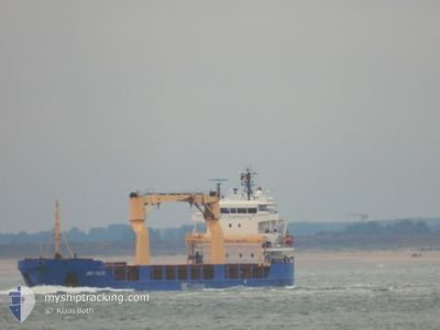
KAMILLA
General Cargo
Current Trip
| Trip Time | --- |
|---|---|
| Trip Distance | --- |
| AVG Speed | --- |
| MAX Speed | --- |
| Dybgang | --- |
| AVG Wind | --- |
| MAX Wind | --- |
| MIN Temp | --- |
| MAX Temp | --- |
| Position Modtaget | 2 d siden |
Current Position
| Longitude | --- |
|---|---|
| Latitude | --- |
| Status | Moored |
| Fart | |
| Kurs | 31° |
| Område | Gulf of Finland |
| Station | T-AIS |
| Position Modtaget | 2 d siden |
Info
Information
The current position of KAMILLA is in Gulf of Finland with coordinates 59.90288° / 30.22470° as reported on 2025-02-23 14:02 by AIS to our vessel tracker app. The vessel's current speed is 0 Knots and is currently inside the port of ST PETERSBURG.
The vessel KAMILLA (IMO: 9427081, MMSI: 305108000) is a General Cargo that was built in 2007 ( 18 år gamle ). It's sailing under the flag of [AG] Antigua Barbuda.
In this page you can find informations about the vessels current position, last detected port calls, and current voyage information. If the vessels is not in coverage by AIS you will find the latest position.
The current position of KAMILLA is detected by our AIS receivers and we are not responsible for the reliability of the data. The last position was recorded while the vessel was in Coverage by the Ais receivers of our vessel tracking app.
The current draught of KAMILLA as reported by AIS is 4.3 meters
Weather
| Temperature | -0.3°C / 31.46°F |
|---|---|
| Wind Speed | 7 knots |
| Direction | 163° SSE |
| Pressure | 1028.9 hPa |
| Humidity | 83.8 % |
| Cloud Coverage | 100 % |
Featured Company
Last Port Calls
| Port | Arrival | Departure | Time In Port |
|---|---|---|---|
| 2025-02-08 15:02 | 2025-02-09 11:48 | 20 h | |
| 2025-01-18 09:40 | |||
| 2025-01-05 07:28 | 2025-01-08 16:28 | 3 d | |
| 2025-01-02 20:10 | 2025-01-02 20:15 | 4 m | |
| 2024-12-25 17:11 | 2024-12-27 17:43 | 2 d | |
| 2024-12-20 05:19 | 2024-12-24 13:27 | 4 d | |
| 2024-12-14 16:13 | 2024-12-14 17:25 | 1 h | |
| 2024-12-06 16:08 |
Most Visited Ports (Last year)
| Port | Arrivals | |
|---|---|---|
| 5 | ||
| 4 | ||
| 3 | ||
| 2 | ||
| 2 | ||
| 1 |
Last Trips
| Origin | Departure | Destination | Arrival | Distance | |
|---|---|---|---|---|---|
| 2025-01-18 12:40 | 2025-02-08 15:02 | 2602.60 nm | |||
| 2025-01-02 21:15 | 2025-01-05 08:28 | 153.22 nm | |||
| 2024-12-27 17:43 | 2025-01-02 21:10 | 1423.99 nm | |||
| 2024-12-24 14:27 | 2024-12-25 17:11 | 310.03 nm | |||
| 2024-12-14 18:25 | 2024-12-20 06:19 | 1143.15 nm | |||
| 2024-11-28 11:17 | 2024-12-06 19:08 | 1822.89 nm |
Events
| Tid | Hændelsen | Detaljer | Position / Dest | Info |
|---|---|---|---|---|
| 2025-02-23 14:02 | Udenfor Dækning |
59.90288 / 30.22470
Gulf of Finland
[RU] ST PETERSBURG
|
Fart: Kurs: 121° |
|
| 2025-02-23 13:56 | Status er ændret | Moored Default |
59.90291 / 30.22469
[RU] ST PETERSBURG
|
Fart: Kurs: 31° |
| 2025-02-23 13:53 | Indenfor Dækning |
59.90291 / 30.22469
Gulf of Finland
[RU] ST PETERSBURG
|
Fart: Kurs: 121° |
|
| 2025-02-23 01:06 | Dybgangen er ændret | 4.3 6.6 |
59.89052 / 30.21365
[RU] ST PETERSBURG
|
Fart: Kurs: 32° |
| 2025-02-17 08:38 | Udenfor Dækning |
60.05578 / 28.50068
Gulf of Finland
RULED
|
Fart: 10 kn Kurs: 118.5° |
|
| 2025-02-17 08:20 | Indenfor Dækning |
60.07496 / 28.42597
Gulf of Finland
RULED
|
Fart: 9.5 kn Kurs: 117.4° |
|
| 2025-02-17 06:29 | Udenfor Dækning |
60.17257 / 27.83236
Gulf of Finland
RULED
|
Fart: 9.5 kn Kurs: 102.3° |
|
| 2025-02-17 06:29 | Status er ændret | Under way using engine Default |
60.17292 / 27.82878
RULED
|
Fart: 8.6 kn Kurs: 67° |
| 2025-02-17 06:18 | Status er ændret | Default Under way using engine |
60.17552 / 27.77757
RULED
|
Fart: 9 kn Kurs: 66.8° |
| 2025-02-17 05:46 | Status er ændret | Under way using engine Default |
60.13372 / 27.64347
RULED
|
Fart: 8.2 kn Kurs: 58° |