
KAARI
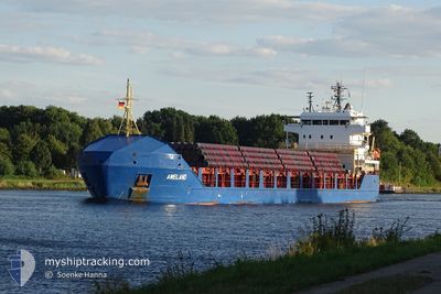
General Cargo
Current Trip
| Time Travelled | 2 days |
|---|---|
| Remaining Time | 18 h, 49 mins |
| Distance Travelled | 566.36 nm |
| Remaining Distance | 354.30 nm |
| AVG Speed | 10.5 Knots |
| MAX Speed | 12.3 Knots |
| AVG Wind | 9.6 knots |
| MAX Wind | 23.9 knots |
| MIN Temp | 5°C / 41°F |
| MAX Temp | 15.3°C / 59.54°F |
| Dybgang | 4.2 m |
| Position Modtaget | 1 d siden |
Current Position
| Longitude | 16.76694° |
|---|---|
| Latitude | 56.03231° |
| Status | Under way using engine |
| Fart | 11.6 Knots |
| Kurs | 56.8° |
| Område | Baltic Sea |
| Station | T-AIS |
| Position Modtaget | 1 d siden |
Info
Information
The current position of KAARI is in Baltic Sea with coordinates 56.03231° / 16.76694° as reported on 2024-05-09 16:54 by AIS to our vessel tracker app. The vessel's current speed is 11.6 Knots and is heading at the port of VYBORG. The estimated time of arrival as calculated by MyShipTracking vessel tracking app is 2024-05-11 13:01 LT
The vessel KAARI (IMO: 9434761, MMSI: 305342000) is a General Cargo that was built in 2009 ( 15 år gamle ). It's sailing under the flag of [AG] Antigua Barbuda.
In this page you can find informations about the vessels current position, last detected port calls, and current voyage information. If the vessels is not in coverage by AIS you will find the latest position.
The current position of KAARI is detected by our AIS receivers and we are not responsible for the reliability of the data. The last position was recorded while the vessel was in Coverage by the Ais receivers of our vessel tracking app.
The current draught of KAARI as reported by AIS is 4.2 meters
Weather
| Temperature | 5.5°C / 41.9°F |
|---|---|
| Wind Speed | 24 knots |
| Direction | 329° NNW |
| Pressure | 1018.6 hPa |
| Humidity | 70.4 % |
| Cloud Coverage | --- |
Featured Company
Last Port Calls
| Port | Arrival | Departure | Time In Port |
|---|---|---|---|
| 2024-05-06 18:10 | 2024-05-08 14:12 | 1 d | |
| 2024-04-28 17:02 | 2024-04-29 13:32 | 20 h | |
| 2024-04-20 04:20 | 2024-04-21 09:08 | 1 d | |
| 2024-04-11 06:04 | 2024-04-17 10:45 | 6 d | |
| 2024-04-07 03:25 | 2024-04-08 07:33 | 1 d | |
| 2024-03-26 13:19 | 2024-03-28 02:27 | 1 d | |
| 2024-03-22 09:58 | 2024-03-23 21:37 | 1 d | |
| 2024-03-14 17:08 | 2024-03-20 12:20 | 5 d | |
| 2024-03-09 13:56 | 2024-03-11 05:13 | 1 d | |
| 2024-03-06 16:34 | 2024-03-06 16:39 | 4 m |
Most Visited Ports (Last year)
| Port | Arrivals | |
|---|---|---|
| 8 | ||
| 4 | ||
| 3 | ||
| 3 | ||
| 3 | ||
| 2 |
Last Trips
| Origin | Departure | Destination | Arrival | Distance | |
|---|---|---|---|---|---|
| 2024-04-29 15:32 | 2024-05-06 20:10 | 1067.15 nm | |||
| 2024-04-21 12:08 | 2024-04-28 19:02 | 716.44 nm | |||
| 2024-04-17 12:45 | 2024-04-20 07:20 | 764.54 nm | |||
| 2024-04-08 10:33 | 2024-04-11 08:04 | 771.42 nm | |||
| 2024-03-28 04:27 | 2024-04-07 06:25 | 1563.82 nm | |||
| 2024-03-23 23:37 | 2024-03-26 15:19 | 333.90 nm | |||
| 2024-03-20 13:20 | 2024-03-22 11:58 | 524.35 nm | |||
| 2024-03-11 08:13 | 2024-03-14 18:08 | 679.11 nm | |||
| 2024-03-06 17:39 | 2024-03-09 16:56 | 753.11 nm | |||
| 2024-03-05 00:46 | 2024-03-06 17:34 | 368.41 nm |
Events
| Tid | Hændelsen | Detaljer | Position / Dest | Info |
|---|---|---|---|---|
| 2024-05-09 17:01 | Status er ændret | Default Under way using engine |
56.04440 / 16.79968
RUVYG
|
Fart: 11.6 kn Kurs: 56.8° |
| 2024-05-09 16:54 | Status er ændret | Under way using engine Default |
56.03231 / 16.76694
RUVYG
|
Fart: 11.6 kn Kurs: 57° |
| 2024-05-09 16:54 | Udenfor Dækning |
56.03231 / 16.76694
Baltic Sea
RUVYG
|
Fart: 11.6 kn Kurs: 56.8° |
|
| 2024-05-09 16:37 | Status er ændret | Default Under way using engine |
56.00244 / 16.68474
RUVYG
|
Fart: 11.5 kn Kurs: 56.7° |
| 2024-05-09 15:27 | Status er ændret | Under way using engine Default |
55.89142 / 16.33746
RUVYG
|
Fart: 11.4 kn Kurs: 61° |
| 2024-05-09 15:25 | Status er ændret | Default Under way using engine |
55.88803 / 16.32662
RUVYG
|
Fart: 11.4 kn Kurs: 61.2° |
| 2024-05-09 14:59 | Status er ændret | Under way using engine Default |
55.84841 / 16.19889
RUVYG
|
Fart: 11.5 kn Kurs: 61° |
| 2024-05-09 14:57 | Status er ændret | Default Under way using engine |
55.84479 / 16.18725
RUVYG
|
Fart: 11.5 kn Kurs: 62.1° |
| 2024-05-09 12:22 | Ændre havområde | Swedish part of the Baltic Sea Danish part of the Kattegat |
55.61230 / 15.41260
Baltic Sea
RUVYG
|
Fart: 11.3 kn Kurs: 63° |
| 2024-05-09 08:04 | Ændre havområde | Danish part of the Kattegat Swedish part of the Baltic Sea |
55.15007 / 14.24836
Kattegat
RUVYG
|
Fart: 11.7 kn Kurs: 94.6° |