
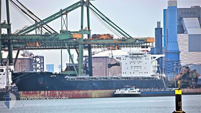
JUTTA
Cargo
Current Trip
| Time Travelled | --- |
|---|---|
| Remaining Time | 5 days |
| Distance Travelled | 5237.14 nm |
| Remaining Distance | 1020.80 nm |
| AVG Speed | 9.3 Knots |
| MAX Speed | 13 Knots |
| AVG Wind | 11.3 knots |
| MAX Wind | 28 knots |
| MIN Temp | 4.6°C / 40.28°F |
| MAX Temp | 27.6°C / 81.68°F |
| Dybgang | 18.4 m |
| Position Modtaget | 3 d siden |
Current Position
| Longitude | --- |
|---|---|
| Latitude | --- |
| Status | Under way using engine |
| Fart | 9.5 Knots |
| Kurs | 121.3° |
| Område | Laccadive Sea |
| Station | T-AIS |
| Position Modtaget | 3 d siden |
Info
Information
The current position of JUTTA is in Laccadive Sea with coordinates 7.34047° / 77.22443° as reported on 2026-01-01 14:01 by AIS to our vessel tracker app. The vessel's current speed is 9.5 Knots and is heading at the port of SINGAPORE. The estimated time of arrival as calculated by MyShipTracking vessel tracking app is 2026-01-10 09:48 LT
The vessel JUTTA (IMO: 9730402, MMSI: 636017188) is a Cargo It's sailing under the flag of [LR] Liberia.
In this page you can find informations about the vessels current position, last detected port calls, and current voyage information. If the vessels is not in coverage by AIS you will find the latest position.
The current position of JUTTA is detected by our AIS receivers and we are not responsible for the reliability of the data. The last position was recorded while the vessel was in Coverage by the Ais receivers of our vessel tracking app.
The current draught of JUTTA as reported by AIS is 18.4 meters
Weather
| Temperature | 27.5°C / 81.5°F |
|---|---|
| Wind Speed | 15 knots |
| Direction | 70° ENE |
| Pressure | 1008.5 hPa |
| Humidity | 75.2 % |
| Cloud Coverage | 100 % |
Featured Company
Last Port Calls
| Port | Arrival | Departure | Time In Port |
|---|---|---|---|
| 2025-12-17 11:02 | 2025-12-17 20:31 | 9 h | |
| 2025-11-05 11:49 | 2025-11-05 13:34 | 1 h |
Last Trips
| Origin | Departure | Destination | Arrival | Distance | |
|---|---|---|---|---|---|
| 2025-11-05 13:34 | 2025-12-17 11:02 | 1381.25 nm | |||
| 2025-09-23 20:26 | 2025-11-05 11:49 | 8222.60 nm |
Events
| Tid | Hændelsen | Detaljer | Position / Dest | Info |
|---|---|---|---|---|
| 2026-01-01 14:03 | Status er ændret | Default Under way using engine |
7.33754 / 77.22938
SG SIN
|
Fart: 9.5 kn Kurs: 121.3° |
| 2026-01-01 14:01 | Udenfor Dækning |
7.34047 / 77.22443
Laccadive Sea
SG SIN
|
Fart: 9.5 kn Kurs: 121.3° |
|
| 2026-01-01 13:22 | Status er ændret | Under way using engine Default |
7.39418 / 77.13441
SG SIN
|
Fart: 9 kn Kurs: 119° |
| 2026-01-01 13:01 | Status er ændret | Default Under way using engine |
7.42183 / 77.08530
SG SIN
|
Fart: 9.5 kn Kurs: 120° |
| 2026-01-01 12:58 | Status er ændret | Under way using engine Default |
7.42535 / 77.07911
SG SIN
|
Fart: 9 kn Kurs: 119° |
| 2026-01-01 12:44 | Status er ændret | Default Under way using engine |
7.44346 / 77.04686
SG SIN
|
Fart: 9.4 kn Kurs: 120° |
| 2026-01-01 09:47 | ETA er ændret | 2026/01/08 06:00 2026/01/07 04:00 |
7.67903 / 76.63688
SG SIN
|
Fart: 9.8 kn Kurs: 124.1° |
| 2026-01-01 09:45 | Status er ændret | Under way using engine Default |
7.68307 / 76.63075
SG SIN
|
Fart: 9 kn Kurs: 123° |
| 2026-01-01 09:31 | Status er ændret | Default Under way using engine |
7.70333 / 76.59834
SG SIN
|
Fart: 10 kn Kurs: 123.9° |
| 2026-01-01 09:25 | Ændre havområde | Indian part of the Laccadive Sea Egyptian part of the Gulf of Suez |
7.71390 / 76.58419
Laccadive Sea
SG SIN
|
Fart: 10 kn Kurs: 123.9° |