
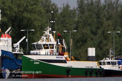
JUNAK
Crew Boat
Current Trip
| Trip Time | 6 h, 54 mins |
|---|---|
| Trip Distance | 68.62 nm |
| AVG Speed | 15.9 Knots |
| MAX Speed | 18.9 Knots |
| Dybgang | 2.5 m |
| AVG Wind | 5.5 knots |
| MAX Wind | 11.2 knots |
| MIN Temp | 2.6°C / 36.68°F |
| MAX Temp | 6.5°C / 43.7°F |
| Position Modtaget | 6 h, 59 m siden |
Current Position
| Longitude | --- |
|---|---|
| Latitude | --- |
| Status | Under way using engine |
| Fart | 10.6 Knots |
| Kurs | 121.3° |
| Område | Adriatic Sea |
| Station | T-AIS |
| Position Modtaget | 6 h, 59 m siden |
Info
Information
The current position of JUNAK is in Adriatic Sea with coordinates 44.88732° / 13.79242° as reported on 2025-02-19 18:29 by AIS to our vessel tracker app. The vessel's current speed is 10.6 Knots and is currently inside the port of PULA.
The vessel JUNAK (IMO: 9510632, MMSI: 238253000) is a Crew Boat that was built in 2009 ( 16 år gamle ). It's sailing under the flag of [HR] Croatia.
In this page you can find informations about the vessels current position, last detected port calls, and current voyage information. If the vessels is not in coverage by AIS you will find the latest position.
The current position of JUNAK is detected by our AIS receivers and we are not responsible for the reliability of the data. The last position was recorded while the vessel was in Coverage by the Ais receivers of our vessel tracking app.
The current draught of JUNAK as reported by AIS is 2.5 meters
Weather
| Temperature | 5.7°C / 42.26°F |
|---|---|
| Wind Speed | 8 knots |
| Direction | 41° NE |
| Pressure | 1029 hPa |
| Humidity | 46.8 % |
| Cloud Coverage | 16 % |
Featured Company
Last Port Calls
| Port | Arrival | Departure | Time In Port |
|---|---|---|---|
| 2025-02-19 19:29 | |||
| 2025-02-18 14:31 | 2025-02-19 12:35 | 22 h | |
| 2025-02-16 20:19 | 2025-02-18 06:51 | 1 d | |
| 2025-02-13 18:57 | 2025-02-16 08:17 | 2 d | |
| 2025-02-10 17:49 | 2025-02-11 07:21 | 13 h | |
| 2025-02-07 11:15 | 2025-02-10 08:11 | 2 d | |
| 2025-02-05 17:16 | 2025-02-07 08:16 | 1 d | |
| 2025-01-31 20:26 | 2025-02-05 08:00 | 4 d | |
| 2025-01-25 20:32 | 2025-01-30 07:28 | 4 d | |
| 2025-01-22 20:45 | 2025-01-24 08:18 | 1 d |
Most Visited Ports (Last year)
| Port | Arrivals | |
|---|---|---|
| 133 |
Last Trips
| Origin | Departure | Destination | Arrival | Distance | |
|---|---|---|---|---|---|
| 2025-02-19 12:35 | 2025-02-19 19:29 | 68.62 nm | |||
| 2025-02-18 06:51 | 2025-02-18 14:31 | 77.86 nm | |||
| 2025-02-16 08:17 | 2025-02-16 20:19 | 69.16 nm | |||
| 2025-02-11 07:21 | 2025-02-13 18:57 | 149.74 nm | |||
| 2025-02-10 08:11 | 2025-02-10 17:49 | 95.66 nm | |||
| 2025-02-07 08:16 | 2025-02-07 11:15 | 38.30 nm | |||
| 2025-02-05 08:00 | 2025-02-05 17:16 | 86.59 nm | |||
| 2025-01-30 07:28 | 2025-01-31 20:26 | 195.69 nm | |||
| 2025-01-24 08:18 | 2025-01-25 20:32 | 180.61 nm | |||
| 2025-01-21 07:42 | 2025-01-22 20:45 | 90.65 nm |
Events
| Tid | Hændelsen | Detaljer | Position / Dest | Info |
|---|---|---|---|---|
| 2025-02-19 18:59 | STOP Sejllads |
44.86494 / 13.83168
[HR] PULA
|
Fart: Kurs: 161° |
|
| 2025-02-19 18:29 | Status er ændret | Default Under way using engine |
44.88713 / 13.79276
[HR] PULA
|
Fart: 10.6 kn Kurs: 121.3° |
| 2025-02-19 18:29 | Udenfor Dækning |
44.88732 / 13.79242
Adriatic Sea
[HR] PULA
|
Fart: 10.6 kn Kurs: 121.3° |
|
| 2025-02-19 18:29 | Skibe i havn |
|
44.88713 / 13.79276
[HR] PULA
|
Fart: 10.6 kn Kurs: 121.3° |
| 2025-02-19 18:06 | Destination er ændret | HRANN>HRPUY HRPUY>HRIVA |
44.78728 / 13.70696
HRANN>HRPUY
|
Fart: 18.8 kn Kurs: 29.9° |
| 2025-02-19 18:06 | ETA er ændret | 2025/02/19 19:45 2025/02/19 13:55 |
44.78728 / 13.70696
HRANN>HRPUY
|
Fart: 18.8 kn Kurs: 29.9° |
| 2025-02-19 17:20 | Status er ændret | Under way using engine Default |
44.58098 / 13.54333
HRPUY>HRIVA
|
Fart: 0.4 kn Kurs: 181° |
| 2025-02-19 17:20 | START Sejllads | 19.96 nm, South West of BANJOLE |
44.58098 / 13.54333
HRPUY>HRIVA
|
Fart: 18.5 kn Kurs: 29.3° |
| 2025-02-19 17:20 | Indenfor Dækning |
44.58098 / 13.54333
Adriatic Sea
HRPUY>HRIVA
|
Fart: 18.5 kn Kurs: 29.3° |
|
| 2025-02-19 15:54 | STOP Sejllads |
44.36330 / 13.37465
HRPUY>HRIVA
|
Fart: 0.2 kn Kurs: 195° |