

JOERG DEYMANN
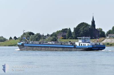
Tanker

Current Trip
| Trip Time | 12 days |
|---|---|
| Trip Distance | 250.55 nm |
| AVG Speed | 8.8 Knots |
| MAX Speed | 12.8 Knots |
| Dybgang | 2.4 m |
| AVG Wind | 7.9 knots |
| MAX Wind | 12 knots |
| MIN Temp | 0.7°C / 33.26°F |
| MAX Temp | 20.6°C / 69.08°F |
| Position Modtaget | 2 m siden |
Current Position
| Longitude | --- |
|---|---|
| Latitude | --- |
| Status | Moored |
| Fart | |
| Kurs | --- |
| Område | North Sea |
| Station | T-AIS |
| Position Modtaget | 2 m siden |
Information
The current position of JOERG DEYMANN is in North Sea with coordinates 51.88945° / 4.31607° as reported on 2025-03-28 14:18 by AIS to our vessel tracker app. The vessel's current speed is 0 Knots and is currently inside the port of BOTLEK - ROTTERDAM.
The vessel JOERG DEYMANN (MMSI: 218041230) is a Tanker It's sailing under the flag of [DE] Germany.
In this page you can find informations about the vessels current position, last detected port calls, and current voyage information. If the vessels is not in coverage by AIS you will find the latest position.
The current position of JOERG DEYMANN is detected by our AIS receivers and we are not responsible for the reliability of the data. The last position was recorded while the vessel was in Coverage by the Ais receivers of our vessel tracking app.
The current draught of JOERG DEYMANN as reported by AIS is 2.4 meters
Weather
| Temperature | 9.8°C / 49.64°F |
|---|---|
| Wind Speed | 10 knots |
| Direction | 242° WSW |
| Pressure | 1010 hPa |
| Humidity | 81.8 % |
| Cloud Coverage | 100 % |


Featured Company
Last Port Calls
| Port | Arrival | Departure | Time In Port |
|---|---|---|---|
| 2025-03-28 13:24 | |||
| 2025-03-15 15:28 | 2025-03-16 08:11 | 16 h | |
| 2025-03-14 20:52 | 2025-03-15 07:00 | 10 h | |
| 2025-03-14 18:59 | 2025-03-14 19:04 | 5 m | |
| 2025-03-01 12:24 | 2025-03-05 10:33 | 3 d | |
| 2025-02-25 19:21 | 2025-02-26 14:23 | 19 h | |
| 2025-02-25 02:19 | 2025-02-25 17:03 | 14 h | |
| 2025-02-23 15:01 | 2025-02-24 07:05 | 16 h | |
| 2025-02-23 13:16 | 2025-02-23 13:21 | 4 m | |
| 2025-02-22 15:09 | 2025-02-23 10:42 | 19 h |
Last Trips
| Origin | Departure | Destination | Arrival | Distance | |
|---|---|---|---|---|---|
| 2025-03-16 08:11 | 2025-03-28 13:24 | 250.55 nm | |||
| 2025-03-15 07:00 | 2025-03-15 15:28 | 51.38 nm | |||
| 2025-03-14 19:04 | 2025-03-14 20:52 | 15.58 nm | |||
| 2025-03-05 10:33 | 2025-03-14 18:59 | 199.91 nm | |||
| 2025-02-26 14:23 | 2025-03-01 12:24 | 42.09 nm | |||
| 2025-02-25 17:03 | 2025-02-25 19:21 | 22.13 nm | |||
| 2025-02-24 07:05 | 2025-02-25 02:19 | 44.89 nm | |||
| 2025-02-23 13:21 | 2025-02-23 15:01 | 15.09 nm | |||
| 2025-02-23 10:42 | 2025-02-23 13:16 | 4.63 nm | |||
| 2025-02-22 13:28 | 2025-02-22 15:09 | 14.25 nm |
Events
| Tid | Hændelsen | Detaljer | Position / Dest | Info |
|---|---|---|---|---|
| 2025-03-28 12:52 | Status er ændret | Moored Under way using engine |
51.88947 / 4.31609
[NL] BOTLEK - ROTTERDAM
|
Fart: Kurs: 511° |
| 2025-03-28 12:28 | STOP Sejllads |
51.88945 / 4.31609
[NL] BOTLEK - ROTTERDAM
|
Fart: 0.2 kn Kurs: 511° |
|
| 2025-03-28 12:24 | Skibe i havn |
|
51.89012 / 4.31748
[NL] BOTLEK - ROTTERDAM
|
Fart: 0.8 kn Kurs: 511° |
| 2025-03-28 05:18 | START Sejllads | 1.27 nm, East of TOLKAMER |
51.84852 / 6.13802
DUISBURG
|
Fart: 8.1 kn Kurs: 232° |
| 2025-03-28 05:16 | Destination er ændret | DUISBURG GELSENKIRCHEN |
51.84962 / 6.14074
DUISBURG
|
Fart: 1.3 kn Kurs: 511° |
| 2025-03-28 05:16 | ETA er ændret | 2025/03/25 08:02 2025/03/23 08:48 |
51.84962 / 6.14074
DUISBURG
|
Fart: 1.3 kn Kurs: 511° |
| 2025-03-28 05:16 | STOP Sejllads | 1.38 nm, East of TOLKAMER |
51.84956 / 6.14099
GELSENKIRCHEN
|
Fart: 0.2 kn Kurs: 511° |
| 2025-03-28 05:15 | Indenfor Dækning |
51.84962 / 6.14074
North Sea
|
Fart: 1.3 kn Kurs: 284° |
|
| 2025-03-26 16:34 | Udenfor Dækning |
51.84852 / 6.13812
North Sea
|
Fart: 5.9 kn Kurs: 328° |
|
| 2025-03-26 16:22 | Indenfor Dækning |
51.83480 / 6.18272
North Sea
|
Fart: 10.2 kn Kurs: 304° |