
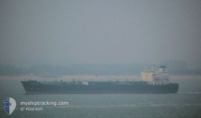
JAZZ
Oil/Chemical Tanker
Current Trip
TUNISIA FOR ORDER
| Time Travelled | 20 days |
|---|---|
| Remaining Time | --- |
| Distance Travelled | 1912.17 nm |
| Remaining Distance | --- |
| AVG Speed | 7.4 Knots |
| MAX Speed | 13.5 Knots |
| AVG Wind | 20.1 knots |
| MAX Wind | 40.7 knots |
| MIN Temp | -6.5°C / 20.3°F |
| MAX Temp | 7.7°C / 45.86°F |
| Dybgang | 11.6 m |
| Position Modtaget | 1 m siden |
Current Position
| Longitude | --- |
|---|---|
| Latitude | --- |
| Status | Under way using engine |
| Fart | 8.8 Knots |
| Kurs | 226° |
| Område | North Sea |
| Station | T-AIS |
| Position Modtaget | 1 m siden |
Info
Information
The current position of JAZZ is in North Sea with coordinates 57.29469° / 8.15194° as reported on 2025-01-16 21:12 by AIS to our vessel tracker app. The vessel's current speed is 8.8 Knots
The vessel JAZZ (IMO: 9337327, MMSI: 352003751) is a Oil/Chemical Tanker that was built in 2006 ( 19 år gamle ). It's sailing under the flag of [PA] Panama.
In this page you can find informations about the vessels current position, last detected port calls, and current voyage information. If the vessels is not in coverage by AIS you will find the latest position.
The current position of JAZZ is detected by our AIS receivers and we are not responsible for the reliability of the data. The last position was recorded while the vessel was in Coverage by the Ais receivers of our vessel tracking app.
The current draught of JAZZ as reported by AIS is 11.6 meters
Weather
| Temperature | --- |
|---|---|
| Wind Speed | --- |
| Direction | --- |
| Pressure | --- |
| Humidity | --- |
| Cloud Coverage | --- |
Featured Company
Last Port Calls
| Port | Arrival | Departure | Time In Port |
|---|---|---|---|
| 2024-12-27 20:34 | 2024-12-27 20:38 | 4 m | |
| 2024-12-13 06:13 |
Most Visited Ports (Last year)
| Port | Arrivals | |
|---|---|---|
| 2 | ||
| 2 | ||
| 1 | ||
| 1 | ||
| 1 | ||
| 1 |
Last Trips
| Origin | Departure | Destination | Arrival | Distance | |
|---|---|---|---|---|---|
| 2024-09-19 12:09 | 2024-12-13 08:13 | 664.35 nm |
Events
| Tid | Hændelsen | Detaljer | Position / Dest | Info |
|---|---|---|---|---|
| 2025-01-16 20:53 | Ændre havområde | Danish part of the North Sea Danish part of the Skaggerak |
57.32698 / 8.21928
North Sea
TUNISIA FOR ORDER
|
Fart: 8.8 kn Kurs: 225.7° |
| 2025-01-16 12:05 | ETA er ændret | 2025/01/26 07:00 2025/01/23 05:00 |
57.83423 / 10.20780
TUNISIA FOR ORDER
|
Fart: 7.2 kn Kurs: 264.9° |
| 2025-01-16 08:46 | Ændre havområde | Danish part of the Skaggerak Danish part of the Kattegat |
57.77223 / 10.80968
Skaggerak
TUNISIA FOR ORDER
|
Fart: 7.5 kn Kurs: 3.1° |
| 2025-01-16 08:04 | Status er ændret | Under way using engine At anchor |
57.68438 / 10.76583
TUNISIA FOR ORDER
|
Fart: 7.9 kn Kurs: 38.1° |
| 2025-01-16 07:32 | START Sejllads | 2.78 nm, South East of SKAGEN |
57.68516 / 10.66435
TUNISIA FOR ORDER
|
Fart: 3.1 kn Kurs: 132° |
| 2025-01-13 11:57 | Dybgangen er ændret | 11.6 11.8 |
57.68979 / 10.66553
TUNISIA FOR ORDER
|
Fart: Kurs: 222° |
| 2025-01-13 06:22 | Status er ændret | At anchor Under way using engine |
57.68903 / 10.66305
TUNISIA FOR ORDER
|
Fart: 0.5 kn Kurs: 196° |
| 2025-01-13 06:18 | STOP Sejllads | 2.6 nm, South East of SKAGEN |
57.68866 / 10.66224
TUNISIA FOR ORDER
|
Fart: 0.3 kn Kurs: 203° |
| 2025-01-13 01:08 | Fundet i havområde | Danish part of the Kattegat |
57.37549 / 11.45758
Kattegat
TUNISIA FOR ORDER
|
Fart: 8.5 kn Kurs: 329.4° |
| 2025-01-12 22:08 | Ændre havområde | Swedish part of the Kattegat Danish part of the Kattegat |
56.98486 / 11.76927
Kattegat
TUNISIA FOR ORDER
|
Fart: 8.3 kn Kurs: 342.4° |