
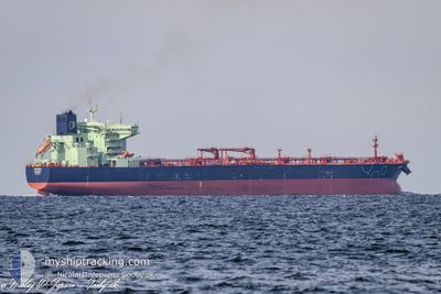
JATULI
Tanker
Current Trip
| Time Travelled | 11 days |
|---|---|
| Remaining Time | 15 h, 2 mins |
| Distance Travelled | 1312.30 nm |
| Remaining Distance | 35.60 nm |
| AVG Speed | 9.8 Knots |
| MAX Speed | 12.8 Knots |
| AVG Wind | 19.2 knots |
| MAX Wind | 38 knots |
| MIN Temp | -0.9°C / 30.38°F |
| MAX Temp | 8.2°C / 46.76°F |
| Dybgang | 8.9 m |
| Position Modtaget | 3 m siden |
Current Position
| Longitude | --- |
|---|---|
| Latitude | --- |
| Status | Under way using engine |
| Fart | 1.8 Knots |
| Kurs | 323° |
| Område | Norwegian Sea |
| Station | T-AIS |
| Position Modtaget | 3 m siden |
Info
Information
The current position of JATULI is in Norwegian Sea with coordinates 61.07584° / 4.01642° as reported on 2025-01-03 05:32 by AIS to our vessel tracker app. The vessel's current speed is 1.8 Knots and is heading at the port of MONGSTAD . The estimated time of arrival as calculated by MyShipTracking vessel tracking app is 2025-01-03 20:37 LT
The vessel JATULI (IMO: 9892444, MMSI: 230688000) is a Tanker It's sailing under the flag of [FI] Finland.
In this page you can find informations about the vessels current position, last detected port calls, and current voyage information. If the vessels is not in coverage by AIS you will find the latest position.
The current position of JATULI is detected by our AIS receivers and we are not responsible for the reliability of the data. The last position was recorded while the vessel was in Coverage by the Ais receivers of our vessel tracking app.
The current draught of JATULI as reported by AIS is 8.9 meters
Weather
| Temperature | 1°C / 33.8°F |
|---|---|
| Wind Speed | 24 knots |
| Direction | 335° NNW |
| Pressure | 1004.3 hPa |
| Humidity | 56.7 % |
| Cloud Coverage | 100 % |
Featured Company
Last Port Calls
| Port | Arrival | Departure | Time In Port |
|---|---|---|---|
| 2024-12-21 17:20 | 2024-12-22 19:35 | 1 d | |
| 2024-12-13 10:52 | 2024-12-14 08:57 | 22 h | |
| 2024-12-07 13:40 | 2024-12-08 22:33 | 1 d | |
| 2024-11-29 15:06 | 2024-12-03 06:54 | 3 d | |
| 2024-11-11 08:13 | 2024-11-22 08:58 | 11 d | |
| 2024-11-06 17:24 | 2024-11-07 05:32 | 12 h | |
| 2024-11-02 08:10 | 2024-11-04 00:13 | 1 d |
Most Visited Ports (Last year)
| Port | Arrivals | |
|---|---|---|
| 14 | ||
| 13 | ||
| 3 | ||
| 3 | ||
| 2 | ||
| 2 |
Last Trips
| Origin | Departure | Destination | Arrival | Distance | |
|---|---|---|---|---|---|
| 2024-12-14 09:57 | 2024-12-21 19:20 | 1279.19 nm | |||
| 2024-12-08 23:33 | 2024-12-13 11:52 | 956.27 nm | |||
| 2024-12-03 07:54 | 2024-12-07 14:40 | 987.26 nm | |||
| 2024-11-22 09:58 | 2024-11-29 16:06 | 610.43 nm | |||
| 2024-11-07 07:32 | 2024-11-11 09:13 | 720.68 nm | |||
| 2024-11-04 02:13 | 2024-11-06 19:24 | 7.57 nm | |||
| 2024-10-27 23:37 | 2024-11-02 10:10 | 1310.86 nm |
Events
| Tid | Hændelsen | Detaljer | Position / Dest | Info |
|---|---|---|---|---|
| 2025-01-03 00:49 | Ændre havområde | Norwegian part of the Norwegian Sea Norwegian part of the North Sea |
61.00046 / 4.05132
Norwegian Sea
|
Fart: 0.9 kn Kurs: 302.1° |
| 2025-01-02 20:42 | STOP Sejllads | 21.28 nm, North West of FEDJE |
60.94261 / 4.06569
FISKV>NOMON
|
Fart: 0.3 kn Kurs: 352° |
| 2025-01-02 20:25 | START Sejllads | 20.85 nm, North West of FEDJE |
60.93848 / 4.07793
FISKV>NOMON
|
Fart: 3.2 kn Kurs: 330° |
| 2025-01-02 19:21 | STOP Sejllads | 19.74 nm, North West of FEDJE |
60.92394 / 4.10562
FISKV>NOMON
|
Fart: 0.2 kn Kurs: 334° |
| 2025-01-02 18:10 | START Sejllads | 15.91 nm, North West of FEDJE |
60.89140 / 4.21889
FISKV>NOMON
|
Fart: 3.8 kn Kurs: 316° |
| 2025-01-02 10:16 | STOP Sejllads | 10.9 nm, West of FEDJE |
60.77357 / 4.34304
FISKV>NOMON
|
Fart: 0.3 kn Kurs: 337° |
| 2025-01-02 10:10 | START Sejllads | 10.98 nm, West of FEDJE |
60.77105 / 4.34070
FISKV>NOMON
|
Fart: 3.1 kn Kurs: 357° |
| 2025-01-02 09:43 | STOP Sejllads | 10.81 nm, West of FEDJE |
60.76859 / 4.34699
FISKV>NOMON
|
Fart: 0.3 kn Kurs: 327° |
| 2025-01-02 07:55 | START Sejllads | 17.46 nm, South West of FEDJE |
60.66340 / 4.17313
FISKV>NOMON
|
Fart: 3.1 kn Kurs: 293° |
| 2025-01-01 17:51 | STOP Sejllads | 21.28 nm, South West of FEDJE |
60.56463 / 4.14583
FISKV>NOMON
|
Fart: 0.3 kn Kurs: 5° |