
JANKI
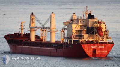
Bulk Carrier
Current Trip
| Time Travelled | 3 days |
|---|---|
| Remaining Time | --- |
| Distance Travelled | 54.30 nm |
| Remaining Distance | --- |
| AVG Speed | 11.6 Knots |
| MAX Speed | 13 Knots |
| AVG Wind | 7.8 knots |
| MAX Wind | 18.7 knots |
| MIN Temp | 19.6°C / 67.28°F |
| MAX Temp | 26.1°C / 78.98°F |
| Dybgang | 6.7 m |
| Position Modtaget | 1 m siden |
Current Position
| Longitude | --- |
|---|---|
| Latitude | --- |
| Status | At anchor |
| Fart | |
| Kurs | 45° |
| Område | Persian Gulf |
| Station | T-AIS |
| Position Modtaget | 1 m siden |
Info
Information
The current position of JANKI is in Persian Gulf with coordinates 25.52959° / 55.38514° as reported on 2025-03-07 13:41 by AIS to our vessel tracker app. The vessel's current speed is 0 Knots
The vessel JANKI (IMO: 9110925, MMSI: 314076000) is a Bulk Carrier that was built in 1997 ( 28 år gamle ). It's sailing under the flag of [BB] Barbados.
In this page you can find informations about the vessels current position, last detected port calls, and current voyage information. If the vessels is not in coverage by AIS you will find the latest position.
The current position of JANKI is detected by our AIS receivers and we are not responsible for the reliability of the data. The last position was recorded while the vessel was in Coverage by the Ais receivers of our vessel tracking app.
The current draught of JANKI as reported by AIS is 6.7 meters
Weather
| Temperature | 25.5°C / 77.9°F |
|---|---|
| Wind Speed | 13 knots |
| Direction | 22° NNE |
| Pressure | 1011.9 hPa |
| Humidity | 55.8 % |
| Cloud Coverage | 3 % |
Featured Company
Last Trips
| Origin | Departure | Destination | Arrival | Distance | |
|---|---|---|---|---|---|
| 2025-02-05 23:30 | 2025-02-14 06:32 | 1286.51 nm | |||
| 2025-01-22 07:48 | 2025-01-25 10:45 | 510.15 nm | |||
| 2025-01-17 12:25 | 2025-01-17 19:04 | 61.96 nm | |||
| 2024-12-30 05:12 | 2025-01-06 03:11 | 774.90 nm |
Events
| Tid | Hændelsen | Detaljer | Position / Dest | Info |
|---|---|---|---|---|
| 2025-03-07 01:56 | Status er ændret | At anchor Default |
25.53000 / 55.38482
HAMRIYAH
|
Fart: Kurs: 63° |
| 2025-03-07 01:50 | Status er ændret | Default At anchor |
25.53008 / 55.38482
HAMRIYAH
|
Fart: Kurs: 62° |
| 2025-03-07 01:41 | Status er ændret | At anchor Default |
25.53000 / 55.38484
HAMRIYAH
|
Fart: Kurs: 50° |
| 2025-03-07 01:32 | Status er ændret | Default At anchor |
25.52981 / 55.38496
HAMRIYAH
|
Fart: Kurs: 49° |
| 2025-03-07 01:26 | Status er ændret | At anchor Default |
25.52988 / 55.38497
HAMRIYAH
|
Fart: Kurs: 59° |
| 2025-03-07 01:20 | Status er ændret | Default At anchor |
25.53001 / 55.38487
HAMRIYAH
|
Fart: Kurs: 57° |
| 2025-03-07 01:08 | Status er ændret | At anchor Default |
25.52998 / 55.38487
HAMRIYAH
|
Fart: Kurs: 57° |
| 2025-03-07 00:53 | Status er ændret | Default At anchor |
25.53003 / 55.38484
HAMRIYAH
|
Fart: Kurs: 62° |
| 2025-03-07 00:35 | Status er ændret | At anchor Default |
25.53026 / 55.38473
HAMRIYAH
|
Fart: Kurs: 72° |
| 2025-03-07 00:29 | Status er ændret | Default At anchor |
25.53032 / 55.38471
HAMRIYAH
|
Fart: Kurs: 71° |