
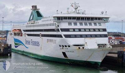
JAMES JOYCE
Ro-Ro/Passenger Ship
Current Trip
| Time Travelled | 29 mins |
|---|---|
| Remaining Time | --- |
| Distance Travelled | 7.14 nm |
| Remaining Distance | --- |
| AVG Speed | 15.5 Knots |
| MAX Speed | 17.3 Knots |
| AVG Wind | 9.6 knots |
| MAX Wind | 10 knots |
| MIN Temp | 12.4°C / 54.32°F |
| MAX Temp | 14.2°C / 57.56°F |
| Dybgang | 6.4 m |
| Position Modtaget | Nu |
Current Position
| Longitude | -4.80617° |
|---|---|
| Latitude | 53.34700° |
| Status | Under way using engine |
| Fart | 17.4 Knots |
| Kurs | 271° |
| Område | Irish Sea and St. George's Channel |
| Station | T-AIS |
| Position Modtaget | Nu |
Info
Information
The current position of JAMES JOYCE is in Irish Sea and St. George's Channel with coordinates 53.34700° / -4.80617° as reported on 2024-09-19 07:29 by AIS to our vessel tracker app. The vessel's current speed is 17.4 Knots
The vessel JAMES JOYCE (IMO: 9364722, MMSI: 209170000) is a Ro-Ro/Passenger Ship that was built in 2007 ( 17 år gamle ). It's sailing under the flag of [CY] Cyprus.
In this page you can find informations about the vessels current position, last detected port calls, and current voyage information. If the vessels is not in coverage by AIS you will find the latest position.
The current position of JAMES JOYCE is detected by our AIS receivers and we are not responsible for the reliability of the data. The last position was recorded while the vessel was in Coverage by the Ais receivers of our vessel tracking app.
The current draught of JAMES JOYCE as reported by AIS is 6.4 meters
Weather
| Temperature | --- |
|---|---|
| Wind Speed | --- |
| Direction | --- |
| Pressure | --- |
| Humidity | --- |
| Cloud Coverage | --- |
Featured Company
Last Port Calls
| Port | Arrival | Departure | Time In Port |
|---|---|---|---|
| 2024-09-19 04:13 | 2024-09-19 07:00 | 2 h | |
| 2024-09-18 22:33 | 2024-09-19 01:08 | 2 h | |
| 2024-09-18 16:48 | 2024-09-18 19:09 | 2 h | |
| 2024-09-18 10:40 | 2024-09-18 13:30 | 2 h | |
| 2024-09-18 04:14 | 2024-09-18 06:58 | 2 h | |
| 2024-09-17 22:25 | 2024-09-18 01:22 | 2 h | |
| 2024-09-17 16:46 | 2024-09-17 19:18 | 2 h | |
| 2024-09-17 10:42 | 2024-09-17 14:00 | 3 h | |
| 2024-09-17 04:12 | 2024-09-17 07:04 | 2 h | |
| 2024-09-16 22:31 | 2024-09-17 01:18 | 2 h |
Last Trips
| Origin | Departure | Destination | Arrival | Distance | |
|---|---|---|---|---|---|
| 2024-09-19 02:08 | 2024-09-19 05:13 | 56.57 nm | |||
| 2024-09-18 20:09 | 2024-09-18 23:33 | 58.52 nm | |||
| 2024-09-18 14:30 | 2024-09-18 17:48 | 56.54 nm | |||
| 2024-09-18 07:58 | 2024-09-18 11:40 | 58.12 nm | |||
| 2024-09-18 02:22 | 2024-09-18 05:14 | 56.65 nm | |||
| 2024-09-17 20:18 | 2024-09-17 23:25 | 57.88 nm | |||
| 2024-09-17 15:00 | 2024-09-17 17:46 | 57.71 nm | |||
| 2024-09-17 08:04 | 2024-09-17 11:42 | 58.51 nm | |||
| 2024-09-17 02:18 | 2024-09-17 05:12 | 56.02 nm | |||
| 2024-09-16 20:07 | 2024-09-16 23:31 | 57.81 nm |
Events
| Tid | Hændelsen | Detaljer | Position / Dest | Info |
|---|---|---|---|---|
| 2024-09-19 07:00 | Afsejlet fra sidste havn |
|
53.32667 / -4.61433
IEDUB<>GBHLY
|
Fart: 13.9 kn Kurs: 23° |
| 2024-09-19 06:57 | START Sejllads |
53.31967 / -4.61950
[GB] HOLYHEAD
|
Fart: 4.7 kn Kurs: 28° |
|
| 2024-09-19 06:55 | Status er ændret | Under way using engine Moored |
53.31933 / -4.61983
[GB] HOLYHEAD
|
Fart: Kurs: 29° |
| 2024-09-19 06:28 | Status er ændret | Moored Default |
53.31933 / -4.61983
[GB] HOLYHEAD
|
Fart: 0.1 kn Kurs: 29° |
| 2024-09-19 06:22 | Status er ændret | Default Moored |
53.31933 / -4.61983
[GB] HOLYHEAD
|
Fart: Kurs: 29° |
| 2024-09-19 04:25 | Status er ændret | Moored Under way using engine |
53.31950 / -4.61967
[GB] HOLYHEAD
|
Fart: Kurs: 29° |
| 2024-09-19 04:16 | STOP Sejllads |
53.32100 / -4.61683
[GB] HOLYHEAD
|
Fart: 0.3 kn Kurs: 98° |
|
| 2024-09-19 04:14 | ETA er ændret | 2024/09/19 11:45 2024/09/19 05:25 |
53.32267 / -4.61767
[GB] HOLYHEAD
|
Fart: 8.2 kn Kurs: 185° |
| 2024-09-19 04:13 | Skibe i havn |
|
53.32500 / -4.61650
[GB] HOLYHEAD
|
Fart: 10.8 kn Kurs: 195° |
| 2024-09-19 02:55 | Ændre havområde | United Kingdom part of the Irish Sea and St. George's Channel Irish part of the Irish Sea and St. George's Channel |
53.36317 / -5.28867
Irish Sea and St. George's Channel
IEDUB<>GBHLY
|
Fart: 21 kn Kurs: 94° |