
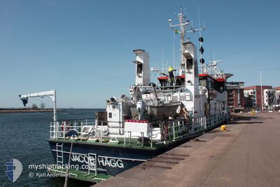
JACOB HAEGG
Research/Survey Vessel
Current Trip
| Trip Time | 21 h, 36 mins |
|---|---|
| Trip Distance | 151.01 nm |
| AVG Speed | 7.8 Knots |
| MAX Speed | 11.9 Knots |
| Dybgang | 2.2 m |
| AVG Wind | 10.5 knots |
| MAX Wind | 17 knots |
| MIN Temp | 3.1°C / 37.58°F |
| MAX Temp | 11.2°C / 52.16°F |
| Position Modtaget | 6 d siden |
Current Position
| Longitude | --- |
|---|---|
| Latitude | --- |
| Status | Restricted manoeuverability |
| Fart | 5.2 Knots |
| Kurs | 137.6° |
| Område | Gulf of Bothnia |
| Station | T-AIS |
| Position Modtaget | 6 d siden |
Info
Information
The current position of JACOB HAEGG is in Gulf of Bothnia with coordinates 60.60556° / 18.14182° as reported on 2024-09-24 12:13 by AIS to our vessel tracker app. The vessel's current speed is 5.2 Knots and is currently inside the port of GAVLE.
The vessel JACOB HAEGG (IMO: 7922879, MMSI: 265291000) is a Research/Survey Vessel that was built in 1983 ( 41 år gamle ). It's sailing under the flag of [SE] Sweden.
In this page you can find informations about the vessels current position, last detected port calls, and current voyage information. If the vessels is not in coverage by AIS you will find the latest position.
The current position of JACOB HAEGG is detected by our AIS receivers and we are not responsible for the reliability of the data. The last position was recorded while the vessel was in Coverage by the Ais receivers of our vessel tracking app.
The current draught of JACOB HAEGG as reported by AIS is 2.2 meters
Weather
| Temperature | 11°C / 51.8°F |
|---|---|
| Wind Speed | 6 knots |
| Direction | 189° S |
| Pressure | 1027.4 hPa |
| Humidity | 65.4 % |
| Cloud Coverage | 62 % |
Featured Company
Last Port Calls
| Port | Arrival | Departure | Time In Port |
|---|---|---|---|
| 2024-09-30 06:25 | |||
| 2024-09-26 15:05 | 2024-09-29 08:49 | 2 d | |
| 2024-09-24 18:45 | 2024-09-26 12:09 | 1 d | |
| 2024-09-16 12:36 | 2024-09-22 08:05 | 5 d | |
| 2024-09-14 07:58 | 2024-09-15 15:13 | 1 d | |
| 2024-09-08 13:40 | 2024-09-12 08:14 | 3 d | |
| 2024-09-06 09:12 | 2024-09-06 13:59 | 4 h | |
| 2024-08-29 14:32 | 2024-08-30 06:41 | 16 h | |
| 2024-07-03 03:45 | 2024-07-26 07:09 | 23 d | |
| 2024-07-02 04:09 |
Most Visited Ports (Last year)
| Port | Arrivals | |
|---|---|---|
| 14 | ||
| 13 | ||
| 9 | ||
| 6 | ||
| 2 | ||
| 1 |
Last Trips
| Origin | Departure | Destination | Arrival | Distance | |
|---|---|---|---|---|---|
| 2024-09-29 10:49 | 2024-09-30 08:25 | 151.01 nm | |||
| 2024-09-26 14:09 | 2024-09-26 17:05 | 13.02 nm | |||
| 2024-09-22 10:05 | 2024-09-24 20:45 | 368.64 nm | |||
| 2024-09-15 17:13 | 2024-09-16 14:36 | 155.36 nm | |||
| 2024-09-12 10:14 | 2024-09-14 09:58 | 258.09 nm | |||
| 2024-09-06 15:59 | 2024-09-08 15:40 | 333.25 nm | |||
| 2024-08-30 08:41 | 2024-09-06 11:12 | 507.72 nm | |||
| 2024-07-26 09:09 | 2024-08-29 16:32 | 2534.17 nm | |||
| 2024-07-02 06:09 | 2024-07-03 05:45 | 162.45 nm |
Events
| Tid | Hændelsen | Detaljer | Position / Dest | Info |
|---|---|---|---|---|
| 2024-09-30 06:41 | STOP Sejllads |
60.67967 / 17.17314
[SE] GAVLE
|
Fart: Kurs: 251° |
|
| 2024-09-30 06:25 | Skibe i havn |
|
60.69149 / 17.23175
[SE] GAVLE
|
Fart: 11.9 kn Kurs: 240° |
| 2024-09-29 08:49 | Afsejlet fra sidste havn |
|
60.69488 / 17.24509
HYDROGRAPHIC SURVEY
|
Fart: 10.6 kn Kurs: 70° |
| 2024-09-29 08:37 | START Sejllads |
60.68127 / 17.18573
[SE] GAVLE
|
Fart: 8.7 kn Kurs: 75° |
|
| 2024-09-26 15:25 | STOP Sejllads |
60.67969 / 17.17312
[SE] GAVLE
|
Fart: Kurs: 255° |
|
| 2024-09-26 15:05 | START Sejllads |
60.69351 / 17.24040
[SE] GAVLE
|
Fart: 10.2 kn Kurs: 239° |
|
| 2024-09-26 15:05 | Skibe i havn |
|
60.69351 / 17.24040
[SE] GAVLE
|
Fart: 5.2 kn Kurs: 144° |
| 2024-09-26 14:57 | STOP Sejllads | 2.12 nm, North East of GAVLE |
60.70105 / 17.24888
HYDROGRAPHIC SURVEY
|
Fart: 0.2 kn Kurs: 90° |
| 2024-09-26 13:45 | START Sejllads | 5.21 nm, North East of GAVLE |
60.73737 / 17.32475
HYDROGRAPHIC SURVEY
|
Fart: 8 kn Kurs: 93° |
| 2024-09-26 12:33 | STOP Sejllads | 5.1 nm, North East of GAVLE |
60.73838 / 17.31846
HYDROGRAPHIC SURVEY
|
Fart: Kurs: 13° |