
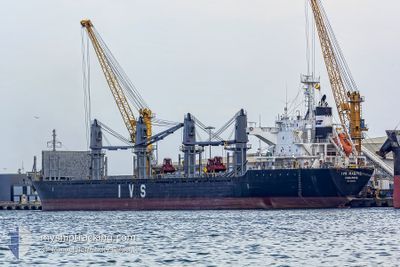
IVS MAGPIE
Bulk Carrier
Current Trip
| Time Travelled | 4 days |
|---|---|
| Remaining Time | 11 days |
| Distance Travelled | 1071.63 nm |
| Remaining Distance | 2685.94 nm |
| AVG Speed | 10.4 Knots |
| MAX Speed | 11.6 Knots |
| AVG Wind | 9.3 knots |
| MAX Wind | 20 knots |
| MIN Temp | 17.7°C / 63.86°F |
| MAX Temp | 26.1°C / 78.98°F |
| Dybgang | 8.9 m |
| Position Modtaget | 2 d siden |
Current Position
| Longitude | --- |
|---|---|
| Latitude | --- |
| Status | Under way using engine |
| Fart | 11.5 Knots |
| Kurs | 134.2° |
| Område | Gulf of Oman |
| Station | T-AIS |
| Position Modtaget | 2 d siden |
Info
Information
The current position of IVS MAGPIE is in Gulf of Oman with coordinates 24.86666° / 56.76690° as reported on 2025-03-05 03:37 by AIS to our vessel tracker app. The vessel's current speed is 11.5 Knots and is heading at the port of SINGAPORE. The estimated time of arrival as calculated by MyShipTracking vessel tracking app is 2025-03-19 02:01 LT
The vessel IVS MAGPIE (IMO: 9604732, MMSI: 538008745) is a Bulk Carrier that was built in 2011 ( 14 år gamle ). It's sailing under the flag of [MH] Marshall Is.
In this page you can find informations about the vessels current position, last detected port calls, and current voyage information. If the vessels is not in coverage by AIS you will find the latest position.
The current position of IVS MAGPIE is detected by our AIS receivers and we are not responsible for the reliability of the data. The last position was recorded while the vessel was in Coverage by the Ais receivers of our vessel tracking app.
The current draught of IVS MAGPIE as reported by AIS is 8.9 meters
Weather
| Temperature | 26°C / 78.8°F |
|---|---|
| Wind Speed | 9 knots |
| Direction | 20° NNE |
| Pressure | 1012.7 hPa |
| Humidity | 66.4 % |
| Cloud Coverage | 1 % |
Featured Company
Events
| Tid | Hændelsen | Detaljer | Position / Dest | Info |
|---|---|---|---|---|
| 2025-03-05 03:40 | Status er ændret | Default Under way using engine |
24.85946 / 56.77491
SINGAPORE
|
Fart: 11.5 kn Kurs: 134.2° |
| 2025-03-05 03:37 | Udenfor Dækning |
24.86666 / 56.76690
Gulf of Oman
SINGAPORE
|
Fart: 11.5 kn Kurs: 134.2° |
|
| 2025-03-05 03:08 | Fundet i havområde | Omani part of the Gulf of Oman |
24.93315 / 56.70114
Gulf of Oman
SINGAPORE
|
Fart: 11.5 kn Kurs: 180.1° |
| 2025-03-05 03:07 | Status er ændret | Under way using engine Default |
24.93421 / 56.70114
SINGAPORE
|
Fart: 11.5 kn Kurs: 181° |
| 2025-03-05 02:22 | Status er ændret | Default Under way using engine |
25.08085 / 56.70641
SINGAPORE
|
Fart: 11.2 kn Kurs: 182.8° |
| 2025-03-04 23:08 | Ændre havområde | United Arab Emirates part of the Gulf of Oman Omani part of the Gulf of Oman |
25.66474 / 56.74579
Gulf of Oman
SINGAPORE
|
Fart: 10.6 kn Kurs: 181.5° |
| 2025-03-04 21:47 | Ændre havområde | Omani part of the Gulf of Oman Omani part of the Persian Gulf |
25.91507 / 56.73507
Gulf of Oman
SINGAPORE
|
Fart: 11 kn Kurs: 178.7° |
| 2025-03-04 21:46 | Status er ændret | Under way using engine Default |
25.91770 / 56.73502
SINGAPORE
|
Fart: 10.8 kn Kurs: 180° |
| 2025-03-04 21:31 | Indenfor Dækning |
25.91507 / 56.73507
Gulf of Oman
SINGAPORE
|
Fart: 11 kn Kurs: 178.7° |
|
| 2025-03-04 13:37 | Udenfor Dækning |
26.20062 / 55.95513
Persian Gulf
SINGAPORE
|
Fart: 10.4 kn Kurs: 48.3° |