
IVONE
Cargo
Current Trip
| Time Travelled | 13 days |
|---|---|
| Remaining Time | --- |
| Distance Travelled | 1274.38 nm |
| Remaining Distance | --- |
| AVG Speed | 11.1 Knots |
| MAX Speed | 14.6 Knots |
| AVG Wind | 12.9 knots |
| MAX Wind | 25.9 knots |
| MIN Temp | 10.5°C / 50.9°F |
| MAX Temp | 21.2°C / 70.16°F |
| Dybgang | 9.9 m |
| Position Modtaget | 7 d siden |
Current Position
| Longitude | 13.94405° |
|---|---|
| Latitude | 36.08432° |
| Status | Under way using engine |
| Fart | 11.3 Knots |
| Kurs | 302.3° |
| Område | Mediterranean Sea - Eastern Basin |
| Station | T-AIS |
| Position Modtaget | 7 d siden |
Info
Information
The current position of IVONE is in Mediterranean Sea - Eastern Basin with coordinates 36.08432° / 13.94405° as reported on 2024-04-22 23:35 by AIS to our vessel tracker app. The vessel's current speed is 11.3 Knots
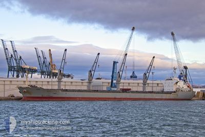
The vessel IVONE (IMO: 9691486, MMSI: 256451000) is a Cargo It's sailing under the flag of [MT] Malta.
In this page you can find informations about the vessels current position, last detected port calls, and current voyage information. If the vessels is not in coverage by AIS you will find the latest position.
The current position of IVONE is detected by our AIS receivers and we are not responsible for the reliability of the data. The last position was recorded while the vessel was in Coverage by the Ais receivers of our vessel tracking app.
The current draught of IVONE as reported by AIS is 9.9 meters
Weather
| Temperature | 16°C / 60.8°F |
|---|---|
| Wind Speed | 16 knots |
| Direction | 137° SE |
| Pressure | 1015.2 hPa |
| Humidity | 94.1 % |
| Cloud Coverage | 99 % |
Featured Company
Last Port Calls
| Port | Arrival | Departure | Time In Port |
|---|---|---|---|
| 2024-04-10 05:25 | 2024-04-16 17:59 | 6 d | |
| 2024-04-01 05:24 | 2024-04-03 13:24 | 2 d | |
| 2024-03-22 06:46 | 2024-03-23 16:15 | 1 d | |
| 2024-03-07 06:44 | 2024-03-20 15:08 | 13 d | |
| 2024-02-27 06:37 | 2024-02-27 09:44 | 3 h |
Last Trips
| Origin | Departure | Destination | Arrival | Distance | |
|---|---|---|---|---|---|
| 2024-04-03 16:24 | 2024-04-10 08:25 | 112.87 nm | |||
| 2024-03-23 17:15 | 2024-04-01 08:24 | 1862.43 nm | |||
| 2024-03-20 16:08 | 2024-03-22 07:46 | 201.35 nm |
Events
| Tid | Hændelsen | Detaljer | Position / Dest | Info |
|---|---|---|---|---|
| 2024-04-22 23:37 | Status er ændret | Default Under way using engine |
36.08893 / 13.93536
TUNISI
|
Fart: 11.3 kn Kurs: 302.3° |
| 2024-04-22 23:35 | Udenfor Dækning |
36.08432 / 13.94405
Mediterranean Sea - Eastern Basin
|
Fart: 11.3 kn Kurs: 302.3° |
|
| 2024-04-22 21:44 | START Sejllads | 1.73 nm, South West of CIRKEWWA |
35.96247 / 14.31617
TUNISI
|
Fart: 3.3 kn Kurs: 286° |
| 2024-04-22 21:34 | Status er ændret | Under way using engine At anchor |
35.95918 / 14.31842
TUNISI
|
Fart: 0.5 kn Kurs: 354° |
| 2024-04-22 17:38 | Status er ændret | At anchor Under way using engine |
35.95770 / 14.31549
TUNISI
|
Fart: 0.2 kn Kurs: 39° |
| 2024-04-22 16:16 | STOP Sejllads | 1.88 nm, South of CIRKEWWA |
35.95929 / 14.31751
TUNISI
|
Fart: 0.3 kn Kurs: 35° |
| 2024-04-22 14:18 | Status er ændret | Under way using engine Default |
35.76067 / 14.41096
TUNISI
|
Fart: 12.8 kn Kurs: 262° |
| 2024-04-22 14:06 | Indenfor Dækning |
35.76006 / 14.40663
Mediterranean Sea - Eastern Basin
TUNISI
|
Fart: 12.8 kn Kurs: 260.7° |
|
| 2024-04-22 13:19 | Status er ændret | Default Under way using engine |
35.79956 / 14.66115
TUNISI
|
Fart: 12.1 kn Kurs: 258.9° |
| 2024-04-22 13:11 | Udenfor Dækning |
35.80586 / 14.69421
Mediterranean Sea - Eastern Basin
TUNISI
|
Fart: 12.1 kn Kurs: 258.9° |