
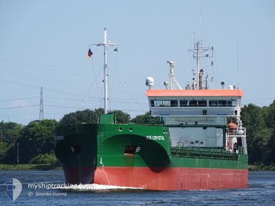
ICE CRYSTAL
Cargo
Current Trip
| Time Travelled | 2 days |
|---|---|
| Remaining Time | 22 h, 55 mins |
| Distance Travelled | 442.00 nm |
| Remaining Distance | 241.75 nm |
| AVG Speed | 8.3 Knots |
| MAX Speed | 10 Knots |
| AVG Wind | 17.2 knots |
| MAX Wind | 26.5 knots |
| MIN Temp | 0.2°C / 32.36°F |
| MAX Temp | 3.1°C / 37.58°F |
| Dybgang | 6.6 m |
| Position Modtaget | 14 h, 6 m siden |
Current Position
| Longitude | --- |
|---|---|
| Latitude | --- |
| Status | Under way using engine |
| Fart | 7 Knots |
| Kurs | 12.9° |
| Område | Gulf of Bothnia |
| Station | T-AIS |
| Position Modtaget | 14 h, 6 m siden |
Info
Information
The current position of ICE CRYSTAL is in Gulf of Bothnia with coordinates 60.58756° / 19.06927° as reported on 2026-01-08 16:37 by AIS to our vessel tracker app. The vessel's current speed is 7 Knots and is heading at the port of RONNSKAR. The estimated time of arrival as calculated by MyShipTracking vessel tracking app is 2026-01-10 06:39 LT
The vessel ICE CRYSTAL (IMO: 9818321, MMSI: 231815000) is a Cargo It's sailing under the flag of [FO] Faroe Is.
In this page you can find informations about the vessels current position, last detected port calls, and current voyage information. If the vessels is not in coverage by AIS you will find the latest position.
The current position of ICE CRYSTAL is detected by our AIS receivers and we are not responsible for the reliability of the data. The last position was recorded while the vessel was in Coverage by the Ais receivers of our vessel tracking app.
The current draught of ICE CRYSTAL as reported by AIS is 6.6 meters
Weather
| Temperature | -3.7°C / 25.34°F |
|---|---|
| Wind Speed | 21 knots |
| Direction | 142° SE |
| Pressure | 1024 hPa |
| Humidity | 72.9 % |
| Cloud Coverage | 100 % |
Featured Company
Last Port Calls
| Port | Arrival | Departure | Time In Port |
|---|---|---|---|
| 2026-01-05 20:44 | 2026-01-06 18:19 | 21 h | |
| 2026-01-02 17:04 | 2026-01-03 17:17 | 1 d | |
| 2025-12-25 08:04 | 2025-12-26 20:01 | 1 d | |
| 2025-12-14 19:10 | 2025-12-18 14:26 | 3 d | |
| 2025-12-10 08:29 | 2025-12-11 15:25 | 1 d | |
| 2025-12-07 00:31 | 2025-12-09 02:20 | 2 d | |
| 2025-12-02 23:11 | 2025-12-04 16:11 | 1 d | |
| 2025-11-26 13:31 | 2025-11-27 15:16 | 1 d | |
| 2025-11-25 00:02 | 2025-11-25 00:41 | 38 m | |
| 2025-11-23 09:20 | 2025-11-24 22:58 | 1 d |
Last Trips
| Origin | Departure | Destination | Arrival | Distance | |
|---|---|---|---|---|---|
| 2026-01-03 17:17 | 2026-01-05 20:44 | 513.09 nm | |||
| 2025-12-26 20:01 | 2026-01-02 17:04 | 826.27 nm | |||
| 2025-12-18 14:26 | 2025-12-25 08:04 | 1612.13 nm | |||
| 2025-12-11 15:25 | 2025-12-14 19:10 | 680.81 nm | |||
| 2025-12-09 02:20 | 2025-12-10 08:29 | 235.06 nm | |||
| 2025-12-04 16:11 | 2025-12-07 00:31 | 208.02 nm | |||
| 2025-11-27 15:16 | 2025-12-02 23:11 | 1061.55 nm | |||
| 2025-11-25 00:41 | 2025-11-26 13:31 | 399.64 nm | |||
| 2025-11-24 22:58 | 2025-11-25 00:02 | 4.25 nm | |||
| 2025-11-11 00:28 | 2025-11-23 09:20 | 2084.54 nm |
Events
| Tid | Hændelsen | Detaljer | Position / Dest | Info |
|---|---|---|---|---|
| 2026-01-08 16:45 | Status er ændret | Default Under way using engine |
60.60193 / 19.07556
DKRNN>SEROR
|
Fart: 7 kn Kurs: 12.9° |
| 2026-01-08 16:37 | Udenfor Dækning |
60.58756 / 19.06927
Gulf of Bothnia
DKRNN>SEROR
|
Fart: 7 kn Kurs: 12.9° |
|
| 2026-01-08 13:28 | Ændre havområde | Swedish part of the Gulf of Bothnia Finnish part of the Gulf of Bothnia |
60.20658 / 19.08818
Gulf of Bothnia
DKRNN>SEROR
|
Fart: 7.9 kn Kurs: 334.3° |
| 2026-01-08 09:22 | Ændre havområde | Finnish part of the Gulf of Bothnia Finnish part of the Baltic Sea |
59.78814 / 19.75801
Gulf of Bothnia
DKRNN>SEROR
|
Fart: 8 kn Kurs: 315.4° |
| 2026-01-08 08:47 | ETA er ændret | 2026/01/09 23:00 2026/01/09 12:00 |
59.73058 / 19.86947
DKRNN>SEROR
|
Fart: 8.6 kn Kurs: 315.3° |
| 2026-01-08 08:09 | Status er ændret | Under way using engine Default |
59.66960 / 19.99340
DKRNN>SEROR
|
Fart: 8.1 kn Kurs: 313° |
| 2026-01-08 08:05 | Status er ændret | Default Under way using engine |
59.66366 / 20.00696
DKRNN>SEROR
|
Fart: 7.3 kn Kurs: 312.3° |
| 2026-01-08 07:58 | Ændre havområde | Finnish part of the Baltic Sea Danish part of the Kattegat |
59.65397 / 20.02850
Baltic Sea
DKRNN>SEROR
|
Fart: 7.6 kn Kurs: 307.1° |
| 2026-01-08 07:56 | Status er ændret | Under way using engine Default |
59.65209 / 20.03260
DKRNN>SEROR
|
Fart: 8.2 kn Kurs: 319° |
| 2026-01-08 07:56 | Indenfor Dækning |
59.65397 / 20.02850
Baltic Sea
DKRNN>SEROR
|
Fart: 7.6 kn Kurs: 307.1° |