
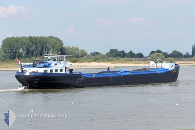
HILDAMAR
Not available
Current Trip
SLHA"2ECHT
| Time Travelled | 8 days |
|---|---|
| Remaining Time | --- |
| Distance Travelled | 1.19 nm |
| Remaining Distance | --- |
| AVG Speed | 5.3 Knots |
| MAX Speed | 6.1 Knots |
| AVG Wind | 13 knots |
| MAX Wind | 13.5 knots |
| MIN Temp | 5.2°C / 41.36°F |
| MAX Temp | 8.3°C / 46.94°F |
| Dybgang | 1.9 m |
| Position Modtaget | 4 d siden |
Current Position
| Longitude | --- |
|---|---|
| Latitude | --- |
| Status | Under way using engine |
| Fart | |
| Kurs | --- |
| Område | North Sea |
| Station | T-AIS |
| Position Modtaget | 4 d siden |
Info
Information
The current position of HILDAMAR is in North Sea with coordinates 52.40004° / 5.24400° as reported on 2025-02-26 15:30 by AIS to our vessel tracker app. The vessel's current speed is 0 Knots
The vessel HILDAMAR (MMSI: 244690150) is a Not available It's sailing under the flag of [NL] Netherlands.
In this page you can find informations about the vessels current position, last detected port calls, and current voyage information. If the vessels is not in coverage by AIS you will find the latest position.
The current position of HILDAMAR is detected by our AIS receivers and we are not responsible for the reliability of the data. The last position was recorded while the vessel was in Coverage by the Ais receivers of our vessel tracking app.
The current draught of HILDAMAR as reported by AIS is 1.9 meters
Weather
| Temperature | 7.5°C / 45.5°F |
|---|---|
| Wind Speed | 10 knots |
| Direction | 194° SSW |
| Pressure | 1013.3 hPa |
| Humidity | 66.3 % |
| Cloud Coverage | 37 % |
Featured Company
Last Port Calls
| Port | Arrival | Departure | Time In Port |
|---|---|---|---|
| 2025-02-22 00:19 | 2025-02-22 07:01 | 6 h | |
| 2025-02-21 19:33 | 2025-02-21 20:01 | 27 m | |
| 2025-02-21 11:44 | 2025-02-21 14:13 | 2 h | |
| 2025-02-20 15:55 | 2025-02-20 16:41 | 45 m | |
| 2025-02-20 11:18 | 2025-02-20 13:27 | 2 h | |
| 2025-02-20 09:07 | 2025-02-20 09:38 | 30 m | |
| 2025-02-17 19:39 | 2025-02-17 20:12 | 32 m | |
| 2025-02-14 17:37 | 2025-02-17 13:34 | 2 d | |
| 2025-02-14 13:47 | 2025-02-14 16:07 | 2 h | |
| 2025-02-13 09:47 | 2025-02-13 12:27 | 2 h |
Most Visited Ports (Last year)
| Port | Arrivals | |
|---|---|---|
| 144 | ||
| 18 | ||
| 10 | ||
| 8 | ||
| 6 | ||
| 6 |
Last Trips
| Origin | Departure | Destination | Arrival | Distance | |
|---|---|---|---|---|---|
| 2025-02-21 21:01 | 2025-02-22 01:19 | 33.84 nm | |||
| 2025-02-21 15:13 | 2025-02-21 20:33 | 49.75 nm | |||
| 2025-02-20 17:41 | 2025-02-21 12:44 | 65.93 nm | |||
| 2025-02-20 14:27 | 2025-02-20 16:55 | 20.00 nm | |||
| 2025-02-20 10:38 | 2025-02-20 12:18 | 12.12 nm | |||
| 2025-02-17 21:12 | 2025-02-20 10:07 | 168.22 nm | |||
| 2025-02-17 14:34 | 2025-02-17 20:39 | 43.72 nm | |||
| 2025-02-14 17:07 | 2025-02-14 18:37 | 11.57 nm | |||
| 2025-02-13 13:27 | 2025-02-14 14:47 | 46.03 nm | |||
| 2025-02-13 06:17 | 2025-02-13 10:47 | 30.13 nm |
Events
| Tid | Hændelsen | Detaljer | Position / Dest | Info |
|---|---|---|---|---|
| 2025-02-26 15:30 | Udenfor Dækning |
52.40004 / 5.24400
North Sea
|
Fart: Kurs: 0° |
|
| 2025-02-23 03:43 | Indenfor Dækning |
52.40000 / 5.24399
North Sea
|
Fart: Kurs: 0° |
|
| 2025-02-23 02:34 | Udenfor Dækning |
52.40003 / 5.24398
North Sea
|
Fart: Kurs: 0° |
|
| 2025-02-23 02:25 | Indenfor Dækning |
52.40003 / 5.24398
North Sea
|
Fart: Kurs: 0° |
|
| 2025-02-23 01:13 | Udenfor Dækning |
52.40004 / 5.24402
North Sea
|
Fart: Kurs: 0° |
|
| 2025-02-22 07:24 | STOP Sejllads | 1.42 nm, South East of DE BLOCQ VAN KUFFELER |
52.40001 / 5.24402
SLHA"2ECHT
|
Fart: 0.2 kn Kurs: 511° |
| 2025-02-22 07:18 | START Sejllads | 0.95 nm, South East of DE BLOCQ VAN KUFFELER |
52.40577 / 5.23555
SLHA"2ECHT
|
Fart: 5.8 kn Kurs: 117.5° |
| 2025-02-22 07:09 | STOP Sejllads | 0.82 nm, South East of DE BLOCQ VAN KUFFELER |
52.40691 / 5.23227
SLHA"2ECHT
|
Fart: Kurs: 511° |
| 2025-02-22 07:01 | START Sejllads | 0.29 nm, South East of DE BLOCQ VAN KUFFELER |
52.41494 / 5.22517
SLHA"2ECHT
|
Fart: 5.4 kn Kurs: 148.5° |
| 2025-02-22 07:01 | Afsejlet fra sidste havn |
|
52.41494 / 5.22517
SLHA"2ECHT
|
Fart: 0.1 kn Kurs: 511° |