
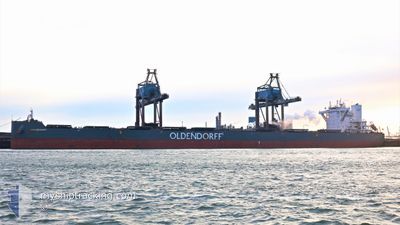
HERA OLDENDORFF
Cargo
Current Trip
| Time Travelled | 7 days |
|---|---|
| Remaining Time | --- |
| Distance Travelled | 438.73 nm |
| Remaining Distance | --- |
| AVG Speed | 8.5 Knots |
| MAX Speed | 12.9 Knots |
| AVG Wind | 10.8 knots |
| MAX Wind | 21.9 knots |
| MIN Temp | 9.6°C / 49.28°F |
| MAX Temp | 15.5°C / 59.9°F |
| Dybgang | 8.9 m |
| Position Modtaget | 5 d siden |
Current Position
| Longitude | 123.05786° |
|---|---|
| Latitude | 36.93909° |
| Status | Under way using engine |
| Fart | 5.5 Knots |
| Kurs | 194.3° |
| Område | Yellow Sea |
| Station | T-AIS |
| Position Modtaget | 5 d siden |
Info
Information
The current position of HERA OLDENDORFF is in Yellow Sea with coordinates 36.93909° / 123.05786° as reported on 2024-04-25 16:28 by AIS to our vessel tracker app. The vessel's current speed is 5.5 Knots and is heading at the port of SHIDAO. The estimated time of arrival as calculated by MyShipTracking vessel tracking app is 2024-04-27 15:00 LT
The vessel HERA OLDENDORFF (IMO: 9718363, MMSI: 636017587) is a Cargo It's sailing under the flag of [LR] Liberia.
In this page you can find informations about the vessels current position, last detected port calls, and current voyage information. If the vessels is not in coverage by AIS you will find the latest position.
The current position of HERA OLDENDORFF is detected by our AIS receivers and we are not responsible for the reliability of the data. The last position was recorded while the vessel was in Coverage by the Ais receivers of our vessel tracking app.
The current draught of HERA OLDENDORFF as reported by AIS is 8.9 meters
Weather
| Temperature | 13.2°C / 55.76°F |
|---|---|
| Wind Speed | 6 knots |
| Direction | 202° SSW |
| Pressure | 1016.3 hPa |
| Humidity | 73.4 % |
| Cloud Coverage | 69 % |
Featured Company
Last Port Calls
| Port | Arrival | Departure | Time In Port |
|---|---|---|---|
| 2024-04-20 19:32 | 2024-04-24 06:00 | 3 d | |
| 2024-03-27 10:06 | 2024-03-28 14:50 | 1 d | |
| 2024-03-08 03:23 | 2024-03-10 16:07 | 2 d |
Last Trips
| Origin | Departure | Destination | Arrival | Distance | |
|---|---|---|---|---|---|
| 2024-03-28 22:50 | 2024-04-21 03:32 | 4009.85 nm | |||
| 2024-03-11 00:07 | 2024-03-27 18:06 | 3917.82 nm | |||
| 2024-02-21 11:14 | 2024-03-08 11:23 | 3862.02 nm |
Events
| Tid | Hændelsen | Detaljer | Position / Dest | Info |
|---|---|---|---|---|
| 2024-04-27 05:53 | STOP Sejllads | 9.73 nm, West of SHIDAO |
36.83391 / 122.27310
SHIDAO, CHINA
|
Fart: 0.1 kn Kurs: 162° |
| 2024-04-27 04:48 | START Sejllads | 14.14 nm, South West of SHIDAO |
36.77873 / 122.20470
SHIDAO, CHINA
|
Fart: 6 kn Kurs: 46° |
| 2024-04-26 11:09 | STOP Sejllads | 14.43 nm, South West of SHIDAO |
36.77390 / 122.20125
SHIDAO, CHINA
|
Fart: Kurs: 278° |
| 2024-04-26 07:12 | START Sejllads |
36.27650 / 122.41743
SHIDAO, CHINA
|
Fart: 3.1 kn Kurs: 276° |
|
| 2024-04-26 06:03 | STOP Sejllads |
36.27501 / 122.43374
SHIDAO, CHINA
|
Fart: Kurs: 185° |
|
| 2024-04-25 21:56 | START Sejllads |
36.88467 / 123.07709
SHIDAO, CHINA
|
Fart: 5.9 kn Kurs: 179° |
|
| 2024-04-25 17:19 | STOP Sejllads |
36.89167 / 123.07667
SHIDAO, CHINA
|
Fart: Kurs: -1° |
|
| 2024-04-25 16:33 | Status er ændret | Default Under way using engine |
36.93261 / 123.05891
SHIDAO, CHINA
|
Fart: 5.5 kn Kurs: 194.3° |
| 2024-04-25 16:28 | Udenfor Dækning |
36.93909 / 123.05786
Yellow Sea
SHIDAO, CHINA
|
Fart: 5.5 kn Kurs: 194.3° |
|
| 2024-04-25 16:19 | Dybgangen er ændret | 8.9 18.4 |
36.95211 / 123.06586
SHIDAO, CHINA
|
Fart: 5.8 kn Kurs: 209.8° |