
HENRIKA SCHULTE
Cargo B
Current Trip
| Time Travelled | 2 days |
|---|---|
| Remaining Time | --- |
| Distance Travelled | 1318.15 nm |
| Remaining Distance | --- |
| AVG Speed | 17.8 Knots |
| MAX Speed | 21 Knots |
| AVG Wind | 9.3 knots |
| MAX Wind | 16 knots |
| MIN Temp | 3.8°C / 38.84°F |
| MAX Temp | 13.5°C / 56.3°F |
| Dybgang | 12.2 m |
| Position Modtaget | 1 m siden |
Current Position
| Longitude | --- |
|---|---|
| Latitude | --- |
| Status | Under way using engine |
| Fart | 19.5 Knots |
| Kurs | 239.7° |
| Område | North Atlantic Ocean |
| Station | T-AIS |
| Position Modtaget | 1 m siden |
Information
The current position of HENRIKA SCHULTE is in North Atlantic Ocean with coordinates 44.25249° / -19.78648° as reported on 2025-03-28 05:07 by AIS to our vessel tracker app. The vessel's current speed is 19.5 Knots and is heading at the port of VERACRUZ. The estimated time of arrival as calculated by MyShipTracking vessel tracking app is 2025-04-07 00:01 LT
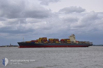
The vessel HENRIKA SCHULTE (IMO: 9535163, MMSI: 477346500) is a Cargo B It's sailing under the flag of [HK] Hong Kong.
In this page you can find informations about the vessels current position, last detected port calls, and current voyage information. If the vessels is not in coverage by AIS you will find the latest position.
The current position of HENRIKA SCHULTE is detected by our AIS receivers and we are not responsible for the reliability of the data. The last position was recorded while the vessel was in Coverage by the Ais receivers of our vessel tracking app.
The current draught of HENRIKA SCHULTE as reported by AIS is 12.2 meters
Weather
| Temperature | 13.5°C / 56.3°F |
|---|---|
| Wind Speed | 10 knots |
| Direction | 281° W |
| Pressure | 1025.5 hPa |
| Humidity | 91.2 % |
| Cloud Coverage | 90 % |
Featured Company
Last Port Calls
| Port | Arrival | Departure | Time In Port |
|---|---|---|---|
| 2025-03-24 13:03 | 2025-03-25 05:38 | 16 h | |
| 2025-03-23 02:01 | 2025-03-23 13:54 | 11 h | |
| 2025-03-20 12:07 | 2025-03-22 10:26 | 1 d | |
| 2025-03-09 20:47 | 2025-03-10 20:31 | 23 h | |
| 2025-03-07 20:15 | 2025-03-08 17:40 | 21 h | |
| 2025-03-02 21:51 | 2025-03-03 23:55 | 1 d | |
| 2025-02-28 08:41 | 2025-03-01 22:11 | 1 d | |
| 2025-02-24 13:52 | 2025-02-25 23:11 | 1 d | |
| 2025-02-21 10:00 | 2025-02-22 01:57 | 15 h | |
| 2025-02-18 09:18 | 2025-02-19 12:19 | 1 d |
Most Visited Ports (Last year)
| Port | Arrivals | |
|---|---|---|
| 12 | ||
| 8 | ||
| 8 | ||
| 7 | ||
| 7 | ||
| 7 |
Last Trips
| Origin | Departure | Destination | Arrival | Distance | |
|---|---|---|---|---|---|
| 2025-03-23 14:54 | 2025-03-24 14:03 | 276.85 nm | |||
| 2025-03-22 11:26 | 2025-03-23 03:01 | 127.16 nm | |||
| 2025-03-10 16:31 | 2025-03-20 13:07 | 3882.49 nm | |||
| 2025-03-08 12:40 | 2025-03-09 16:47 | 420.61 nm | |||
| 2025-03-03 17:55 | 2025-03-07 15:15 | 946.95 nm | |||
| 2025-03-01 16:11 | 2025-03-02 15:51 | 288.95 nm | |||
| 2025-02-25 18:11 | 2025-02-28 02:41 | 901.23 nm | |||
| 2025-02-21 20:57 | 2025-02-24 08:52 | 448.24 nm | |||
| 2025-02-19 07:19 | 2025-02-21 05:00 | 650.08 nm | |||
| 2025-02-06 15:10 | 2025-02-18 04:18 | 4357.05 nm |
Events
| Tid | Hændelsen | Detaljer | Position / Dest | Info |
|---|---|---|---|---|
| 2025-03-28 01:09 | Fundet i havområde | High seas of the North Atlantic Ocean |
44.95703 / -18.25752
North Atlantic Ocean
VERACRUZ
|
Fart: 19.7 kn Kurs: 236.2° |
| 2025-03-28 01:09 | Indenfor Dækning |
44.95703 / -18.25752
North Atlantic Ocean
VERACRUZ
|
Fart: 19.7 kn Kurs: 236.2° |
|
| 2025-03-26 18:12 | Status er ændret | Default Under way using engine |
49.39146 / -5.37421
VERACRUZ
|
Fart: 18.8 kn Kurs: 245.6° |
| 2025-03-26 18:04 | Udenfor Dækning |
49.40731 / -5.31955
Celtic Sea
VERACRUZ
|
Fart: 18.8 kn Kurs: 245.6° |
|
| 2025-03-26 18:02 | Ændre havområde | United Kingdom part of the Celtic Sea United Kingdom part of the English Channel |
49.41327 / -5.29915
Celtic Sea
VERACRUZ
|
Fart: 18.6 kn Kurs: 245.6° |
| 2025-03-26 18:02 | Status er ændret | Under way using engine Default |
49.41327 / -5.29915
VERACRUZ
|
Fart: 18.5 kn Kurs: 246° |
| 2025-03-26 18:00 | Status er ændret | Default Under way using engine |
49.41707 / -5.28618
VERACRUZ
|
Fart: 18.5 kn Kurs: 245.6° |
| 2025-03-26 17:59 | Status er ændret | Under way using engine Default |
49.41871 / -5.28054
VERACRUZ
|
Fart: 18.5 kn Kurs: 246° |
| 2025-03-26 17:24 | Status er ændret | Default Under way using engine |
49.48833 / -5.02933
VERACRUZ
|
Fart: 17.9 kn Kurs: 251° |
| 2025-03-26 13:01 | Status er ændret | Under way using engine Default |
49.89926 / -3.14358
VERACRUZ
|
Fart: 19.1 kn Kurs: 247° |