
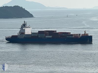
HELGOLAND
Cargo A
Current Trip
| Trip Time | 1 day |
|---|---|
| Trip Distance | 211.31 nm |
| AVG Speed | 8 Knots |
| MAX Speed | 8 Knots |
| Dybgang | 7.1 m |
| AVG Wind | 8 knots |
| MAX Wind | 11.8 knots |
| MIN Temp | 25.6°C / 78.08°F |
| MAX Temp | 28.7°C / 83.66°F |
| Position Modtaget | 3 m siden |
Current Position
| Longitude | --- |
|---|---|
| Latitude | --- |
| Status | Moored |
| Fart | |
| Kurs | 120° |
| Område | Singapore Strait |
| Station | T-AIS |
| Position Modtaget | 3 m siden |
Info
Information
The current position of HELGOLAND is in Singapore Strait with coordinates 1.28741° / 103.76562° as reported on 2025-01-01 13:19 by AIS to our vessel tracker app. The vessel's current speed is 0 Knots and is currently inside the port of SINGAPORE.
The vessel HELGOLAND (IMO: 9944766, MMSI: 305523000) is a Cargo A It's sailing under the flag of [AG] Antigua Barbuda.
In this page you can find informations about the vessels current position, last detected port calls, and current voyage information. If the vessels is not in coverage by AIS you will find the latest position.
The current position of HELGOLAND is detected by our AIS receivers and we are not responsible for the reliability of the data. The last position was recorded while the vessel was in Coverage by the Ais receivers of our vessel tracking app.
The current draught of HELGOLAND as reported by AIS is 9.4 meters
Weather
| Temperature | 26.8°C / 80.24°F |
|---|---|
| Wind Speed | 12 knots |
| Direction | 27° NNE |
| Pressure | 1009.9 hPa |
| Humidity | 80.4 % |
| Cloud Coverage | 100 % |
Featured Company
Last Port Calls
| Port | Arrival | Departure | Time In Port |
|---|---|---|---|
| 2024-12-31 21:23 | |||
| 2024-12-30 06:41 | 2024-12-30 14:57 | 8 h | |
| 2024-12-28 21:29 | 2024-12-29 11:36 | 14 h | |
| 2024-12-17 11:11 | 2024-12-18 04:09 | 16 h | |
| 2024-12-16 06:13 | 2024-12-16 21:53 | 15 h | |
| 2024-12-14 21:50 | 2024-12-15 12:11 | 14 h | |
| 2024-12-03 10:31 | 2024-12-04 04:36 | 18 h | |
| 2024-12-02 05:09 | 2024-12-02 19:13 | 14 h | |
| 2024-11-30 14:52 | 2024-12-01 03:04 | 12 h | |
| 2024-11-20 03:58 | 2024-11-20 19:55 | 15 h |
Last Trips
| Origin | Departure | Destination | Arrival | Distance | |
|---|---|---|---|---|---|
| 2024-12-30 22:57 | 2025-01-01 05:23 | 211.31 nm | |||
| 2024-12-29 19:36 | 2024-12-30 14:41 | 199.49 nm | |||
| 2024-12-18 12:09 | 2024-12-29 05:29 | 2699.99 nm | |||
| 2024-12-17 05:53 | 2024-12-17 19:11 | 202.00 nm | |||
| 2024-12-15 20:11 | 2024-12-16 14:13 | 203.72 nm | |||
| 2024-12-04 12:36 | 2024-12-15 05:50 | 2691.16 nm | |||
| 2024-12-03 03:13 | 2024-12-03 18:31 | 201.95 nm | |||
| 2024-12-01 11:04 | 2024-12-02 13:09 | 201.37 nm | |||
| 2024-11-21 03:55 | 2024-11-30 22:52 | 2688.98 nm | |||
| 2024-11-19 22:08 | 2024-11-20 11:58 | 200.82 nm |
Events
| Tid | Hændelsen | Detaljer | Position / Dest | Info |
|---|---|---|---|---|
| 2025-01-01 09:46 | Status er ændret | Moored Default |
1.28741 / 103.76562
[SG] SINGAPORE
|
Fart: Kurs: 119° |
| 2025-01-01 09:43 | Status er ændret | Default Moored |
1.28744 / 103.76561
[SG] SINGAPORE
|
Fart: Kurs: 119° |
| 2025-01-01 07:47 | Destination er ændret | BD CGP SG SIN PWBGA |
1.28741 / 103.76552
[SG] SINGAPORE
|
Fart: Kurs: 120° |
| 2025-01-01 07:47 | ETA er ændret | 2025/01/05 17:00 2025/01/05 19:45 |
1.28741 / 103.76552
[SG] SINGAPORE
|
Fart: Kurs: 120° |
| 2025-01-01 06:58 | Status er ændret | Moored Default |
1.28743 / 103.76558
[SG] SINGAPORE
|
Fart: Kurs: 120° |
| 2025-01-01 06:56 | Status er ændret | Default Moored |
1.28744 / 103.76560
[SG] SINGAPORE
|
Fart: Kurs: 120° |
| 2025-01-01 06:47 | Dybgangen er ændret | 9.4 7.1 |
1.28745 / 103.76559
[SG] SINGAPORE
|
Fart: Kurs: 120° |
| 2025-01-01 06:47 | ETA er ændret | 2025/01/05 19:45 2025/12/31 19:45 |
1.28745 / 103.76559
[SG] SINGAPORE
|
Fart: Kurs: 120° |
| 2025-01-01 06:28 | Status er ændret | Moored Default |
1.28745 / 103.76558
[SG] SINGAPORE
|
Fart: Kurs: 120° |
| 2025-01-01 06:22 | Status er ændret | Default Moored |
1.28744 / 103.76558
[SG] SINGAPORE
|
Fart: Kurs: 120° |