
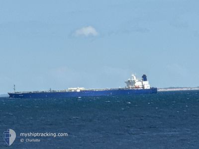
HECTOR
Crude Oil Tanker
Current Trip
| Time Travelled | 23 days |
|---|---|
| Remaining Time | 3 days |
| Distance Travelled | 6356.09 nm |
| Remaining Distance | 1456.95 nm |
| AVG Speed | 12.2 Knots |
| MAX Speed | 16.7 Knots |
| AVG Wind | 10.5 knots |
| MAX Wind | 24.8 knots |
| MIN Temp | 12.5°C / 54.5°F |
| MAX Temp | 31.5°C / 88.7°F |
| Dybgang | 8.2 m |
| Position Modtaget | 1 m siden |
Current Position
| Longitude | --- |
|---|---|
| Latitude | --- |
| Status | Under way using engine |
| Fart | 14.7 Knots |
| Kurs | 11.3° |
| Område | North Sea |
| Station | T-AIS |
| Position Modtaget | 1 m siden |
Info
Information
The current position of HECTOR is in North Sea with coordinates 51.80117° / 2.60638° as reported on 2024-10-04 16:06 by AIS to our vessel tracker app. The vessel's current speed is 14.7 Knots and is heading at the port of UST-LUGA. The estimated time of arrival as calculated by MyShipTracking vessel tracking app is 2024-10-08 14:04 LT
The vessel HECTOR (IMO: 9388742, MMSI: 626284000) is a Crude Oil Tanker that was built in 2008 ( 16 år gamle ). It's sailing under the flag of [GA] Gabon.
In this page you can find informations about the vessels current position, last detected port calls, and current voyage information. If the vessels is not in coverage by AIS you will find the latest position.
The current position of HECTOR is detected by our AIS receivers and we are not responsible for the reliability of the data. The last position was recorded while the vessel was in Coverage by the Ais receivers of our vessel tracking app.
The current draught of HECTOR as reported by AIS is 8.2 meters
Weather
| Temperature | 13.4°C / 56.12°F |
|---|---|
| Wind Speed | 6 knots |
| Direction | 94° E |
| Pressure | 1020.8 hPa |
| Humidity | 62.5 % |
| Cloud Coverage | 8 % |
Featured Company
Last Port Calls
| Port | Arrival | Departure | Time In Port |
|---|---|---|---|
| 2024-09-23 03:31 | 2024-09-23 13:17 | 9 h | |
| 2024-09-08 05:59 | 2024-09-11 14:26 | 3 d |
Most Visited Ports (Last year)
| Port | Arrivals | |
|---|---|---|
| 7 | ||
| 2 | ||
| 1 | ||
| 1 |
Last Trips
| Origin | Departure | Destination | Arrival | Distance | |
|---|---|---|---|---|---|
| 2024-09-11 19:56 | 2024-09-23 05:31 | 2975.21 nm | |||
| 2024-07-01 01:55 | 2024-09-08 11:29 | 1751.09 nm |
Events
| Tid | Hændelsen | Detaljer | Position / Dest | Info |
|---|---|---|---|---|
| 2024-10-04 14:43 | Ændre havområde | Belgian part of the North Sea French part of the North Sea |
51.52677 / 2.26172
North Sea
RU ULU
|
Fart: 15.5 kn Kurs: 42° |
| 2024-10-04 11:58 | Ændre havområde | French part of the North Sea French part of the English Channel |
51.00696 / 1.60981
North Sea
RU ULU
|
Fart: 16.2 kn Kurs: 56.3° |
| 2024-10-04 10:59 | Status er ændret | Under way using engine Default |
50.79124 / 1.41649
RU ULU
|
Fart: 14.8 kn Kurs: 20° |
| 2024-10-04 10:45 | Status er ændret | Default Under way using engine |
50.73838 / 1.38824
RU ULU
|
Fart: 14.1 kn Kurs: 16.8° |
| 2024-10-04 10:34 | Status er ændret | Under way using engine Default |
50.69653 / 1.36325
RU ULU
|
Fart: 14.5 kn Kurs: 48° |
| 2024-10-04 10:13 | Status er ændret | Default Under way using engine |
50.64303 / 1.26320
RU ULU
|
Fart: 14.6 kn Kurs: 53.5° |
| 2024-10-04 09:07 | Ændre havområde | French part of the English Channel United Kingdom part of the English Channel |
50.47887 / .92175
English Channel
RU ULU
|
Fart: 14.9 kn Kurs: 65° |
| 2024-10-04 08:36 | Status er ændret | Under way using engine Default |
50.43622 / .73264
RU ULU
|
Fart: 14.9 kn Kurs: 91° |
| 2024-10-04 07:57 | Status er ændret | Default Under way using engine |
50.40476 / .49317
RU ULU
|
Fart: 14.7 kn Kurs: 72.5° |
| 2024-10-04 05:32 | Status er ændret | Under way using engine Default |
50.24259 / -.33890
RU ULU
|
Fart: 12.7 kn Kurs: 73° |