
HE-JO
Cargo
Current Trip
EUROPA
| Time Travelled | 7 days |
|---|---|
| Remaining Time | --- |
| Distance Travelled | 228.34 nm |
| Remaining Distance | --- |
| AVG Speed | 6.7 Knots |
| MAX Speed | 9.7 Knots |
| AVG Wind | 8.6 knots |
| MAX Wind | 17.8 knots |
| MIN Temp | 2.2°C / 35.96°F |
| MAX Temp | 18.1°C / 64.58°F |
| Dybgang | 2.5 m |
| Position Modtaget | 2 d siden |
Current Position
| Longitude | 9.74745° |
|---|---|
| Latitude | 52.40561° |
| Status | Under way using engine |
| Fart | 5.4 Knots |
| Kurs | 106.2° |
| Område | North Sea |
| Station | T-AIS |
| Position Modtaget | 2 d siden |
Info
Information
The current position of HE-JO is in North Sea with coordinates 52.40561° / 9.74745° as reported on 2024-04-28 17:18 by AIS to our vessel tracker app. The vessel's current speed is 5.4 Knots
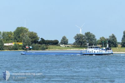
The vessel HE-JO (MMSI: 244700851) is a Cargo It's sailing under the flag of [NL] Netherlands.
In this page you can find informations about the vessels current position, last detected port calls, and current voyage information. If the vessels is not in coverage by AIS you will find the latest position.
The current position of HE-JO is detected by our AIS receivers and we are not responsible for the reliability of the data. The last position was recorded while the vessel was in Coverage by the Ais receivers of our vessel tracking app.
The current draught of HE-JO as reported by AIS is 2.5 meters
Weather
| Temperature | 16.4°C / 61.52°F |
|---|---|
| Wind Speed | 9 knots |
| Direction | 239° WSW |
| Pressure | 1012.3 hPa |
| Humidity | 62.4 % |
| Cloud Coverage | 100 % |
Featured Company
Events
| Tid | Hændelsen | Detaljer | Position / Dest | Info |
|---|---|---|---|---|
| 2024-04-28 17:18 | Udenfor Dækning |
52.40561 / 9.74745
North Sea
|
Fart: 5.4 kn Kurs: 106.2° |
|
| 2024-04-28 17:04 | Indenfor Dækning |
52.41636 / 9.71453
North Sea
|
Fart: 6.1 kn Kurs: 120° |
|
| 2024-04-28 15:44 | Udenfor Dækning |
52.40594 / 9.51556
North Sea
|
Fart: 5.9 kn Kurs: 109.8° |
|
| 2024-04-28 14:24 | Indenfor Dækning |
52.38721 / 9.30841
North Sea
|
Fart: 5.9 kn Kurs: 81.4° |
|
| 2024-04-28 13:17 | Udenfor Dækning |
52.36333 / 9.13570
North Sea
|
Fart: 5.9 kn Kurs: 58.8° |
|
| 2024-04-28 11:09 | Indenfor Dækning |
52.29769 / 8.85826
North Sea
|
Fart: 5.6 kn Kurs: 104.7° |
|
| 2024-04-28 07:37 | Udenfor Dækning |
52.33235 / 8.32696
North Sea
|
Fart: 6.1 kn Kurs: 118.8° |
|
| 2024-04-28 03:35 | Indenfor Dækning |
52.36010 / 7.75880
North Sea
|
Fart: 5.4 kn Kurs: 80.8° |
|
| 2024-04-25 05:51 | Udenfor Dækning |
51.83114 / 6.18928
North Sea
|
Fart: 5.8 kn Kurs: 115° |
|
| 2024-04-25 02:55 | START Sejllads | 0.44 nm, North of DRIEL |
51.97125 / 5.81630
EUROPA
|
Fart: 4 kn Kurs: 70.3° |