
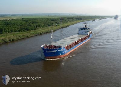
HAV STREYM
General Cargo
Current Trip
| Trip Time | 1 day |
|---|---|
| Trip Distance | 395.85 nm |
| AVG Speed | 8.9 Knots |
| MAX Speed | 10.2 Knots |
| Dybgang | 5.5 m |
| AVG Wind | 12.6 knots |
| MAX Wind | 28.8 knots |
| MIN Temp | 6°C / 42.8°F |
| MAX Temp | 8.8°C / 47.84°F |
| Position Modtaget | 6 h, 21 m siden |
Current Position
| Longitude | -6.61967° |
|---|---|
| Latitude | 62.02760° |
| Status | Under way using engine |
| Fart | 9.5 Knots |
| Kurs | 289.9° |
| Område | North Atlantic Ocean |
| Station | T-AIS |
| Position Modtaget | 6 h, 21 m siden |
Info
Information
The current position of HAV STREYM is in North Atlantic Ocean with coordinates 62.02760° / -6.61967° as reported on 2024-04-29 21:32 by AIS to our vessel tracker app. The vessel's current speed is 9.5 Knots and is currently inside the port of SUND.
The vessel HAV STREYM (IMO: 9126625, MMSI: 231251000) is a General Cargo that was built in 1996 ( 28 år gamle ). It's sailing under the flag of [FO] Faroe Is.
In this page you can find informations about the vessels current position, last detected port calls, and current voyage information. If the vessels is not in coverage by AIS you will find the latest position.
The current position of HAV STREYM is detected by our AIS receivers and we are not responsible for the reliability of the data. The last position was recorded while the vessel was in Coverage by the Ais receivers of our vessel tracking app.
The current draught of HAV STREYM as reported by AIS is 5.5 meters
Weather
| Temperature | 6.3°C / 43.34°F |
|---|---|
| Wind Speed | 5 knots |
| Direction | 48° NE |
| Pressure | 1004.1 hPa |
| Humidity | 88.5 % |
| Cloud Coverage | 39 % |
Featured Company
Last Port Calls
| Port | Arrival | Departure | Time In Port |
|---|---|---|---|
| 2024-04-29 22:24 | |||
| 2024-04-27 23:36 | 2024-04-28 03:26 | 3 h | |
| 2024-04-27 14:26 | 2024-04-27 19:32 | 5 h | |
| 2024-04-24 14:42 | 2024-04-25 21:16 | 1 d | |
| 2024-04-20 10:10 | 2024-04-20 18:01 | 7 h | |
| 2024-04-18 15:33 | 2024-04-18 15:36 | 2 m | |
| 2024-04-17 15:16 | 2024-04-17 20:45 | 5 h | |
| 2024-04-16 22:15 | 2024-04-17 14:30 | 16 h | |
| 2024-04-09 01:46 | 2024-04-11 16:48 | 2 d | |
| 2024-04-04 03:18 | 2024-04-05 14:57 | 1 d |
Last Trips
| Origin | Departure | Destination | Arrival | Distance | |
|---|---|---|---|---|---|
| 2024-04-28 05:26 | 2024-04-29 23:24 | 395.85 nm | |||
| 2024-04-27 21:32 | 2024-04-28 01:36 | 37.78 nm | |||
| 2024-04-25 22:16 | 2024-04-27 16:26 | 432.97 nm | |||
| 2024-04-20 20:01 | 2024-04-24 15:42 | 879.94 nm | |||
| 2024-04-18 17:36 | 2024-04-20 12:10 | 182.60 nm | |||
| 2024-04-17 22:45 | 2024-04-18 17:33 | 143.23 nm | |||
| 2024-04-17 16:30 | 2024-04-17 17:16 | 8.42 nm | |||
| 2024-04-11 17:48 | 2024-04-17 00:15 | 775.12 nm | |||
| 2024-04-05 16:57 | 2024-04-09 02:46 | 799.61 nm | |||
| 2024-04-03 18:55 | 2024-04-04 05:18 | 95.25 nm |
Events
| Tid | Hændelsen | Detaljer | Position / Dest | Info |
|---|---|---|---|---|
| 2024-04-29 22:24 | STOP Sejllads |
62.04833 / -6.84167
[FO] SUND
|
Fart: Kurs: -1° |
|
| 2024-04-29 22:24 | Skibe i havn |
|
62.04833 / -6.84167
[FO] SUND
|
Fart: 8 kn Kurs: 253° |
| 2024-04-29 21:42 | Status er ændret | Default Under way using engine |
62.03667 / -6.67167
SUND
|
Fart: 9.5 kn Kurs: 289.9° |
| 2024-04-29 21:32 | Udenfor Dækning |
62.02760 / -6.61967
North Atlantic Ocean
[FO] SUND
|
Fart: 9.5 kn Kurs: 289.9° |
|
| 2024-04-29 21:31 | Status er ændret | Under way using engine Default |
62.02634 / -6.61247
SUND
|
Fart: 9 kn Kurs: 290° |
| 2024-04-29 21:09 | Status er ændret | Default Under way using engine |
62.00500 / -6.49833
SUND
|
Fart: 9.5 kn Kurs: 294.5° |
| 2024-04-29 20:55 | Ændre havområde | Faeroe Islands part of the North Atlantic Ocean Norwegian part of the North Sea |
61.99086 / -6.42611
North Atlantic Ocean
SUND
|
Fart: 9.5 kn Kurs: 292.7° |
| 2024-04-29 20:55 | Status er ændret | Under way using engine Default |
61.99086 / -6.42611
SUND
|
Fart: 9 kn Kurs: 293° |
| 2024-04-29 20:55 | Indenfor Dækning |
61.99086 / -6.42611
North Atlantic Ocean
SUND
|
Fart: 9.5 kn Kurs: 292.7° |
|
| 2024-04-28 12:56 | Udenfor Dækning |
60.06752 / 2.70695
North Sea
SUND
|
Fart: 9.8 kn Kurs: 294.2° |