

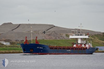
HAV MARLIN
General Cargo

Current Trip
| Time Travelled | 3 days |
|---|---|
| Remaining Time | --- |
| Distance Travelled | 964.30 nm |
| Remaining Distance | 579.23 nm |
| AVG Speed | 21.9 Knots |
| MAX Speed | 21.9 Knots |
| AVG Wind | 13.8 knots |
| MAX Wind | 23.8 knots |
| MIN Temp | 2.5°C / 36.5°F |
| MAX Temp | 11.3°C / 52.34°F |
| Dybgang | 4.6 m |
| Position Modtaget | 3 h, 59 m siden |
Current Position
| Longitude | --- |
|---|---|
| Latitude | --- |
| Status | Default |
| Fart | |
| Kurs | --- |
| Område | English Channel |
| Station | T-AIS |
| Position Modtaget | 3 h, 59 m siden |
Information
The current position of HAV MARLIN is in English Channel with coordinates 50.81183° / -1.20710° as reported on 2025-02-13 21:10 by AIS to our vessel tracker app. The vessel's current speed is 0 Knots and is heading at the port of BILBAO. The estimated time of arrival as calculated by MyShipTracking vessel tracking app is 2025-02-14 15:00 LT
The vessel HAV MARLIN (IMO: 9006954, MMSI: 304734000) is a General Cargo that was built in 1993 ( 32 år gamle ). It's sailing under the flag of [AG] Antigua Barbuda.
In this page you can find informations about the vessels current position, last detected port calls, and current voyage information. If the vessels is not in coverage by AIS you will find the latest position.
The current position of HAV MARLIN is detected by our AIS receivers and we are not responsible for the reliability of the data. The last position was recorded while the vessel was in Coverage by the Ais receivers of our vessel tracking app.
The current draught of HAV MARLIN as reported by AIS is 4.6 meters
Weather
| Temperature | 4.5°C / 40.1°F |
|---|---|
| Wind Speed | 16 knots |
| Direction | 89° E |
| Pressure | 1023.2 hPa |
| Humidity | 77.2 % |
| Cloud Coverage | 100 % |


Featured Company
Last Port Calls
| Port | Arrival | Departure | Time In Port |
|---|---|---|---|
| 2025-02-09 19:30 | 2025-02-10 17:36 | 22 h | |
| 2025-02-07 11:18 | 2025-02-07 11:19 | 1 m | |
| 2025-02-07 10:21 | 2025-02-07 11:06 | 45 m | |
| 2025-02-07 10:19 | 2025-02-07 10:20 | 1 m | |
| 2025-02-04 22:42 | 2025-02-05 08:41 | 9 h | |
| 2025-02-04 06:42 | 2025-02-04 07:52 | 1 h | |
| 2025-02-01 17:24 | 2025-02-02 07:45 | 14 h | |
| 2025-02-01 08:38 | 2025-02-01 11:12 | 2 h | |
| 2025-01-29 21:14 | 2025-01-30 02:11 | 4 h | |
| 2025-01-28 22:08 | 2025-01-29 16:06 | 17 h |
Most Visited Ports (Last year)
| Port | Arrivals | |
|---|---|---|
| 8 | ||
| 5 | ||
| 3 | ||
| 3 | ||
| 2 | ||
| 2 |
Last Trips
| Origin | Departure | Destination | Arrival | Distance | |
|---|---|---|---|---|---|
| 2025-02-07 11:19 | 2025-02-09 20:30 | 642.09 nm | |||
| 2025-02-07 11:06 | 2025-02-07 11:18 | 20.09 nm | |||
| 2025-02-07 10:20 | 2025-02-07 10:21 | 2.08 nm | |||
| 2025-02-05 08:41 | 2025-02-07 10:19 | 982.75 nm | |||
| 2025-02-04 07:52 | 2025-02-04 22:42 | 245.56 nm | |||
| 2025-02-02 08:45 | 2025-02-04 06:42 | 853.99 nm | |||
| 2025-02-01 12:12 | 2025-02-01 18:24 | 132.65 nm | |||
| 2025-01-30 03:11 | 2025-02-01 09:38 | 396.65 nm | |||
| 2025-01-29 17:06 | 2025-01-29 22:14 | 190.65 nm | |||
| 2025-01-28 18:04 | 2025-01-28 23:08 | 190.65 nm |
Events
| Tid | Hændelsen | Detaljer | Position / Dest | Info |
|---|---|---|---|---|
| 2025-02-13 21:10 | Udenfor Dækning |
50.81183 / -1.20710
English Channel
ESBIO
|
Fart: Kurs: 0° |
|
| 2025-02-13 20:59 | STOP Sejllads | 3.62 nm, West of GOSPORT |
50.81175 / -1.20702
ESBIO
|
Fart: Kurs: 94.8° |
| 2025-02-13 20:49 | START Sejllads | 1.26 nm, North East of ST HELENS |
50.70533 / -1.08118
ESBIO
|
Fart: 6 kn Kurs: 75.8° |
| 2025-02-13 20:30 | STOP Sejllads | 1.17 nm, North East of ST HELENS |
50.70549 / -1.08407
ESBIO
|
Fart: Kurs: 174.2° |
| 2025-02-13 19:25 | Ændre havområde | United Kingdom part of the English Channel French part of the Celtic Sea |
50.77185 / -1.17003
English Channel
ESBIO
|
Fart: 104 kn Kurs: 147.2° |
| 2025-02-13 19:23 | START Sejllads | 3.39 nm, West of GOSPORT |
50.81166 / -1.20081
ESBIO
|
Fart: 56 kn Kurs: 96.6° |
| 2025-02-13 19:10 | Indenfor Dækning |
50.81165 / -1.20698
Celtic Sea
ESBIO
|
Fart: Kurs: 0° |
|
| 2025-02-13 15:49 | Udenfor Dækning |
50.81167 / -1.20698
Celtic Sea
ESBIO
|
Fart: Kurs: 0° |
|
| 2025-02-13 13:28 | Indenfor Dækning |
50.81162 / -1.20776
Celtic Sea
ESBIO
|
Fart: Kurs: 0° |
|
| 2025-02-13 08:09 | Udenfor Dækning |
47.52558 / -5.29318
Celtic Sea
ESBIO
|
Fart: 8.9 kn Kurs: 159° |