
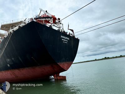
HANUMAN
Oil Products Tanker
Current Trip
| Time Travelled | 45 days |
|---|---|
| Remaining Time | 9 days |
| Distance Travelled | 1781.83 nm |
| Remaining Distance | 2628.06 nm |
| AVG Speed | 9.4 Knots |
| MAX Speed | 12.7 Knots |
| AVG Wind | 9.2 knots |
| MAX Wind | 23.3 knots |
| MIN Temp | 19.1°C / 66.38°F |
| MAX Temp | 25.5°C / 77.9°F |
| Dybgang | 8 m |
| Position Modtaget | 4 d siden |
Current Position
| Longitude | --- |
|---|---|
| Latitude | --- |
| Status | Under way using engine |
| Fart | 10 Knots |
| Kurs | 132.7° |
| Område | Gulf of Oman |
| Station | T-AIS |
| Position Modtaget | 4 d siden |
Info
Information
The current position of HANUMAN is in Gulf of Oman with coordinates 24.95080° / 57.30772° as reported on 2025-02-13 16:12 by AIS to our vessel tracker app. The vessel's current speed is 10 Knots and is heading at the port of VALLETTA. The estimated time of arrival as calculated by MyShipTracking vessel tracking app is 2025-02-27 14:20 LT
The vessel HANUMAN (IMO: 9295048, MMSI: 636012414) is a Oil Products Tanker that was built in 2004 ( 21 år gamle ). It's sailing under the flag of [LR] Liberia.
In this page you can find informations about the vessels current position, last detected port calls, and current voyage information. If the vessels is not in coverage by AIS you will find the latest position.
The current position of HANUMAN is detected by our AIS receivers and we are not responsible for the reliability of the data. The last position was recorded while the vessel was in Coverage by the Ais receivers of our vessel tracking app.
The current draught of HANUMAN as reported by AIS is 8 meters
Weather
| Temperature | 24.1°C / 75.38°F |
|---|---|
| Wind Speed | 12 knots |
| Direction | 69° ENE |
| Pressure | 1013.6 hPa |
| Humidity | 75.1 % |
| Cloud Coverage | 5 % |
Featured Company
Most Visited Ports (Last year)
| Port | Arrivals | |
|---|---|---|
| 4 | ||
| 2 | ||
| 2 | ||
| 2 | ||
| 1 | ||
| 1 |
Last Trips
| Origin | Departure | Destination | Arrival | Distance |
|---|
Events
| Tid | Hændelsen | Detaljer | Position / Dest | Info |
|---|---|---|---|---|
| 2025-02-13 16:16 | Status er ændret | Default Under way using engine |
24.94317 / 57.31675
MALTA
|
Fart: 10 kn Kurs: 132.7° |
| 2025-02-13 16:12 | Udenfor Dækning |
24.95080 / 57.30772
Gulf of Oman
MALTA
|
Fart: 10 kn Kurs: 132.7° |
|
| 2025-02-13 15:28 | Status er ændret | Under way using engine Default |
25.02262 / 57.19827
MALTA
|
Fart: 10.2 kn Kurs: 126° |
| 2025-02-13 15:23 | Status er ændret | Default Under way using engine |
25.03081 / 57.18559
MALTA
|
Fart: 10.2 kn Kurs: 125.7° |
| 2025-02-13 15:15 | Status er ændret | Under way using engine Default |
25.04562 / 57.16293
MALTA
|
Fart: 10.4 kn Kurs: 126° |
| 2025-02-13 15:02 | Status er ændret | Default Under way using engine |
25.06559 / 57.13242
MALTA
|
Fart: 10.3 kn Kurs: 125.7° |
| 2025-02-13 14:43 | Ændre havområde | Omani part of the Gulf of Oman United Arab Emirates part of the Gulf of Oman |
25.09789 / 57.08272
Gulf of Oman
MALTA
|
Fart: 10.3 kn Kurs: 125.9° |
| 2025-02-13 11:56 | Status er ændret | Under way using engine At anchor |
25.36212 / 56.65277
MALTA
|
Fart: 9.3 kn Kurs: 125.4° |
| 2025-02-13 11:28 | START Sejllads | 13.03 nm, East of KHORFAKKAN |
25.39498 / 56.59811
MALTA
|
Fart: 3.1 kn Kurs: 121° |
| 2025-02-13 11:17 | ETA er ændret | 2025/02/23 21:00 2025/03/02 21:00 |
25.39599 / 56.59504
MALTA
|
Fart: 0.1 kn Kurs: 59° |