
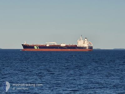
HAFNIA CATERINA
Tanker
Current Trip
| Time Travelled | 11 days |
|---|---|
| Remaining Time | 2 h, 5 mins |
| Distance Travelled | 2675.21 nm |
| Remaining Distance | 73.76 nm |
| AVG Speed | 12.3 Knots |
| MAX Speed | 16.3 Knots |
| AVG Wind | 8.5 knots |
| MAX Wind | 24 knots |
| MIN Temp | 26.5°C / 79.7°F |
| MAX Temp | 32.3°C / 90.14°F |
| Dybgang | 9.6 m |
| Position Modtaget | 8 d siden |
Current Position
| Longitude | 77.23743° |
|---|---|
| Latitude | 7.57268° |
| Status | Under way using engine |
| Fart | 13.1 Knots |
| Kurs | 122.1° |
| Område | Laccadive Sea |
| Station | T-AIS |
| Position Modtaget | 8 d siden |
Info
Information
The current position of HAFNIA CATERINA is in Laccadive Sea with coordinates 7.57268° / 77.23743° as reported on 2024-09-14 03:20 by AIS to our vessel tracker app. The vessel's current speed is 13.1 Knots and is heading at the port of CHITTAGONG. The estimated time of arrival as calculated by MyShipTracking vessel tracking app is 2024-09-22 05:47 LT
The vessel HAFNIA CATERINA (IMO: 9688427, MMSI: 563099900) is a Tanker It's sailing under the flag of [SG] Singapore.
In this page you can find informations about the vessels current position, last detected port calls, and current voyage information. If the vessels is not in coverage by AIS you will find the latest position.
The current position of HAFNIA CATERINA is detected by our AIS receivers and we are not responsible for the reliability of the data. The last position was recorded while the vessel was in Coverage by the Ais receivers of our vessel tracking app.
The current draught of HAFNIA CATERINA as reported by AIS is 9.6 meters
Weather
| Temperature | --- |
|---|---|
| Wind Speed | --- |
| Direction | --- |
| Pressure | --- |
| Humidity | --- |
| Cloud Coverage | --- |
Featured Company
Last Port Calls
| Port | Arrival | Departure | Time In Port |
|---|---|---|---|
| 2024-09-08 22:11 | 2024-09-10 12:13 | 1 d | |
| 2024-08-16 10:42 | 2024-08-16 20:49 | 10 h | |
| 2024-07-25 11:04 | 2024-07-28 20:52 | 3 d |
Last Trips
| Origin | Departure | Destination | Arrival | Distance | |
|---|---|---|---|---|---|
| 2024-08-16 22:49 | 2024-09-09 03:41 | 4862.58 nm | |||
| 2024-07-28 17:52 | 2024-08-16 12:42 | 4186.86 nm | |||
| 2024-06-03 04:08 | 2024-07-25 08:04 | 8274.30 nm |
Events
| Tid | Hændelsen | Detaljer | Position / Dest | Info |
|---|---|---|---|---|
| 2024-09-21 18:13 | START Sejllads | 5.76 nm, West of CHITTAGONG |
22.26356 / 91.71790
INIXY>BDCGP
|
Fart: 5 kn Kurs: 174° |
| 2024-09-18 20:26 | STOP Sejllads | 5.49 nm, West of CHITTAGONG |
22.25497 / 91.72051
INIXY>BDCGP
|
Fart: Kurs: 337° |
| 2024-09-14 03:36 | Status er ændret | Default Under way using engine |
7.53147 / 77.27644
INIXY>BDCGP
|
Fart: 13.1 kn Kurs: 122.1° |
| 2024-09-14 03:20 | Status er ændret | Under way using engine Default |
7.57268 / 77.23743
INIXY>BDCGP
|
Fart: 13.2 kn Kurs: 125° |
| 2024-09-14 03:20 | Udenfor Dækning |
7.57268 / 77.23743
Laccadive Sea
INIXY>BDCGP
|
Fart: 13.1 kn Kurs: 122.1° |
|
| 2024-09-14 03:05 | Status er ændret | Default Under way using engine |
7.60150 / 77.19205
INIXY>BDCGP
|
Fart: 13.1 kn Kurs: 124.4° |
| 2024-09-14 00:54 | Dybgangen er ændret | 9.6 12.6 |
7.88790 / 76.80440
INIXY>BDCGP
|
Fart: 13.2 kn Kurs: 129.8° |
| 2024-09-14 00:54 | Destination er ændret | INIXY>BDCGP ZACPT >INIXY |
7.88790 / 76.80440
INIXY>BDCGP
|
Fart: 13.2 kn Kurs: 129.8° |
| 2024-09-14 00:54 | ETA er ændret | 2024/09/19 08:00 2024/09/02 00:30 |
7.88790 / 76.80440
INIXY>BDCGP
|
Fart: 13.2 kn Kurs: 129.8° |
| 2024-09-14 00:11 | Status er ændret | Under way using engine Default |
7.98888 / 76.68096
ZACPT >INIXY
|
Fart: 13.1 kn Kurs: 129° |