

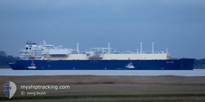
GUI YING
Other Type

Current Trip
SG SIN (PGBG)
| Time Travelled | 4 days |
|---|---|
| Remaining Time | --- |
| Distance Travelled | 1644.18 nm |
| Remaining Distance | --- |
| AVG Speed | 15.3 Knots |
| MAX Speed | 19.6 Knots |
| AVG Wind | 8 knots |
| MAX Wind | 14 knots |
| MIN Temp | 21.9°C / 71.42°F |
| MAX Temp | 29.2°C / 84.56°F |
| Dybgang | 9.3 m |
| Position Modtaget | 3 m siden |
Current Position
| Longitude | --- |
|---|---|
| Latitude | --- |
| Status | At anchor |
| Fart | |
| Kurs | 25° |
| Område | Singapore Strait |
| Station | T-AIS |
| Position Modtaget | 3 m siden |
Information
The current position of GUI YING is in Singapore Strait with coordinates 1.17685° / 103.77754° as reported on 2025-03-27 18:48 by AIS to our vessel tracker app. The vessel's current speed is 0 Knots
The vessel GUI YING (IMO: 9878888, MMSI: 563138800) is a Other Type It's sailing under the flag of [SG] Singapore.
In this page you can find informations about the vessels current position, last detected port calls, and current voyage information. If the vessels is not in coverage by AIS you will find the latest position.
The current position of GUI YING is detected by our AIS receivers and we are not responsible for the reliability of the data. The last position was recorded while the vessel was in Coverage by the Ais receivers of our vessel tracking app.
The current draught of GUI YING as reported by AIS is 9.3 meters
Weather
| Temperature | 26.9°C / 80.42°F |
|---|---|
| Wind Speed | 5 knots |
| Direction | 332° NNW |
| Pressure | 1005.9 hPa |
| Humidity | 86.5 % |
| Cloud Coverage | 21 % |


Featured Company
Last Port Calls
| Port | Arrival | Departure | Time In Port |
|---|---|---|---|
| 2025-03-22 07:38 | 2025-03-23 10:56 | 1 d | |
| 2025-02-17 06:15 | 2025-02-18 02:27 | 20 h | |
| 2025-02-14 16:49 | 2025-02-15 16:30 | 23 h | |
| 2025-01-06 11:21 | 2025-01-07 12:28 | 1 d |
Most Visited Ports (Last year)
| Port | Arrivals | |
|---|---|---|
| 3 | ||
| 2 | ||
| 1 | ||
| 1 | ||
| 1 | ||
| 1 |
Last Trips
| Origin | Departure | Destination | Arrival | Distance | |
|---|---|---|---|---|---|
| 2025-02-18 02:27 | 2025-03-22 07:38 | 13363.11 nm | |||
| 2025-02-15 16:30 | 2025-02-17 06:15 | 52.17 nm | |||
| 2025-01-07 12:28 | 2025-02-14 16:49 | 13362.22 nm | |||
| 2024-11-05 20:34 | 2025-01-06 11:21 | 15132.48 nm |
Events
| Tid | Hændelsen | Detaljer | Position / Dest | Info |
|---|---|---|---|---|
| 2025-03-27 11:51 | Status er ændret | At anchor Default |
1.17796 / 103.77676
SG SIN (PGBG)
|
Fart: Kurs: 77° |
| 2025-03-27 11:48 | Status er ændret | Default At anchor |
1.17797 / 103.77676
SG SIN (PGBG)
|
Fart: Kurs: 77° |
| 2025-03-27 01:23 | Status er ændret | At anchor Under way using engine |
1.17712 / 103.77614
SG SIN (PGBG)
|
Fart: Kurs: 52° |
| 2025-03-26 23:23 | STOP Sejllads | 3.78 nm, South of BUKOM ISLAND |
1.17787 / 103.77671
SG SIN (PGBG)
|
Fart: 0.3 kn Kurs: 64° |
| 2025-03-26 21:47 | Ændre havområde | Singaporean part of the Singapore Strait Indonesian part of the Singapore Strait |
1.24959 / 103.98278
Singapore Strait
SG SIN (PGBG)
|
Fart: 15.8 kn Kurs: 253.4° |
| 2025-03-26 21:33 | Destination er ændret | SG SIN (PGBG) SG SIN |
1.25958 / 104.03929
SG SIN (PGBG)
|
Fart: 15.5 kn Kurs: 260.9° |
| 2025-03-26 21:26 | Ændre havområde | Indonesian part of the Singapore Strait Malaysian part of the Singapore Strait |
1.27073 / 104.07023
Singapore Strait
SG SIN
|
Fart: 15.1 kn Kurs: 243.4° |
| 2025-03-26 20:41 | Status er ændret | Under way using engine Default |
1.30167 / 104.26138
SG SIN
|
Fart: 14.4 kn Kurs: 271° |
| 2025-03-26 20:38 | Status er ændret | Default Under way using engine |
1.30176 / 104.27381
SG SIN
|
Fart: 14.5 kn Kurs: 263° |
| 2025-03-26 20:31 | Ændre havområde | Malaysian part of the Singapore Strait Indonesian part of the South China Sea |
1.30301 / 104.30208
Singapore Strait
SG SIN
|
Fart: 14.7 kn Kurs: 258.7° |