

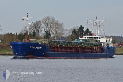
GT FORSETI
General Cargo

Current Trip
| Time Travelled | 2 days |
|---|---|
| Remaining Time | --- |
| Distance Travelled | 539.68 nm |
| Remaining Distance | 12.46 nm |
| AVG Speed | 10.4 Knots |
| MAX Speed | 13.5 Knots |
| AVG Wind | 6.7 knots |
| MAX Wind | 14 knots |
| MIN Temp | 6.1°C / 42.98°F |
| MAX Temp | 15.3°C / 59.54°F |
| Dybgang | 3.5 m |
| Position Modtaget | 4 m siden |
Current Position
| Longitude | --- |
|---|---|
| Latitude | --- |
| Status | At anchor |
| Fart | |
| Kurs | 145° |
| Område | North Sea |
| Station | T-AIS |
| Position Modtaget | 4 m siden |
Information
The current position of GT FORSETI is in North Sea with coordinates 53.61794° / 9.54357° as reported on 2025-03-08 11:25 by AIS to our vessel tracker app. The vessel's current speed is 0 Knots and is heading at the port of HAMBURG. The estimated time of arrival as calculated by MyShipTracking vessel tracking app is 2025-03-07 22:00 LT
The vessel GT FORSETI (IMO: 9041320, MMSI: 304010297) is a General Cargo that was built in 1993 ( 32 år gamle ). It's sailing under the flag of [AG] Antigua Barbuda.
In this page you can find informations about the vessels current position, last detected port calls, and current voyage information. If the vessels is not in coverage by AIS you will find the latest position.
The current position of GT FORSETI is detected by our AIS receivers and we are not responsible for the reliability of the data. The last position was recorded while the vessel was in Coverage by the Ais receivers of our vessel tracking app.
The current draught of GT FORSETI as reported by AIS is 3.5 meters
Weather
| Temperature | 15.1°C / 59.18°F |
|---|---|
| Wind Speed | 7 knots |
| Direction | 113° ESE |
| Pressure | 1016.8 hPa |
| Humidity | 44.7 % |
| Cloud Coverage | 69 % |


Featured Company
Last Port Calls
| Port | Arrival | Departure | Time In Port |
|---|---|---|---|
| 2025-03-02 19:51 | 2025-03-05 13:43 | 2 d | |
| 2025-02-24 22:05 | 2025-02-26 12:41 | 1 d | |
| 2025-02-19 23:34 | 2025-02-22 13:59 | 2 d | |
| 2025-02-12 14:20 | 2025-02-12 22:56 | 8 h | |
| 2025-02-10 19:17 | 2025-02-12 13:59 | 1 d | |
| 2025-02-06 19:58 | 2025-02-10 16:34 | 3 d | |
| 2025-01-29 14:09 | 2025-02-01 01:13 | 2 d | |
| 2025-01-12 21:05 | 2025-01-15 12:01 | 2 d | |
| 2025-01-09 00:20 | 2025-01-10 01:50 | 1 d | |
| 2025-01-05 12:48 | 2025-01-08 00:46 | 2 d |
Last Trips
| Origin | Departure | Destination | Arrival | Distance | |
|---|---|---|---|---|---|
| 2025-02-26 12:41 | 2025-03-02 19:51 | 1001.50 nm | |||
| 2025-02-22 13:59 | 2025-02-24 22:05 | 481.47 nm | |||
| 2025-02-12 22:56 | 2025-02-19 23:34 | 1188.08 nm | |||
| 2025-02-12 13:59 | 2025-02-12 14:20 | 3.22 nm | |||
| 2025-02-10 16:34 | 2025-02-10 19:17 | 29.37 nm | |||
| 2025-02-01 01:13 | 2025-02-06 19:58 | 1151.73 nm | |||
| 2025-01-15 12:01 | 2025-01-29 14:09 | 716.38 nm | |||
| 2025-01-10 01:50 | 2025-01-12 21:05 | 579.59 nm | |||
| 2025-01-08 00:46 | 2025-01-09 00:20 | 133.36 nm | |||
| 2024-12-24 10:33 | 2025-01-05 12:48 | 1001.21 nm |
Events
| Tid | Hændelsen | Detaljer | Position / Dest | Info |
|---|---|---|---|---|
| 2025-03-08 10:28 | Status er ændret | At anchor Default |
53.61780 / 9.54376
HAMBURG
|
Fart: Kurs: 139° |
| 2025-03-08 10:22 | Status er ændret | Default At anchor |
53.61780 / 9.54382
HAMBURG
|
Fart: 0.1 kn Kurs: 136° |
| 2025-03-08 09:04 | Status er ændret | At anchor Default |
53.61650 / 9.54555
HAMBURG
|
Fart: Kurs: 359° |
| 2025-03-08 09:01 | Status er ændret | Default At anchor |
53.61649 / 9.54564
HAMBURG
|
Fart: Kurs: 350° |
| 2025-03-07 17:34 | STOP Sejllads | 0.73 nm, South East of STADERSAND |
53.61655 / 9.54625
HAMBURG
|
Fart: 0.3 kn Kurs: 320° |
| 2025-03-07 17:31 | Status er ændret | At anchor Under way using engine |
53.61720 / 9.54541
HAMBURG
|
Fart: 2 kn Kurs: 305° |
| 2025-03-07 13:36 | Status er ændret | Under way using engine Default |
53.96327 / 8.57187
HAMBURG
|
Fart: 11.9 kn Kurs: 102° |
| 2025-03-07 13:06 | Status er ændret | Default Under way using engine |
53.98210 / 8.40624
HAMBURG
|
Fart: 12.3 kn Kurs: 98.2° |
| 2025-03-07 12:40 | Status er ændret | Under way using engine Default |
53.99104 / 8.26102
HAMBURG
|
Fart: 12.2 kn Kurs: 91° |
| 2025-03-07 12:33 | Status er ændret | Default Under way using engine |
53.99091 / 8.22038
HAMBURG
|
Fart: 12.2 kn Kurs: 76.7° |