
GREEN DELTA
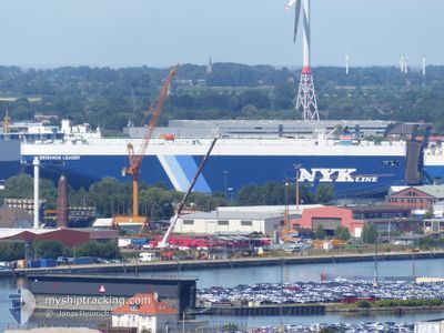
Vehicles Carrier
Current Trip
| Time Travelled | 20 days |
|---|---|
| Remaining Time | --- |
| Distance Travelled | 2424.46 nm |
| Remaining Distance | --- |
| AVG Speed | 15.9 Knots |
| MAX Speed | 18.8 Knots |
| AVG Wind | 7.4 knots |
| MAX Wind | 13.5 knots |
| MIN Temp | 5.4°C / 41.72°F |
| MAX Temp | 27.1°C / 80.78°F |
| Dybgang | 8.1 m |
| Position Modtaget | 9 d siden |
Current Position
| Longitude | --- |
|---|---|
| Latitude | --- |
| Status | Under way using engine |
| Fart | 18.5 Knots |
| Kurs | 305° |
| Område | North Pacific Ocean |
| Station | T-AIS |
| Position Modtaget | 9 d siden |
Info
Information
The current position of GREEN DELTA is in North Pacific Ocean with coordinates 19.94665° / -107.33568° as reported on 2025-12-01 09:43 by AIS to our vessel tracker app. The vessel's current speed is 18.5 Knots
The vessel GREEN DELTA (IMO: 9498602, MMSI: 367185000) is a Vehicles Carrier that was built in 2010 ( 15 år gamle ). It's sailing under the flag of [US] USA.
In this page you can find informations about the vessels current position, last detected port calls, and current voyage information. If the vessels is not in coverage by AIS you will find the latest position.
The current position of GREEN DELTA is detected by our AIS receivers and we are not responsible for the reliability of the data. The last position was recorded while the vessel was in Coverage by the Ais receivers of our vessel tracking app.
The current draught of GREEN DELTA as reported by AIS is 8.1 meters
Weather
| Temperature | 26.9°C / 80.42°F |
|---|---|
| Wind Speed | 11 knots |
| Direction | 343° NNW |
| Pressure | 1012.2 hPa |
| Humidity | 64.5 % |
| Cloud Coverage | 100 % |
Featured Company
Last Port Calls
Last Trips
| Origin | Departure | Destination | Arrival | Distance | |
|---|---|---|---|---|---|
| 2025-11-18 18:03 | 2025-11-19 04:57 | 109.41 nm | |||
| 2025-11-16 20:30 | 2025-11-18 05:59 | 379.37 nm | |||
| 2025-11-13 13:48 | 2025-11-15 20:31 | 705.57 nm | |||
| 2025-10-15 17:04 | 2025-11-12 20:03 | 9130.85 nm | |||
| 2025-09-15 14:17 | 2025-10-15 07:39 | 6437.07 nm |
Events
| Tid | Hændelsen | Detaljer | Position / Dest | Info |
|---|---|---|---|---|
| 2025-12-01 09:43 | Udenfor Dækning |
19.94665 / -107.33568
North Pacific Ocean
JP KWS
|
Fart: 18.5 kn Kurs: 305° |
|
| 2025-12-01 08:24 | Indenfor Dækning |
19.71453 / -106.98163
North Pacific Ocean
JP KWS
|
Fart: 18.3 kn Kurs: 305° |
|
| 2025-12-01 07:22 | Udenfor Dækning |
19.52873 / -106.71113
North Pacific Ocean
JP KWS
|
Fart: 18.5 kn Kurs: 305° |
|
| 2025-12-01 04:53 | Dybgangen er ændret | 8.1 8.4 |
19.05608 / -106.06628
JP KWS
|
Fart: 18.6 kn Kurs: 310° |
| 2025-12-01 04:53 | Destination er ændret | JP KWS PA PCL |
19.05608 / -106.06628
JP KWS
|
Fart: 18.6 kn Kurs: 310° |
| 2025-12-01 04:53 | ETA er ændret | 2025/12/16 20:00 2025/11/26 07:00 |
19.05608 / -106.06628
JP KWS
|
Fart: 18.6 kn Kurs: 310° |
| 2025-12-01 04:43 | Ændre havområde | Mexican part of the North Pacific Ocean United States part of the North Atlantic Ocean |
19.02398 / -106.02295
North Pacific Ocean
|
Fart: 18.5 kn Kurs: 302° |
| 2025-12-01 04:41 | Indenfor Dækning |
19.02398 / -106.02295
North Pacific Ocean
|
Fart: 18.5 kn Kurs: 302° |