
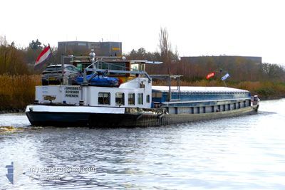
GREBBE
Cargo
Current Trip
| Time Travelled | 19 h, 41 mins |
|---|---|
| Remaining Time | --- |
| Distance Travelled | 44.58 nm |
| Remaining Distance | --- |
| AVG Speed | 5.7 Knots |
| MAX Speed | 7.5 Knots |
| AVG Wind | 11.8 knots |
| MAX Wind | 13 knots |
| MIN Temp | 11.3°C / 52.34°F |
| MAX Temp | 12.9°C / 55.22°F |
| Dybgang | 0.1 m |
| Position Modtaget | 11 h, 17 m siden |
Current Position
| Longitude | --- |
|---|---|
| Latitude | --- |
| Status | Under way using engine |
| Fart | 5.9 Knots |
| Kurs | 94° |
| Område | North Sea |
| Station | T-AIS |
| Position Modtaget | 11 h, 17 m siden |
Info
Information
The current position of GREBBE is in North Sea with coordinates 51.54688° / 6.08210° as reported on 2025-12-09 19:49 by AIS to our vessel tracker app. The vessel's current speed is 5.9 Knots
The vessel GREBBE (MMSI: 244700931) is a Cargo It's sailing under the flag of [NL] Netherlands.
In this page you can find informations about the vessels current position, last detected port calls, and current voyage information. If the vessels is not in coverage by AIS you will find the latest position.
The current position of GREBBE is detected by our AIS receivers and we are not responsible for the reliability of the data. The last position was recorded while the vessel was in Coverage by the Ais receivers of our vessel tracking app.
The current draught of GREBBE as reported by AIS is 0.1 meters
Weather
| Temperature | 11.8°C / 53.24°F |
|---|---|
| Wind Speed | 13 knots |
| Direction | 207° SSW |
| Pressure | 1010.2 hPa |
| Humidity | 71.7 % |
| Cloud Coverage | 100 % |
Featured Company
Last Port Calls
| Port | Arrival | Departure | Time In Port |
|---|---|---|---|
| 2025-12-09 10:58 | 2025-12-09 11:26 | 28 m | |
| 2025-12-08 15:30 | 2025-12-09 06:13 | 14 h | |
| 2025-12-05 15:44 | 2025-12-08 09:57 | 2 d | |
| 2025-12-03 14:48 | 2025-12-05 09:57 | 1 d | |
| 2025-12-02 16:11 | 2025-12-02 20:21 | 4 h | |
| 2025-12-01 07:41 | 2025-12-01 08:06 | 25 m | |
| 2025-11-28 16:06 | 2025-12-01 05:44 | 2 d | |
| 2025-11-20 15:12 | 2025-11-20 17:37 | 2 h | |
| 2025-11-20 12:19 | 2025-11-20 13:08 | 49 m | |
| 2025-11-20 10:02 | 2025-11-20 10:54 | 52 m |
Most Visited Ports (Last year)
| Port | Arrivals | |
|---|---|---|
| 18 | ||
| 14 | ||
| 13 | ||
| 10 | ||
| 9 | ||
| 9 |
Last Trips
| Origin | Departure | Destination | Arrival | Distance | |
|---|---|---|---|---|---|
| 2025-12-09 07:13 | 2025-12-09 11:58 | 31.16 nm | |||
| 2025-12-08 10:57 | 2025-12-08 16:30 | 30.27 nm | |||
| 2025-12-05 10:57 | 2025-12-05 16:44 | 33.58 nm | |||
| 2025-12-02 21:21 | 2025-12-03 15:48 | 54.56 nm | |||
| 2025-12-01 09:06 | 2025-12-02 17:11 | 88.81 nm | |||
| 2025-12-01 06:44 | 2025-12-01 08:41 | 10.15 nm | |||
| 2025-11-20 18:37 | 2025-11-28 17:06 | 136.06 nm | |||
| 2025-11-20 14:08 | 2025-11-20 16:12 | 14.86 nm | |||
| 2025-11-20 11:54 | 2025-11-20 13:19 | 10.58 nm | |||
| 2025-11-20 09:14 | 2025-11-20 11:02 | 9.51 nm |
Events
| Tid | Hændelsen | Detaljer | Position / Dest | Info |
|---|---|---|---|---|
| 2025-12-09 19:49 | Udenfor Dækning |
51.54688 / 6.08210
North Sea
VEGHEL
|
Fart: 5.9 kn Kurs: 94° |
|
| 2025-12-09 18:37 | START Sejllads | 2.06 nm, South East of BOXMEER |
51.63921 / 5.98464
VEGHEL
|
Fart: 5.8 kn Kurs: 119.8° |
| 2025-12-09 18:23 | STOP Sejllads | 1.95 nm, South East of BOXMEER |
51.64030 / 5.98175
VEGHEL
|
Fart: Kurs: 511° |
| 2025-12-09 15:40 | START Sejllads | 0.35 nm, North of NIJMEGEN |
51.85273 / 5.82095
VEGHEL
|
Fart: 4.6 kn Kurs: 205.1° |
| 2025-12-09 15:20 | STOP Sejllads | 0.44 nm, North of NIJMEGEN |
51.85436 / 5.82223
VEGHEL
|
Fart: 0.3 kn Kurs: 511° |
| 2025-12-09 14:56 | Destination er ændret | VEGHEL SNEEK |
51.87397 / 5.80332
VEGHEL
|
Fart: 5.5 kn Kurs: 109.2° |
| 2025-12-09 14:56 | ETA er ændret | 2025/12/10 21:00 2025/12/03 17:00 |
51.87397 / 5.80332
VEGHEL
|
Fart: 5.5 kn Kurs: 109.2° |
| 2025-12-09 12:30 | START Sejllads | 0.92 nm, North East of TIEL |
51.90060 / 5.45447
SNEEK
|
Fart: 4.4 kn Kurs: 158° |
| 2025-12-09 12:16 | STOP Sejllads | 1 nm, North of TIEL |
51.90239 / 5.45328
SNEEK
|
Fart: 0.3 kn Kurs: 511° |
| 2025-12-09 11:26 | Afsejlet fra sidste havn |
|
51.96031 / 5.34075
SNEEK
|
Fart: 6.8 kn Kurs: 122.6° |