
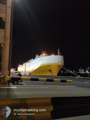
GRANDE DETROIT
Vehicles Carrier
Current Trip
| Time Travelled | 2 days |
|---|---|
| Remaining Time | 4 h, 9 mins |
| Distance Travelled | 807.48 nm |
| Remaining Distance | 117.25 nm |
| AVG Speed | 15.5 Knots |
| MAX Speed | 16.8 Knots |
| AVG Wind | 9.6 knots |
| MAX Wind | 22.5 knots |
| MIN Temp | 11.5°C / 52.7°F |
| MAX Temp | 20.4°C / 68.72°F |
| Dybgang | 8.7 m |
| Position Modtaget | 3 h, 55 m siden |
Current Position
| Longitude | 32.56156° |
|---|---|
| Latitude | 32.91326° |
| Status | Under way using engine |
| Fart | 15.6 Knots |
| Kurs | 124.8° |
| Område | Mediterranean Sea - Eastern Basin |
| Station | T-AIS |
| Position Modtaget | 3 h, 55 m siden |
Info
Information
The current position of GRANDE DETROIT is in Mediterranean Sea - Eastern Basin with coordinates 32.91326° / 32.56156° as reported on 2024-05-04 03:53 by AIS to our vessel tracker app. The vessel's current speed is 15.6 Knots and is heading at the port of ASHDOD. The estimated time of arrival as calculated by MyShipTracking vessel tracking app is 2024-05-04 11:57 LT
The vessel GRANDE DETROIT (IMO: 9293272, MMSI: 247186300) is a Vehicles Carrier that was built in 2005 ( 19 år gamle ). It's sailing under the flag of [IT] Italy.
In this page you can find informations about the vessels current position, last detected port calls, and current voyage information. If the vessels is not in coverage by AIS you will find the latest position.
The current position of GRANDE DETROIT is detected by our AIS receivers and we are not responsible for the reliability of the data. The last position was recorded while the vessel was in Coverage by the Ais receivers of our vessel tracking app.
The current draught of GRANDE DETROIT as reported by AIS is 8.7 meters
Weather
| Temperature | 20.5°C / 68.9°F |
|---|---|
| Wind Speed | 16 knots |
| Direction | 252° WSW |
| Pressure | 1012.7 hPa |
| Humidity | 77.6 % |
| Cloud Coverage | --- |
Featured Company
Last Port Calls
| Port | Arrival | Departure | Time In Port |
|---|---|---|---|
| 2024-05-01 06:01 | 2024-05-02 02:21 | 20 h | |
| 2024-04-30 16:58 | 2024-05-01 05:21 | 12 h | |
| 2024-04-29 11:52 | 2024-04-30 16:35 | 1 d | |
| 2024-04-25 04:50 | 2024-04-26 04:05 | 23 h | |
| 2024-04-22 15:45 | 2024-04-23 10:00 | 18 h | |
| 2024-04-18 07:18 | 2024-04-21 09:51 | 3 d | |
| 2024-04-16 03:27 | 2024-04-16 18:05 | 14 h | |
| 2024-04-14 12:43 | 2024-04-15 00:53 | 12 h | |
| 2024-04-12 04:55 | 2024-04-12 17:39 | 12 h | |
| 2024-04-06 15:36 | 2024-04-07 17:02 | 1 d |
Last Trips
| Origin | Departure | Destination | Arrival | Distance | |
|---|---|---|---|---|---|
| 2024-05-01 08:21 | 2024-05-01 09:01 | 4.67 nm | |||
| 2024-04-30 19:35 | 2024-04-30 19:58 | 1.93 nm | |||
| 2024-04-26 06:05 | 2024-04-29 14:52 | 1235.92 nm | |||
| 2024-04-23 12:00 | 2024-04-25 06:50 | 681.74 nm | |||
| 2024-04-21 11:51 | 2024-04-22 17:45 | 482.54 nm | |||
| 2024-04-16 20:05 | 2024-04-18 09:18 | 585.55 nm | |||
| 2024-04-15 01:53 | 2024-04-16 05:27 | 414.86 nm | |||
| 2024-04-12 18:39 | 2024-04-14 13:43 | 408.26 nm | |||
| 2024-04-07 18:02 | 2024-04-12 05:55 | 1148.33 nm | |||
| 2024-04-05 00:40 | 2024-04-06 16:36 | 586.25 nm |
Events
| Tid | Hændelsen | Detaljer | Position / Dest | Info |
|---|---|---|---|---|
| 2024-05-04 04:00 | Status er ændret | Default Under way using engine |
32.89532 / 32.59092
ILASH
|
Fart: 15.6 kn Kurs: 124.8° |
| 2024-05-04 03:53 | Udenfor Dækning |
32.91326 / 32.56156
Mediterranean Sea - Eastern Basin
ILASH
|
Fart: 15.6 kn Kurs: 124.8° |
|
| 2024-05-04 03:49 | Status er ændret | Under way using engine Default |
32.92282 / 32.54552
ILASH
|
Fart: 15.5 kn Kurs: 126° |
| 2024-05-04 03:21 | Status er ændret | Default Under way using engine |
32.99426 / 32.42427
ILASH
|
Fart: 15.7 kn Kurs: 122.2° |
| 2024-05-04 02:53 | Ændre havområde | Egyptian part of the Mediterranean Sea - Eastern Basin Cypriote part of the Mediterranean Sea - Eastern Basin |
33.05922 / 32.30212
Mediterranean Sea - Eastern Basin
ILASH
|
Fart: 15.7 kn Kurs: 121.3° |
| 2024-05-04 02:52 | Status er ændret | Under way using engine Default |
33.06111 / 32.29855
ILASH
|
Fart: 15.5 kn Kurs: 122° |
| 2024-05-04 02:32 | Status er ændret | Default Under way using engine |
33.10662 / 32.21326
ILASH
|
Fart: 15.8 kn Kurs: 123.3° |
| 2024-05-04 02:16 | Status er ændret | Under way using engine Default |
33.14516 / 32.14417
ILASH
|
Fart: 15.7 kn Kurs: 125° |
| 2024-05-04 01:57 | Status er ændret | Default Under way using engine |
33.19439 / 32.05759
ILASH
|
Fart: 15.7 kn Kurs: 123.9° |
| 2024-05-04 00:31 | Status er ændret | Under way using engine Default |
33.41142 / 31.68755
ILASH
|
Fart: 16.1 kn Kurs: 125° |