

GRAMOS
Cargo

Current Trip
CAI LAN
| Time Travelled | 11 days |
|---|---|
| Remaining Time | --- |
| Distance Travelled | 1406.74 nm |
| Remaining Distance | --- |
| AVG Speed | 10.5 Knots |
| MAX Speed | 13.6 Knots |
| AVG Wind | 14.7 knots |
| MAX Wind | 31.7 knots |
| MIN Temp | -10.6°C / 12.92°F |
| MAX Temp | 14°C / 57.2°F |
| Dybgang | 11.7 m |
| Position Modtaget | 2024-12-26 06:41 |
Current Position
| Longitude | --- |
|---|---|
| Latitude | --- |
| Status | Under way using engine |
| Fart | 8.3 Knots |
| Kurs | 186° |
| Område | South China Sea |
| Station | T-AIS |
| Position Modtaget | 2024-12-26 06:41 |
Information
The current position of GRAMOS is in South China Sea with coordinates 20.72720° / 107.17261° as reported on 2024-12-26 06:41 by AIS to our vessel tracker app. The vessel's current speed is 8.3 Knots
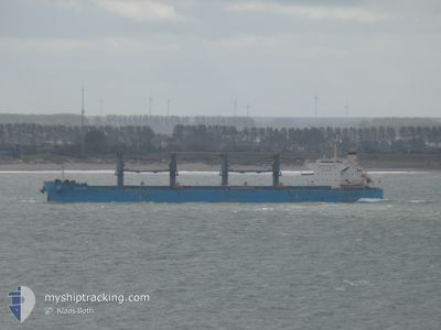
The vessel GRAMOS (IMO: 9859789, MMSI: 314482000) is a Cargo It's sailing under the flag of [BB] Barbados.
In this page you can find informations about the vessels current position, last detected port calls, and current voyage information. If the vessels is not in coverage by AIS you will find the latest position.
The current position of GRAMOS is detected by our AIS receivers and we are not responsible for the reliability of the data. The last position was recorded while the vessel was in Coverage by the Ais receivers of our vessel tracking app.
The current draught of GRAMOS as reported by AIS is 11.7 meters
Weather
| Temperature | 4.1°C / 39.38°F |
|---|---|
| Wind Speed | 9 knots |
| Direction | 331° NNW |
| Pressure | 1028.4 hPa |
| Humidity | 38.1 % |
| Cloud Coverage | 9 % |


Featured Company
Last Port Calls
| Port | Arrival | Departure | Time In Port |
|---|---|---|---|
| 2025-02-04 01:21 | 2025-02-08 11:29 | 4 d | |
| 2025-01-05 21:01 | 2025-01-15 07:21 | 9 d | |
| 2024-12-23 07:49 | 2024-12-26 04:53 | 2 d |
Last Trips
| Origin | Departure | Destination | Arrival | Distance | |
|---|---|---|---|---|---|
| 2025-01-15 15:21 | 2025-02-04 09:21 | 3315.47 nm | |||
| 2024-12-26 11:53 | 2025-01-06 05:01 | 1730.41 nm | |||
| 2024-11-23 07:00 | 2024-12-23 14:49 | 6282.96 nm |
Events
| Tid | Hændelsen | Detaljer | Position / Dest | Info |
|---|---|---|---|---|
| 2025-02-15 01:16 | START Sejllads |
34.45587 / 130.28349
CAI LAN
|
Fart: 11.3 kn Kurs: 288° |
|
| 2025-02-15 00:57 | STOP Sejllads |
34.45667 / 130.29500
CAI LAN
|
Fart: Kurs: -1° |
|
| 2025-02-13 13:15 | START Sejllads |
34.40208 / 130.15540
CAI LAN
|
Fart: 3.1 kn Kurs: 307° |
|
| 2025-02-13 08:29 | STOP Sejllads |
34.51116 / 130.05420
CAI LAN
|
Fart: 0.3 kn Kurs: 341° |
|
| 2025-02-12 00:24 | START Sejllads | 20.07 nm, East of KIN TSUSHIMA |
34.48061 / 129.85742
CAI LAN
|
Fart: 5.3 kn Kurs: 74° |
| 2025-02-11 19:10 | STOP Sejllads |
34.48331 / 129.93964
CAI LAN
|
Fart: 0.2 kn Kurs: 330° |
|
| 2025-02-10 06:08 | START Sejllads | 11.25 nm, West of GUNSAN |
35.93025 / 126.36818
CAI LAN
|
Fart: 10.3 kn Kurs: 278° |
| 2025-02-10 02:41 | STOP Sejllads | 10.19 nm, West of GUNSAN |
35.92746 / 126.39178
CAI LAN
|
Fart: 0.1 kn Kurs: 225° |