
GRAMBA
Cargo
Current Trip
| Time Travelled | 2 days |
|---|---|
| Remaining Time | --- |
| Distance Travelled | 303.29 nm |
| Remaining Distance | --- |
| AVG Speed | 11.3 Knots |
| MAX Speed | 13 Knots |
| AVG Wind | 21 knots |
| MAX Wind | 35 knots |
| MIN Temp | 3.2°C / 37.76°F |
| MAX Temp | 8.1°C / 46.58°F |
| Dybgang | 8.3 m |
| Position Modtaget | 2 d siden |
Current Position
| Longitude | --- |
|---|---|
| Latitude | --- |
| Status | Under way using engine |
| Fart | 9 Knots |
| Kurs | 233.9° |
| Område | Baltic Sea |
| Station | T-AIS |
| Position Modtaget | 2 d siden |
Info
Information
The current position of GRAMBA is in Baltic Sea with coordinates 59.19808° / 21.76240° as reported on 2025-12-08 23:19 by AIS to our vessel tracker app. The vessel's current speed is 9 Knots
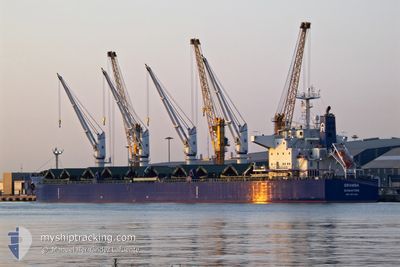
The vessel GRAMBA (IMO: 9917048, MMSI: 563134200) is a Cargo It's sailing under the flag of [SG] Singapore.
In this page you can find informations about the vessels current position, last detected port calls, and current voyage information. If the vessels is not in coverage by AIS you will find the latest position.
The current position of GRAMBA is detected by our AIS receivers and we are not responsible for the reliability of the data. The last position was recorded while the vessel was in Coverage by the Ais receivers of our vessel tracking app.
The current draught of GRAMBA as reported by AIS is 8.3 meters
Weather
| Temperature | 7.7°C / 45.86°F |
|---|---|
| Wind Speed | 10 knots |
| Direction | 239° WSW |
| Pressure | 1009.4 hPa |
| Humidity | 84.9 % |
| Cloud Coverage | 100 % |
Featured Company
Last Port Calls
| Port | Arrival | Departure | Time In Port |
|---|---|---|---|
| 2025-12-05 08:58 | 2025-12-08 15:43 | 3 d | |
| 2025-11-29 18:45 | 2025-12-01 13:15 | 1 d | |
| 2025-11-14 12:44 | 2025-11-15 17:56 | 1 d | |
| 2025-11-05 19:40 | 2025-11-11 23:40 | 6 d | |
| 2025-10-26 04:22 | 2025-10-28 09:10 | 2 d | |
| 2025-10-04 04:51 | 2025-10-07 04:23 | 2 d | |
| 2025-10-02 11:28 |
Last Trips
| Origin | Departure | Destination | Arrival | Distance | |
|---|---|---|---|---|---|
| 2025-12-01 13:15 | 2025-12-05 08:58 | 1123.69 nm | |||
| 2025-11-15 17:56 | 2025-11-29 18:45 | 3734.00 nm | |||
| 2025-11-11 23:40 | 2025-11-14 12:44 | 697.59 nm | |||
| 2025-10-28 09:10 | 2025-11-05 19:40 | 167.11 nm | |||
| 2025-10-02 11:28 | 2025-10-26 04:22 | 5035.85 nm | |||
| 2025-10-02 11:28 | 2025-10-04 04:51 | 174.40 nm |
Events
| Tid | Hændelsen | Detaljer | Position / Dest | Info |
|---|---|---|---|---|
| 2025-12-09 17:43 | STOP Sejllads | 4.98 nm, North of RIGA |
57.03099 / 24.08941
LVRIX
|
Fart: Kurs: 121° |
| 2025-12-08 23:24 | Status er ændret | Default Under way using engine |
59.19052 / 21.74490
LVRIX
|
Fart: 9 kn Kurs: 233.9° |
| 2025-12-08 23:19 | Status er ændret | Under way using engine Default |
59.19808 / 21.76240
LVRIX
|
Fart: 10.3 kn Kurs: 224° |
| 2025-12-08 23:19 | Udenfor Dækning |
59.19808 / 21.76240
Baltic Sea
LVRIX
|
Fart: 9 kn Kurs: 233.9° |
|
| 2025-12-08 22:53 | Status er ændret | Default Under way using engine |
59.24886 / 21.85929
LVRIX
|
Fart: 9.9 kn Kurs: 223.9° |
| 2025-12-08 22:53 | Status er ændret | Under way using engine Default |
59.24985 / 21.86117
LVRIX
|
Fart: 10.5 kn Kurs: 234° |
| 2025-12-08 22:42 | Status er ændret | Default Under way using engine |
59.26890 / 21.91065
LVRIX
|
Fart: 10.5 kn Kurs: 236.5° |
| 2025-12-08 22:31 | Fundet i havområde | Estonian part of the Baltic Sea |
59.28692 / 21.96006
Baltic Sea
LVRIX
|
Fart: 10.7 kn Kurs: 234.2° |
| 2025-12-08 22:31 | Status er ændret | Under way using engine Default |
59.28779 / 21.96239
LVRIX
|
Fart: 11 kn Kurs: 234° |
| 2025-12-08 21:41 | Status er ændret | Default Under way using engine |
59.37439 / 22.20274
LVRIX
|
Fart: 10.9 kn Kurs: 234.6° |