
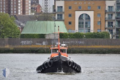
GPS VINCIA
Tug
Current Trip
GBUPR
| Time Travelled | 6 h, 7 mins |
|---|---|
| Remaining Time | --- |
| Distance Travelled | 0.07 nm |
| Remaining Distance | --- |
| AVG Speed | --- |
| MAX Speed | --- |
| AVG Wind | 6.8 knots |
| MAX Wind | 6.8 knots |
| MIN Temp | 3.9°C / 39.02°F |
| MAX Temp | 3.9°C / 39.02°F |
| Dybgang | 3 m |
| Position Modtaget | 5 h, 53 m siden |
Current Position
| Longitude | --- |
|---|---|
| Latitude | --- |
| Status | Restricted manoeuverability |
| Fart | 0.1 Knots |
| Kurs | --- |
| Område | North Sea |
| Station | T-AIS |
| Position Modtaget | 5 h, 53 m siden |
Information
The current position of GPS VINCIA is in North Sea with coordinates 51.49848° / 0.07224° as reported on 2025-02-14 17:27 by AIS to our vessel tracker app. The vessel's current speed is 0.1 Knots
The vessel GPS VINCIA (MMSI: 235053644) is a Tug It's sailing under the flag of [GB] United Kingdom.
In this page you can find informations about the vessels current position, last detected port calls, and current voyage information. If the vessels is not in coverage by AIS you will find the latest position.
The current position of GPS VINCIA is detected by our AIS receivers and we are not responsible for the reliability of the data. The last position was recorded while the vessel was in Coverage by the Ais receivers of our vessel tracking app.
The current draught of GPS VINCIA as reported by AIS is 3 meters
Weather
| Temperature | 3.9°C / 39.02°F |
|---|---|
| Wind Speed | 7 knots |
| Direction | 135° SE |
| Pressure | 1024.7 hPa |
| Humidity | 56.3 % |
| Cloud Coverage | 95 % |
Featured Company
Last Port Calls
| Port | Arrival | Departure | Time In Port |
|---|---|---|---|
| 2025-02-14 17:10 | 2025-02-14 17:13 | 2 m | |
| 2025-02-14 14:17 | 2025-02-14 16:23 | 2 h | |
| 2025-02-14 07:52 | 2025-02-14 12:03 | 4 h | |
| 2025-02-13 16:31 | 2025-02-14 07:03 | 14 h | |
| 2025-02-13 13:42 | 2025-02-13 15:55 | 2 h | |
| 2025-02-13 02:59 | 2025-02-13 11:32 | 8 h | |
| 2025-02-12 23:24 | 2025-02-13 00:50 | 1 h | |
| 2025-02-12 16:52 | 2025-02-12 22:04 | 5 h | |
| 2025-02-12 12:52 | 2025-02-12 16:18 | 3 h | |
| 2025-02-12 02:06 | 2025-02-12 10:50 | 8 h |
Last Trips
| Origin | Departure | Destination | Arrival | Distance | |
|---|---|---|---|---|---|
| 2025-02-14 16:23 | 2025-02-14 17:10 | 4.02 nm | |||
| 2025-02-14 12:03 | 2025-02-14 14:17 | 16.78 nm | |||
| 2025-02-14 07:03 | 2025-02-14 07:52 | 3.08 nm | |||
| 2025-02-13 15:55 | 2025-02-13 16:31 | 3.41 nm | |||
| 2025-02-13 11:32 | 2025-02-13 13:42 | 16.71 nm | |||
| 2025-02-13 00:50 | 2025-02-13 02:59 | 6.06 nm | |||
| 2025-02-12 22:04 | 2025-02-12 23:24 | 3.26 nm | |||
| 2025-02-12 16:18 | 2025-02-12 16:52 | 3.27 nm | |||
| 2025-02-12 10:50 | 2025-02-12 12:52 | 16.58 nm | |||
| 2025-02-12 00:38 | 2025-02-12 02:06 | 5.71 nm |
Events
| Tid | Hændelsen | Detaljer | Position / Dest | Info |
|---|---|---|---|---|
| 2025-02-14 17:27 | Udenfor Dækning |
51.49848 / .07224
North Sea
|
Fart: 0.1 kn Kurs: 511° |
|
| 2025-02-14 17:14 | STOP Sejllads | 0.22 nm, North East of WOOLWICH |
51.49846 / .07218
GBUPR
|
Fart: 0.1 kn Kurs: 511° |
| 2025-02-14 17:13 | START Sejllads | 0.18 nm, North East of WOOLWICH |
51.49786 / .07198
GBUPR
|
Fart: 4.8 kn Kurs: 23.3° |
| 2025-02-14 17:13 | Afsejlet fra sidste havn |
|
51.49766 / .07184
GBUPR
|
Fart: 5.8 kn Kurs: 25.9° |
| 2025-02-14 17:11 | STOP Sejllads |
51.49599 / .07114
[GB] WOOLWICH
|
Fart: 0.3 kn Kurs: 511° |
|
| 2025-02-14 17:10 | Skibe i havn |
|
51.49602 / .07122
[GB] WOOLWICH
|
Fart: 2.2 kn Kurs: 511° |
| 2025-02-14 17:04 | START Sejllads | 0.57 nm, East of GALLIONS POINT |
51.50566 / .08436
GBUPR
|
Fart: 7.3 kn Kurs: 228.7° |
| 2025-02-14 16:47 | STOP Sejllads | 0.68 nm, East of GALLIONS POINT |
51.50656 / .08726
GBUPR
|
Fart: 0.1 kn Kurs: 511° |
| 2025-02-14 16:23 | Afsejlet fra sidste havn |
|
51.49664 / .02221
GBUPR
|
Fart: 9.9 kn Kurs: 114° |
| 2025-02-14 14:53 | START Sejllads |
51.46611 / -.18528
[GB] LONDON
|
Fart: 6 kn Kurs: 46.5° |